
More to explore
-

-
Column (4/27/24)There should be no right to sleep in all public placesIn a Supreme Court showdown Monday over whether the homeless have a "right" to camp in public, almost no one mentioned the actual victims of that crazy idea. Homeless advocates, including the American Civil Liberties Union, told the court that...
-
Column (4/27/24)Republicans are doomed if they don�t get it togetherAnother week, another round of Republicans attacking each other. This time it was over the Ukraine funding bill that was passed by the House and ultimately became part of the big military aid package for Ukraine, Israel and Taiwan that Congress...
-
Column (4/26/24)The Republican Party can still do what�s rational and right. Here�s the proofThere�s no record of Edmund Burke � the great Irish-born British statesman and father of modern conservatism � actually saying what is often attributed to him: "The only thing necessary for the triumph of evil is for good men to do nothing." But it...
-
-
Column (4/25/24)Legislation would help safeguard Missouri water against unregulated exportAs past president of the Southeast Missouri Regional Water District and a local farmer, I will not stand idly as our precious water resources are attacked. This is why I fully support State. Rep. Jamie Burger and State. Sen. Jason Bean as they...
-
Column (4/25/24)Nothing good comes from Columbia University's radicalismColumbia University is once again the center of the radical universe. More than 50 years after anti-Vietnam War demonstrators roiled the Columbia campus in 1968, anti-Israel agitators are disrupting the school�s operations, and inspiring similar...
-
Column (4/24/24)Alvin Bragg makes history -- preposterouslyAlvin Bragg is to be commended for getting to trial on the Trump hush-payments case. Lesser prosecutors would have been daunted by the prospect of creating a national melodrama and a norm-breaking prosecution of a former president over what is,...
-
-
Column (4/23/24)Are Iran�s nine lives nearing an end?The theocracy of Iran has been the world�s arch-embassy attacker over the last half century. So it has zero credibility in crying foul over Israel�s April 1 attacks on its "consulate" in Damascus and the killing of Iran�s kingpin terrorists of...
-
-
Editorial (4/22/24)Cape County mourns the loss of Public Administrator Lisa ReitzelLisa Reitzel, the dedicated Cape Girardeau County public administrator, died unexpectedly from a heart attack April 13 at the age of 55. Serving in her role for over a decade, Reitzel�s sudden departure marks a significant loss for the community she...
-
Column (4/22/24)Happiness is a home to tinker withMy husband and I have never bought a home we didn�t tinker with. And by "tinker", I don�t mean a coat of fresh paint and new shelving. I mean the knock out a wall, rip up the flooring and till the backyard for a new garden kind of tinkering. Real...
-
-
Editorial (4/19/24)LifeHouse will fill needs in Southeast MissouriNeeds come in all shapes and sizes, and when a need comes in the form of a baby, it is Priority 1. LifeHouse Crisis Maternity House in Cape Girardeau will soon satisfy various needs of pregnant women and new mothers experiencing or at risk of...
-
-
Editorial (4/17/24)UWSEMO tours to showcase volunteer opportunitiesEver thought about volunteering with a local not-for-profit organization but don�t know how or where to start? United Way of Southeast Missouri can help. April is National Volunteer Month, and UWSEMO has scheduled two Get on the Bus tours that...
-
Editorial (4/15/24)Cape Girardeau Heritage Museum unveils exhibits on old bridge, Truman and American quiltingThe Cape Girardeau Heritage Museum is set to unveil three new exhibits this week that promise to enrich our understanding of both local and national heritage. These exhibits, focusing on the construction of the old Cape Girardeau bridge, President...
-
-
Letter (4/11/24)Overcoming Missouri�s opioid epidemicBad news: Missouri�s opioid epidemic emerged as our most serious public health problem with drug overdose Missouri�s no. 1 leading cause of death among adults aged 18-44. Overcoming this crisis will be difficult, yet not insurmountable. Accidental...
-
Editorial (4/10/24)Nominations open for Difference Makers 2024Many people who work to improve lives, communities and societies have one thing in common: They don�t do what they do for a pat on the back. Instead of looking for a congratulatory spotlight, they are heads-down, shoulder-to-the-wheel helping...
-
-
Editorial (4/8/24)Cape Chamber celebrates local innovators at annual dinnerThe Cape Girardeau Area Chamber of Commerce�s annual dinner is always an inspiring evening recognizing the achievements of business innovators in our region who are leading industries, championing new ideas, and taking leadership roles that propel...
-
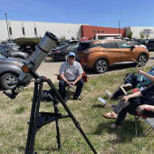
Editorial (4/4/24)Solar eclipse 2024 is on the horizonA solar eclipse will bring four minutes of midday darkness to Southeast Missouri on Monday, April 8. This celestial oddity is revisting the region only seven years after its last appearance, though another won�t reveal itself until Aug. 12, 2045....
-
-
-
-
Respond to this story
Posting a comment requires a subscription.