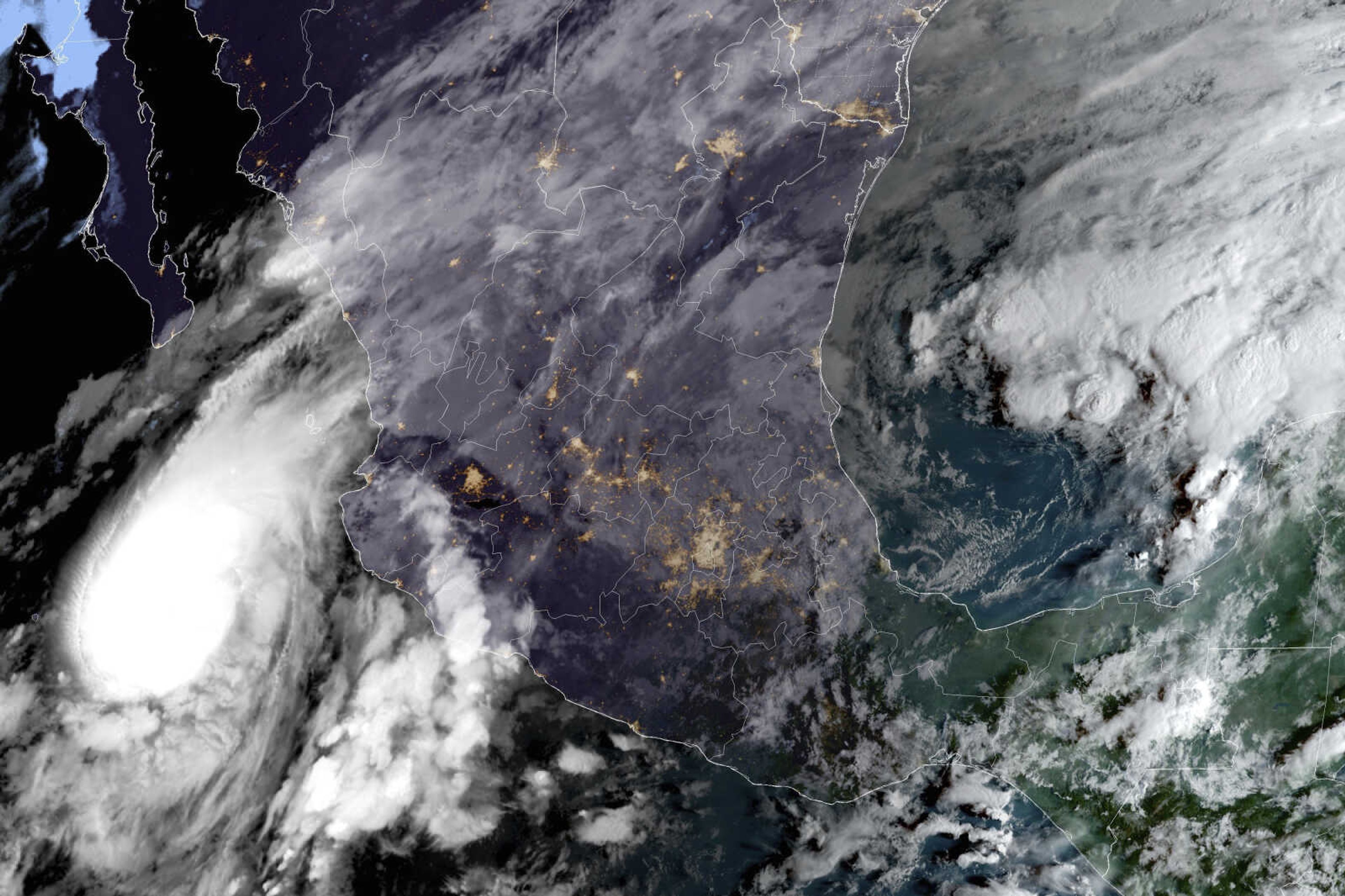
Lidia makes landfall as Category 4 hurricane with 140 mph winds near Mexico's Puerto Vallarta resort
MEXICO CITY -- Hurricane Lidia made landfall as an "extremely dangerous" Category 4 storm Tuesday evening with winds of 140 mph near Mexico's Pacific coast resort of Puerto Vallarta. The U.S. National Hurricane Center said Lidia's eye appeared to have reached land near Las Penitas in the western state of Jalisco. The area is a sparsely populated peninsula. The storm is moving south of Puerto Vallarta, which could cushion the blow on the resort...
MEXICO CITY -- Hurricane Lidia made landfall as an "extremely dangerous" Category 4 storm Tuesday evening with winds of 140 mph near Mexico's Pacific coast resort of Puerto Vallarta.
The U.S. National Hurricane Center said Lidia's eye appeared to have reached land near Las Penitas in the western state of Jalisco. The area is a sparsely populated peninsula. The storm is moving south of Puerto Vallarta, which could cushion the blow on the resort.
In 2015, Hurricane Patricia, a Category 5 hurricane, also made landfall on the same sparsely-populated stretch of coastline between the resort of Puerto Vallarta and major port of Manzanillo.
Lidia was expected to rapidly weaken over the mountains and dissipate, but was still capable of soaking the region with heavy rain. Forecasters predicted Lidia could still be a Category 1 hurricane when it brushed by Guadalajara, Mexico's second-largest city, around midnight.
The U.S. National Hurricane Center forecast rainfall totals of 4 to 8 inches with localized totals of 12 inches possible in some places in the state of Nayarit, southern portions of the state of Sinaloa, and coastal areas of Jalisco.
Local authorities canceled classes in communities around the coast. The expected impact comes one day after Tropical Storm Max hit the southern Pacific coast, hundred of miles away, and then dissipated. Rains from Max washed out part of a coastal highway in the southern state of Guerrero.
Lidia was centered Tuesday about 35 miles south-southwest of Puerto Vallarta, and was moving east-northeast at about 16 mph.
The hurricane center warned of possible flash flooding and storm surge from the hurricane.
____
Follow AP's climate coverage at: https://apnews.com/hub/climate-and-environment
Connect with the Southeast Missourian Newsroom:
For corrections to this story or other insights for the editor, click here. To submit a letter to the editor, click here. To learn about the Southeast Missourian’s AI Policy, click here.


