A landscape transformed by the Little River Drainage District
One hundred years ago, most of Southeast Missouri looked like the swampy Mingo Wildlife Refuge near Puxico appears now. The 2 million-acre region called the Missouri glades was the largest wetland in America. Except at the edges and on the ridges, the swamp was nearly impenetrable and considered almost useless by most everyone...
One hundred years ago, most of Southeast Missouri looked like the swampy Mingo Wildlife Refuge near Puxico appears now. The 2 million-acre region called the Missouri glades was the largest wetland in America. Except at the edges and on the ridges, the swamp was nearly impenetrable and considered almost useless by most everyone.
Plans to turn the swamp into farmland date to the 1840s, but the job seemed too big. Not even the government had ever undertaken anything of that magnitude before. But in 1907, a group of men formed an organization called the Little River Drainage District to take on the swamp. They issued bonds and taxed landowners in the district for the benefits derived.
From topographical maps they knew that the elevation of the land falls 1 foot per mile from Cape Girardeau to the Arkansas border. They devised a system of levees and ditches that rely heavily on gravity.
By 1928, the district had built nearly 1,000 miles of ditches, more than 300 miles of levees and had drained 1.2 million acres of land in a drainage project that at the time was the largest in the history of the world. The district drains 750,000 acres upland of the drainage system and 1.2 million acres total.
Land once 95 percent covered in water and trees is now largely cleared and free of water most of the year. The project moved more earth than was moved in digging the Panama Canal.

Now one third of Missouri's agricultural income is produced in the seven counties in the Bootheel.
"It is one of the major transformations of the American landscape," said Dr. Frank Nickell, director of the Center for Regional History at Southeast Missouri State University.
Reception at Kent Library
The Little River Drainage District celebrates its 100th anniversary with a reception from 2 to 5 p.m. today at Southeast's Kent Library. The university serves as the repository for the district's old records.
The district's board of supervisors and former board members will be among the attendees. The guest speaker will be H. Riley Bock, a historian and former attorney for the district. The library will show a Missouri Department of Conservation video titled "A Southeast Story: We Changed the Land, the Land Changed Us."

The land in the district initially was owned by the United States government and granted to the state through the Swamp Land Act of 1850. Not knowing what to do with it, the state conveyed the land to the counties. The counties eventually sold the land to private owners and companies at low cost with the stipulation that it had to be developed and drained.
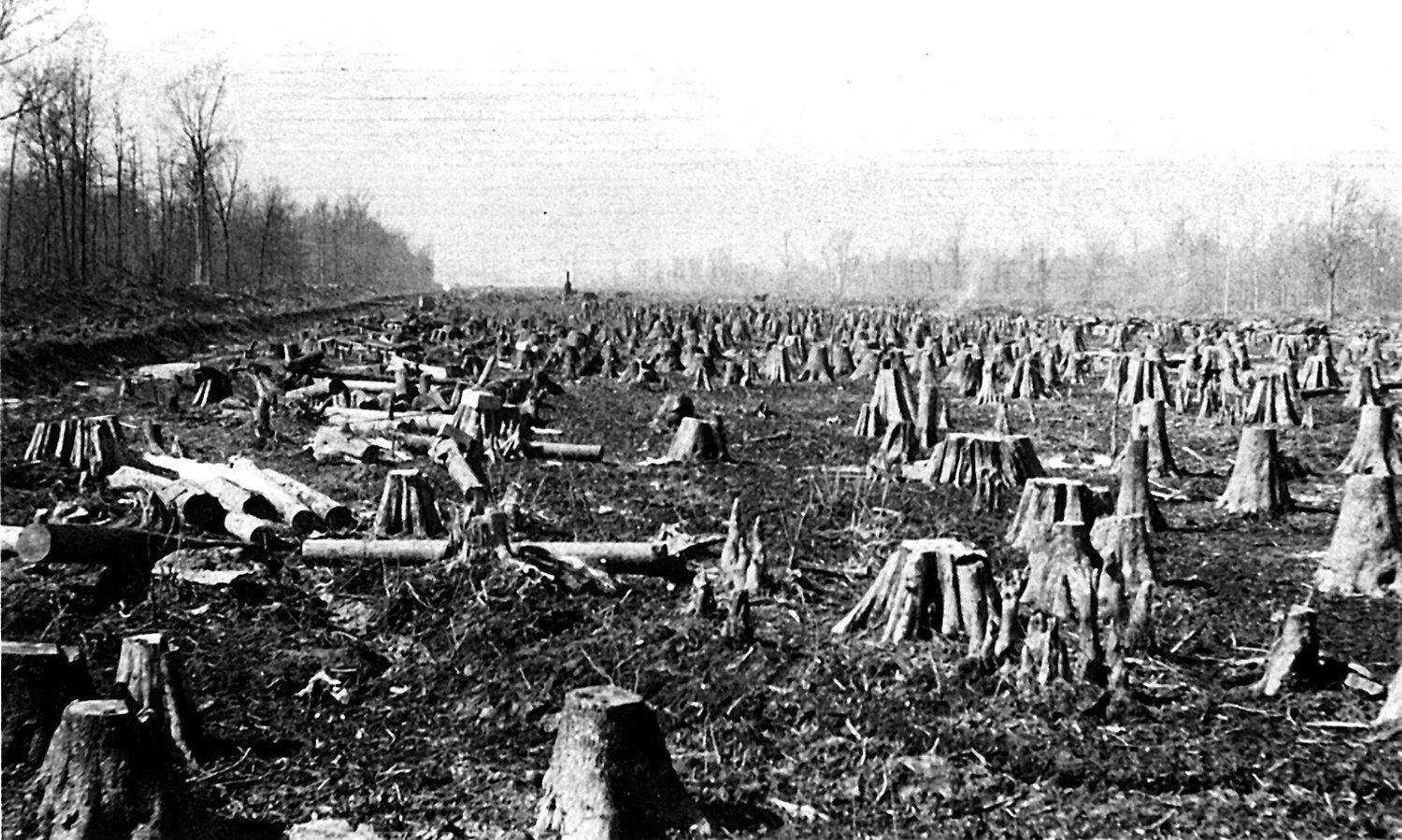
At the end of the 19th century, timber companies came in and clear-cut many of the forests. Railroad companies serving the timber companies needed 3,500 logs for each mile of track being laid into the swamp. But after the trees were cut, the railroad and timber companies didn't want to pay the drainage district taxes on land that was once again worthless to them. Cape Girardeau railroad pioneer Louis Houck challenged the district's rights all the way to the U.S. Supreme Court. He lost but had a big payday when he sold the railroad's right of way.
Names synonymous with wealth in Southeast Missouri -- among them Matthews and Himmelberger -- were there as the first earth was being moved. Land companies that popped up as the drainage district was being formed paid pennies an acre for some of it. Retired Bell City farmer Joe Brown, who has written a number of books and pamphlets about Bootheel history, says a company bought 160,000 acres from Stoddard County for $4,300, a price of less than 40 cents per acre. The company was headed by a lawyer the county owed money to.
The genius of the Little River Drainage District was its unified approach to draining the swamp. Before 1907, some farmers had tried to do the job piecemeal.
'All came together'

Nickell says two events that coincided with the start of construction sped up the project's success. The first was the building of a lock and dam in Keokuk, Iowa, in 1913. The dam, fought by timber interests, transformed the lumber industry in the upper Midwest because it stopped log drives from coming down the river. Timber companies began looking south for hardwood forests.
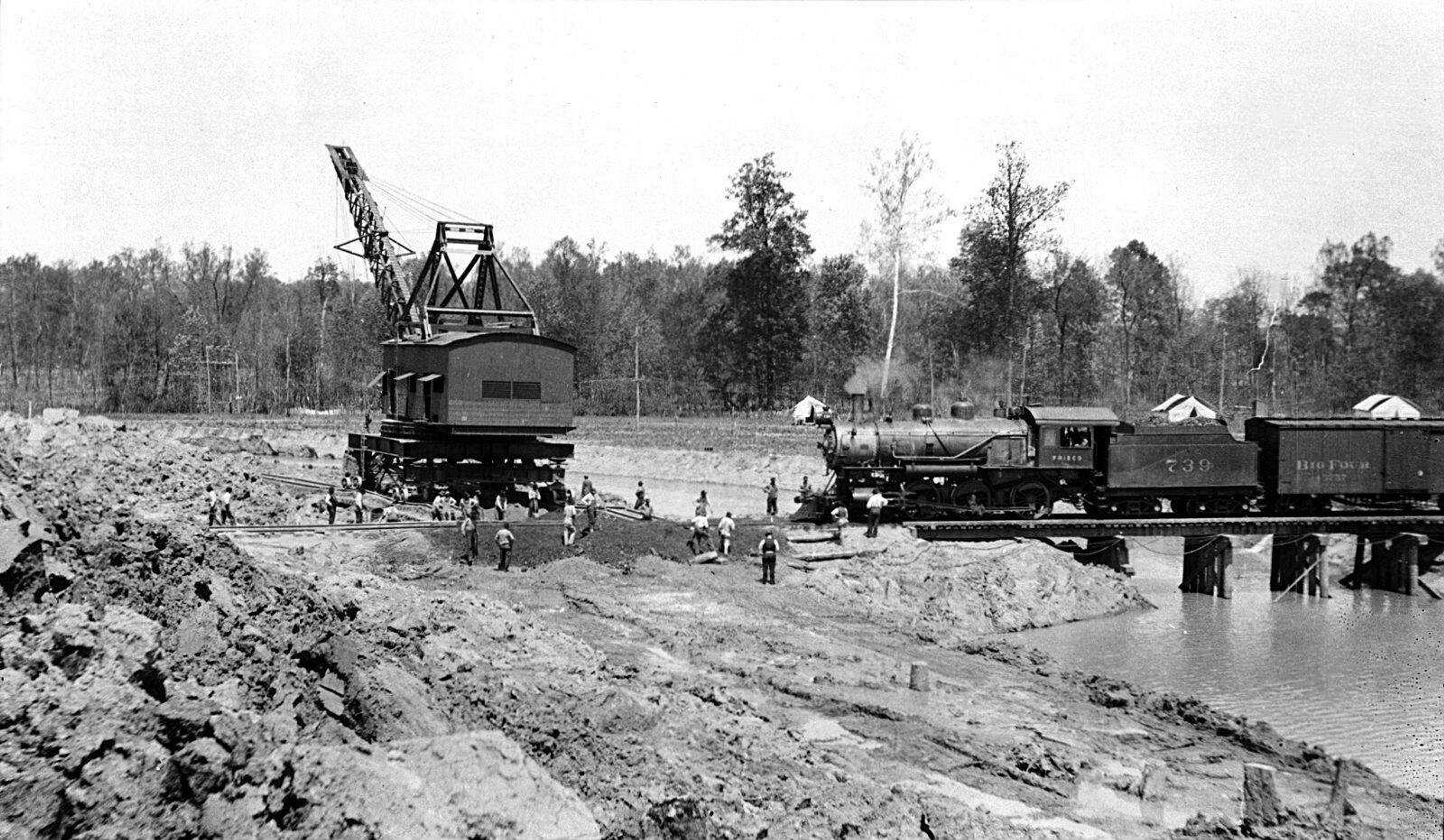
Construction of the Panama Canal ended the following year, leaving huge numbers of workers in the earth-moving business looking for new jobs. Many found them in Southeast Missouri.
"They all came together at the same time," Nickell said. "That's how they were able to do it as fast as they did." Thousands of workers participated in the incredibly difficult and dangerous work of clearing the swamps of trees and stumps, mostly by hand. Some of the oak trees were 27 feet in circumference. Some trees in the sprawling cypress forest were almost half as big.
The district extends from the Headwaters Diversion Channel just south of Cape Girardeau to the Arkansas border and includes parts of seven Southeast Missouri counties -- Cape Girardeau, Bollinger, Dunklin, New Madrid, Pemiscot, Scott and Stoddard. The Diversion Channel motorists cross without a thought when driving south from Cape Girardeau on I-55 is the key to the project. Beginning near Greenbriar in Stoddard County, it collects water from the St. Francis, Castor and Whitewater rivers and from Crooked, Hubble, LaCroix and Ramsey creeks, finally funneling into the Mississippi River. The district is named for a tributary of the St. Francis River.
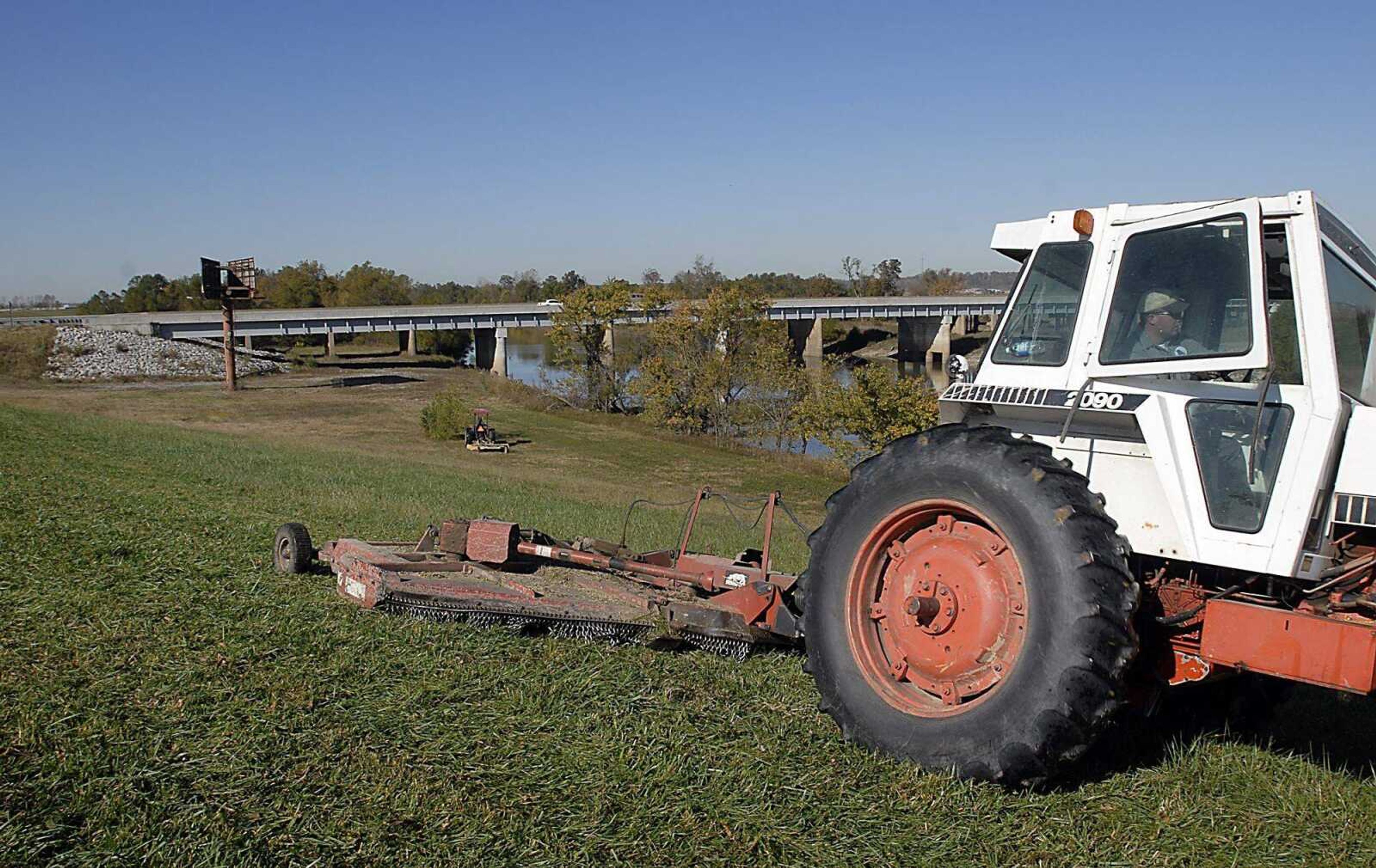
The levee that guards the Diversion Channel has never been breached. In the flood of 1995, water was still 12 feet from the top.
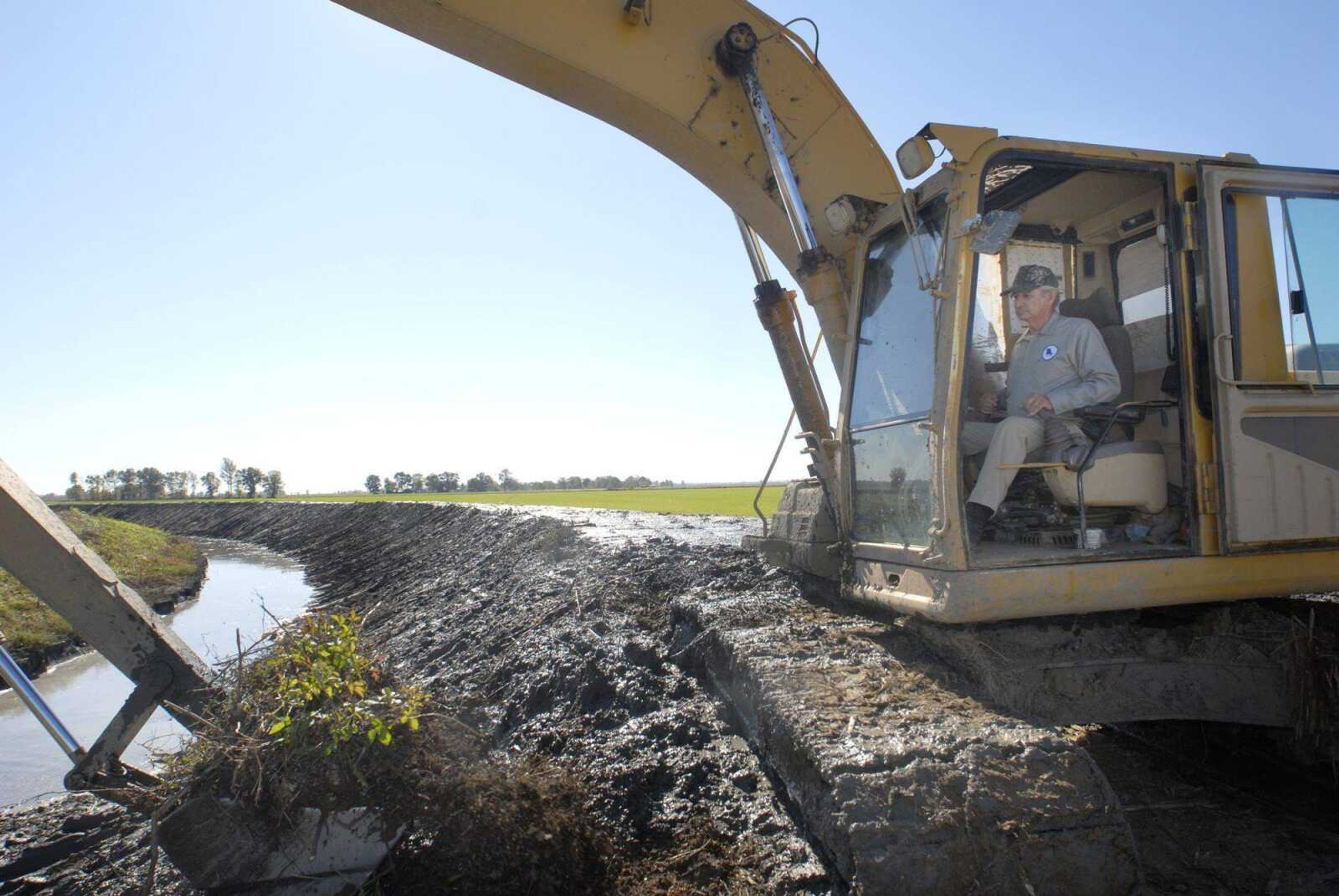
The 950 miles of ditches that extend from Cape Girardeau south to Arkansas border carry the remainder of the low-velocity water. The main ditches maintained by draglines are 200 feet wide with water 8 feet deep. The smaller ditches are 30 or 40 feet wide. An estimated 31.5 million gallons of water travel through the system annually. Through a collection system in Arkansas not operated by the district, the water eventually flows into the Mississippi River at Helena, Ark. Some of the water has traveled 231 miles to get there.
Before the swamp was drained, the only road out of Cape Girardeau heading south was the Bloomfield Road, which followed the ridges. If the Little River Drainage District had never been built, the Southeast Missouri we know would not exist, said Larry Dowdy, the district's executive vice president. He doubts I-55 would have been built -- "You would not be able to justify the cost" -- and whether the industries that located here because of the highway would have come. "I'm convinced Procter & Gamble wouldn't be here," he said. He thinks the university would be much smaller.
If the drainage system hadn't been built, up to 20 feet of water would cover the land where the Cape Girardeau Regional Airport is located at certain times of the year, he said.
If the district suddenly stopped operating, within a couple of years much of the rich farmland between Sikeston and Dexter would be underwater, Dowdy said.
Today the district has 3,000 landowners whose holdings range from half an acre to 50,000 acres. They pay the $1.5 million annual cost of maintaining the district and paying its 20 full-time workers.
Longevity and continuity have characterized the district. Dowdy has been with the organization for 37 1/2 years, starting out as the assistant chief engineer. His predecessor in leading the district, Earl Schultz, started with the district in 1913 and stayed 60 years.
"Some entity like us will be around until Christ comes again or the Bootheel won't be like it is," Dowdy said.
Not all of the district's effects on Southeast Missouri have been positive for everyone. Draining the swamp concentrated ownership of much of the land in the Bootheel in a smaller number of hands. Sharecropping became a way of life for the region's underclass.
Once the timber was cut down, the workers were stuck here, Brown said. "It turned into a landlord and sharecropper thing. People couldn't pay the taxes. ... They couldn't hardly make a dime anywhere.
"Bootleggers were thick."
Today some of the most impoverished counties in America are in the Bootheel. In Pemiscot County, more than a fourth of the population lives in poverty. The numbers are 23.3 percent in Mississippi County and 21.5 percent in New Madrid County.
Nickell said the population of the region has declined since the big surge when the land first opened up. The populations of New Madrid and Pemiscot counties today are much smaller than in the 1920s and 1930s. Most farmers return to their homes in town at night.
Where men with axes and steam-powered shovels once felled trees and drained dense swamps, professional farm managers now orchestrate the movements of high-tech equipment over perfect rows of genetically engineered crops.
The landscape has changed dramatically in 100 years.
sblackwell@semissourian.com
335-6611, extension 137
Connect with the Southeast Missourian Newsroom:
For corrections to this story or other insights for the editor, click here. To submit a letter to the editor, click here. To learn about the Southeast Missourian’s AI Policy, click here.


