custom ad
NewsJuly 17, 2012

View historical photos of the construction of I-55 in the 1960's.

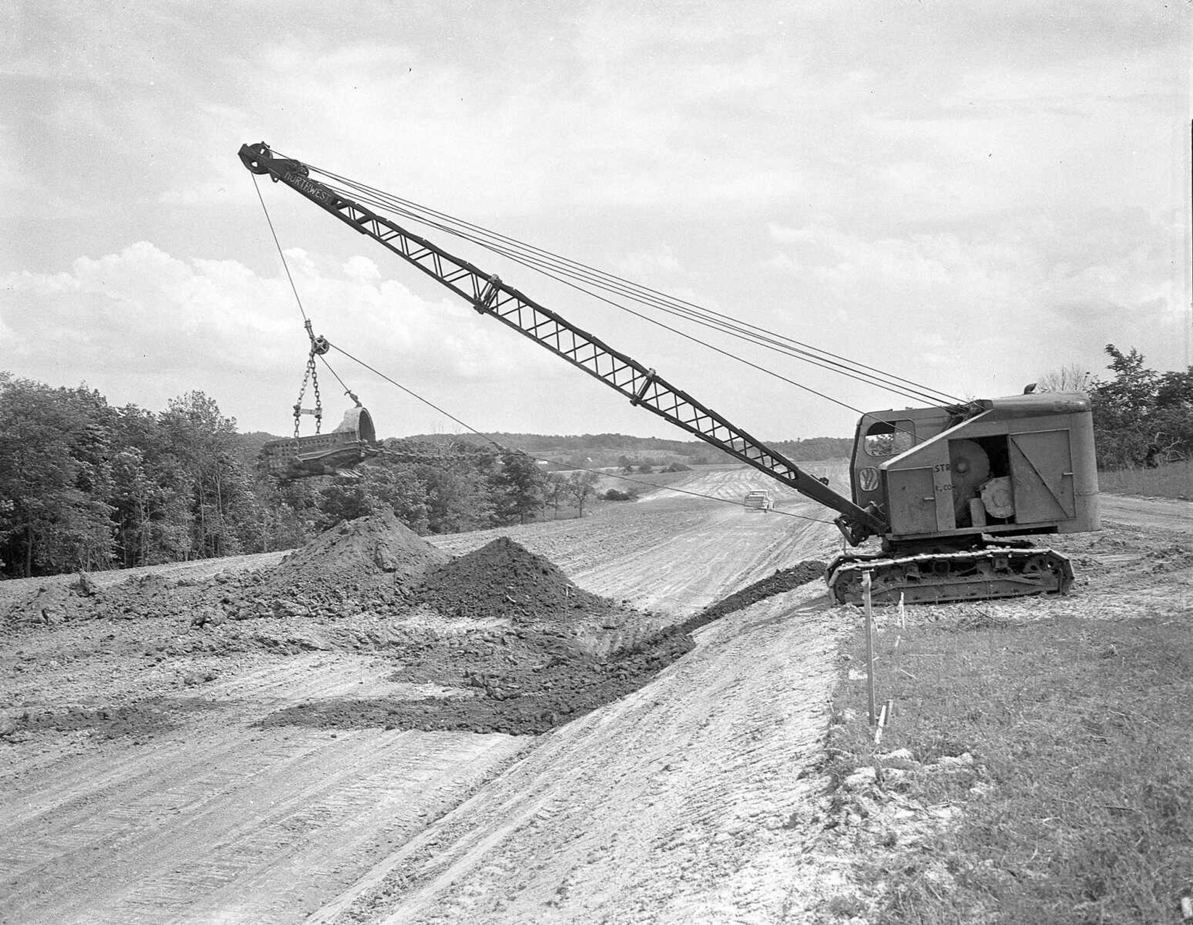
This photo is believed to show construction of Interstate 55 in the early 1960s. (Missourian archives, G.D. Fronabarger photo)
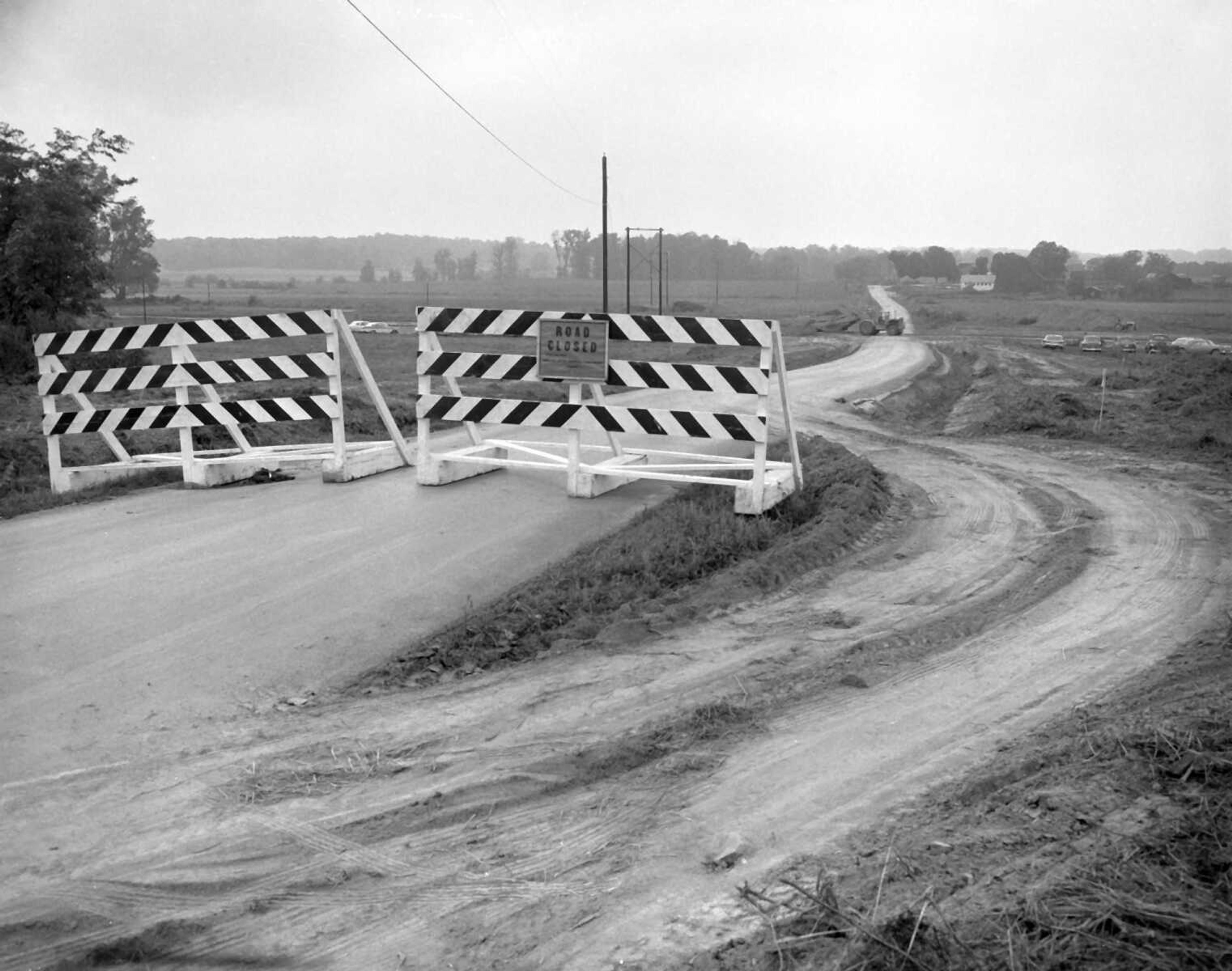
Published Aug. 25, 1961, pg. 3
Two routes west of Cape were closed this week as construction of Interstate Highway 55 was pushed. At the top Bloomfield Road barricade is in a westward view from the 3100 block. In the background is the Albert Keller Farm...(Missourian archive photo by G.D. "Frony" Fronabarger)
Published Aug. 25, 1961, pg. 3 Two routes west of Cape were closed this week as construction of Interstate Highway 55 was pushed. At the top Bloomfield Road barricade is in a westward view from the 3100 block. In the background is the Albert Keller Farm...(Missourian archive photo by G.D. "Frony" Fronabarger)
Published Tuesday, Aug. 22, 1961, pg. 1
Scarred earth is marking a ribbon across Cape Girardeau County as Interstate Highway 55 begins to take form... Lower view is near the start of the project at Diversion Channel. Right is the abandoned section of Highway 61. Left is new 61 and parallel to it, right, road and bridge construction. The new road right of way continues into top of picture. (Missourian archives, G.D. Fronabarger photo)
Published Tuesday, Aug. 22, 1961, pg. 1 Scarred earth is marking a ribbon across Cape Girardeau County as Interstate Highway 55 begins to take form... Lower view is near the start of the project at Diversion Channel. Right is the abandoned section of Highway 61. Left is new 61 and parallel to it, right, road and bridge construction. The new road right of way continues into top of picture. (Missourian archives, G.D. Fronabarger photo)
Published Jan. 5, 1961, pg. 3
Highway right of way survey crews are scattered all over the landscape around Cape Girardeau, laying out two important future routes for this community. Crews shown here are mapping the route of the new Federal Interstate Highway 55. ...At the bottom another crew is working where the new route will tie into the present 4-lane route at Municipal Airport. This view is to the northwest from a point near the north end of the airport. Still other crews are busy laying out the new city four-lane route which will run from Highway 74 to Wedekind Park where the new interstate route will cross the present Highway 61. (Missourian archives, G.D. Fronabarger photo)
Published Jan. 5, 1961, pg. 3 Highway right of way survey crews are scattered all over the landscape around Cape Girardeau, laying out two important future routes for this community. Crews shown here are mapping the route of the new Federal Interstate Highway 55. ...At the bottom another crew is working where the new route will tie into the present 4-lane route at Municipal Airport. This view is to the northwest from a point near the north end of the airport. Still other crews are busy laying out the new city four-lane route which will run from Highway 74 to Wedekind Park where the new interstate route will cross the present Highway 61. (Missourian archives, G.D. Fronabarger photo)
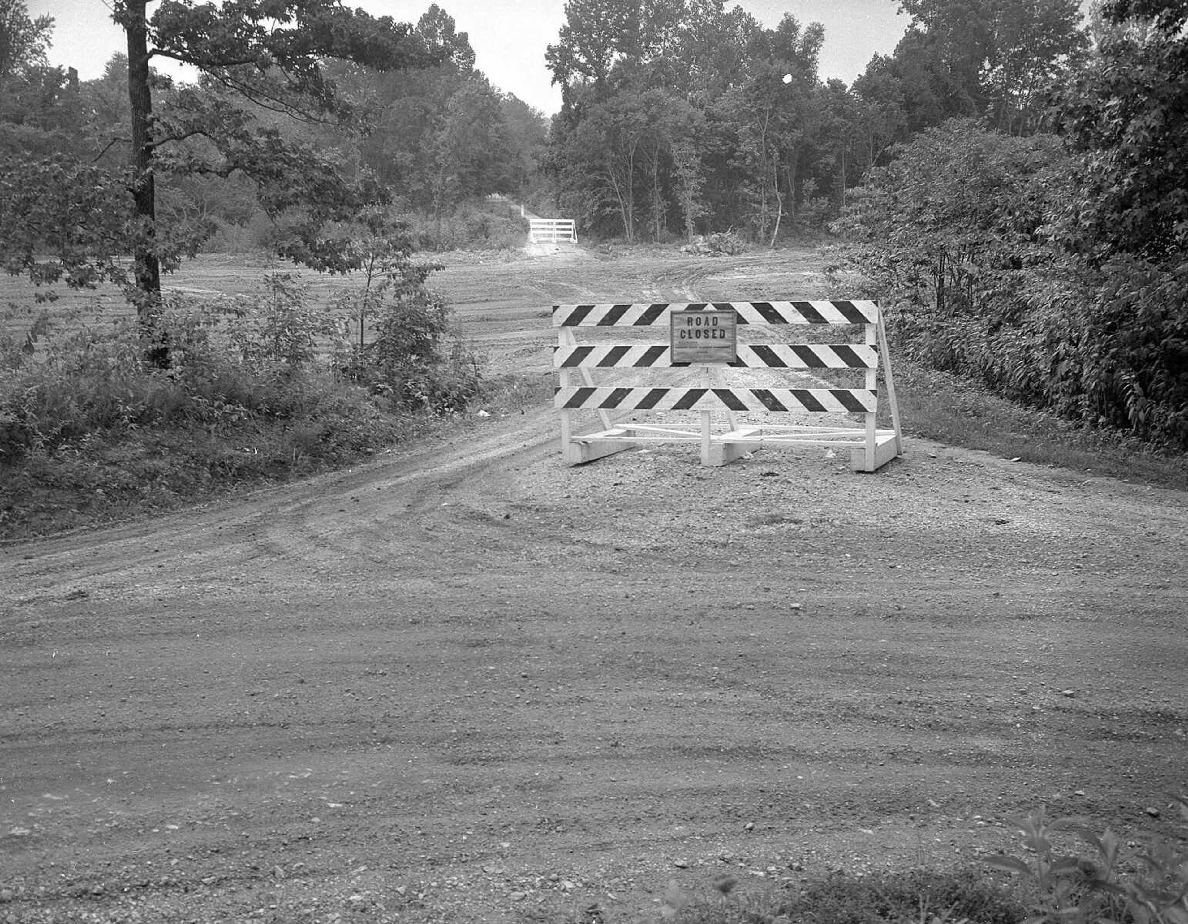
Published Aug. 25, 1961, pg. 3
Two routes west of Cape were closed this week as construction of Interstate Highway 55 was pushed...At the bottom is a view westward across the junction of Benton Hill and Silver Springs roads, where the former has been closed to traffic. The new highway cuts across the road at this point, and in the background is a barricade at the Ramsey Branch bridge. (Missourian archive photo by G.D. "Frony" Fronabarger)
Published Aug. 25, 1961, pg. 3 Two routes west of Cape were closed this week as construction of Interstate Highway 55 was pushed...At the bottom is a view westward across the junction of Benton Hill and Silver Springs roads, where the former has been closed to traffic. The new highway cuts across the road at this point, and in the background is a barricade at the Ramsey Branch bridge. (Missourian archive photo by G.D. "Frony" Fronabarger)
This photo is believed to show construction of Interstate 55 in the early 1960s. (Missourian archives, G.D. Fronabarger photo)
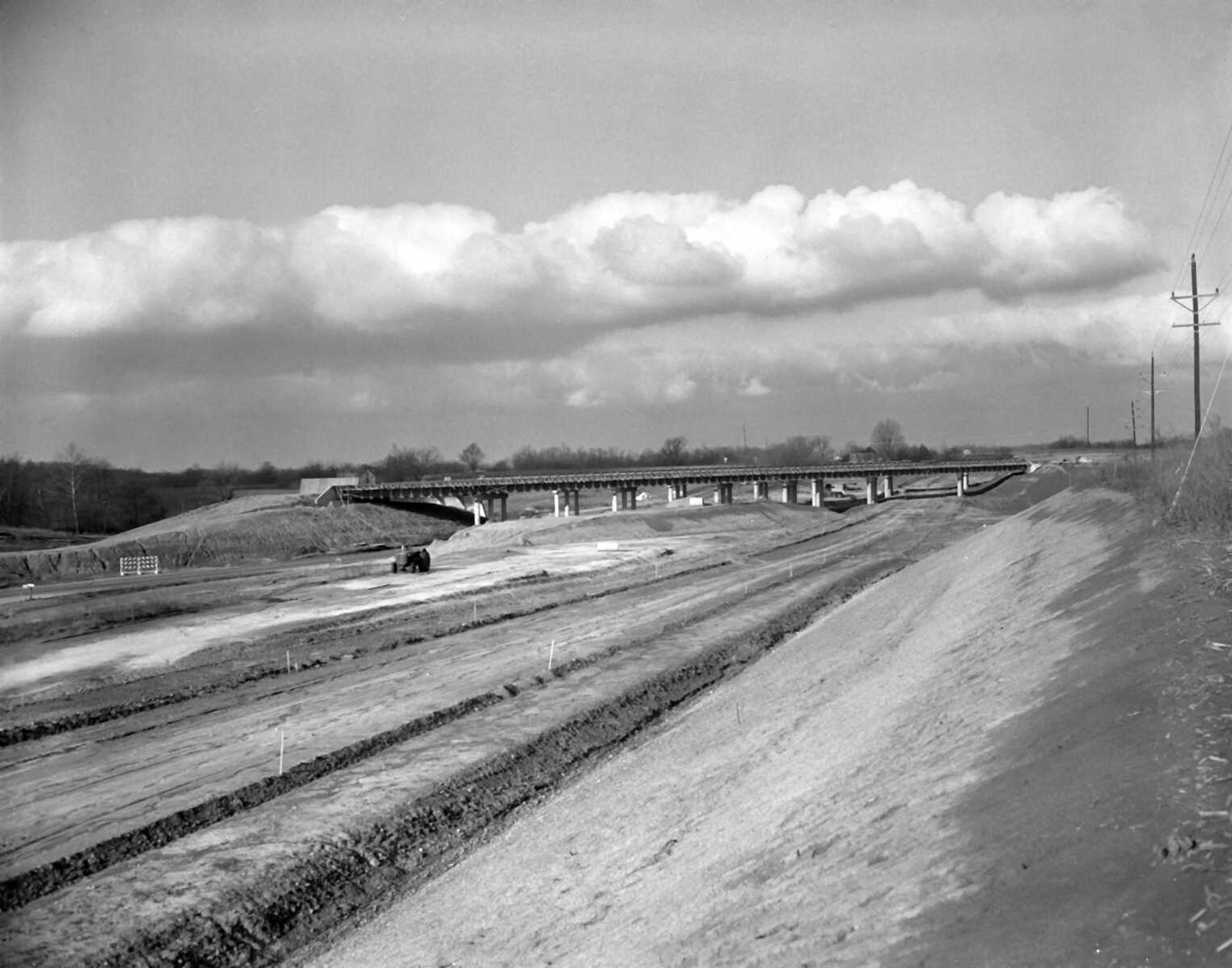
Published Wednesday, Nov. 29, 1961, pg. 1
The Wedekind Park interchange on Interstate Highway 55 now presents this view to travelers on Highway 61. The superstructure of the I-55 overpass is near completion, which may be delayed by winter weather. In the foreground is the roughed out roadway for a new lane of Highway 61 to carry northbound traffic for a distance of about a quarter of a mile. The present Highway 61 is in left center of picture, which looks toward Jackson. (Missourian archives, G.D. Fronabarger photo)
Published Wednesday, Nov. 29, 1961, pg. 1 The Wedekind Park interchange on Interstate Highway 55 now presents this view to travelers on Highway 61. The superstructure of the I-55 overpass is near completion, which may be delayed by winter weather. In the foreground is the roughed out roadway for a new lane of Highway 61 to carry northbound traffic for a distance of about a quarter of a mile. The present Highway 61 is in left center of picture, which looks toward Jackson. (Missourian archives, G.D. Fronabarger photo)
This photo is believed to show construction of Interstate 55 in the early 1960s. (Missourian archives, G.D. Fronabarger photo)
Published June 3, 1961
The broad path of new Interstate Highway 55 is rapidly becoming defined across Cape County as working forces for the Potashnick and Harrison construction companies push forward on the development. This view of the 300-foot long right of way for the four-lane ribbon shows one point of they busy construction, the view looking south from the Edwin Phillips farm five miles northwest of Cape Girardeau. (Missourian archives, G.D. Fronabarger photo)
Published June 3, 1961 The broad path of new Interstate Highway 55 is rapidly becoming defined across Cape County as working forces for the Potashnick and Harrison construction companies push forward on the development. This view of the 300-foot long right of way for the four-lane ribbon shows one point of they busy construction, the view looking south from the Edwin Phillips farm five miles northwest of Cape Girardeau. (Missourian archives, G.D. Fronabarger photo)
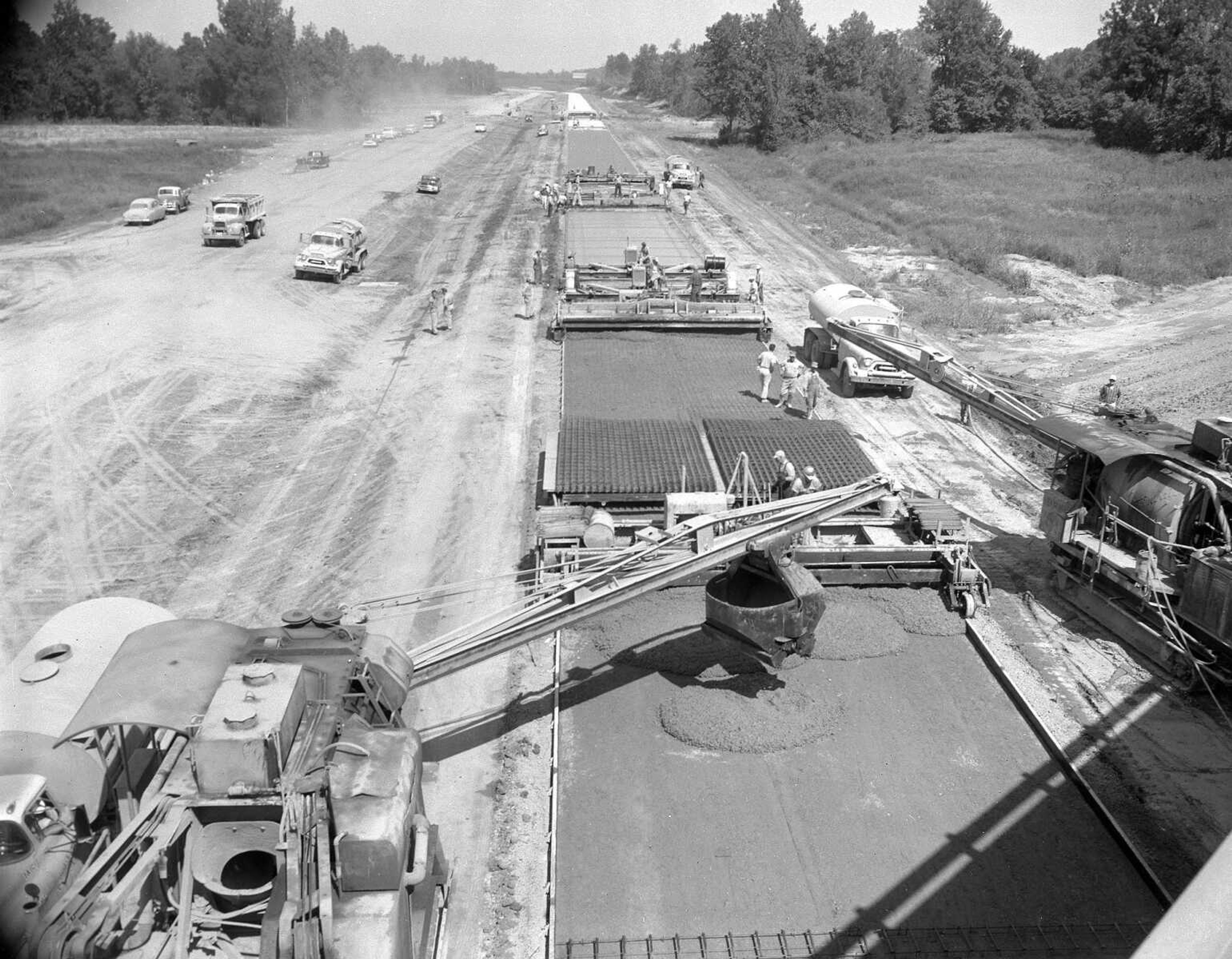
Published Tuesday, July 17, 1962, pg. 1
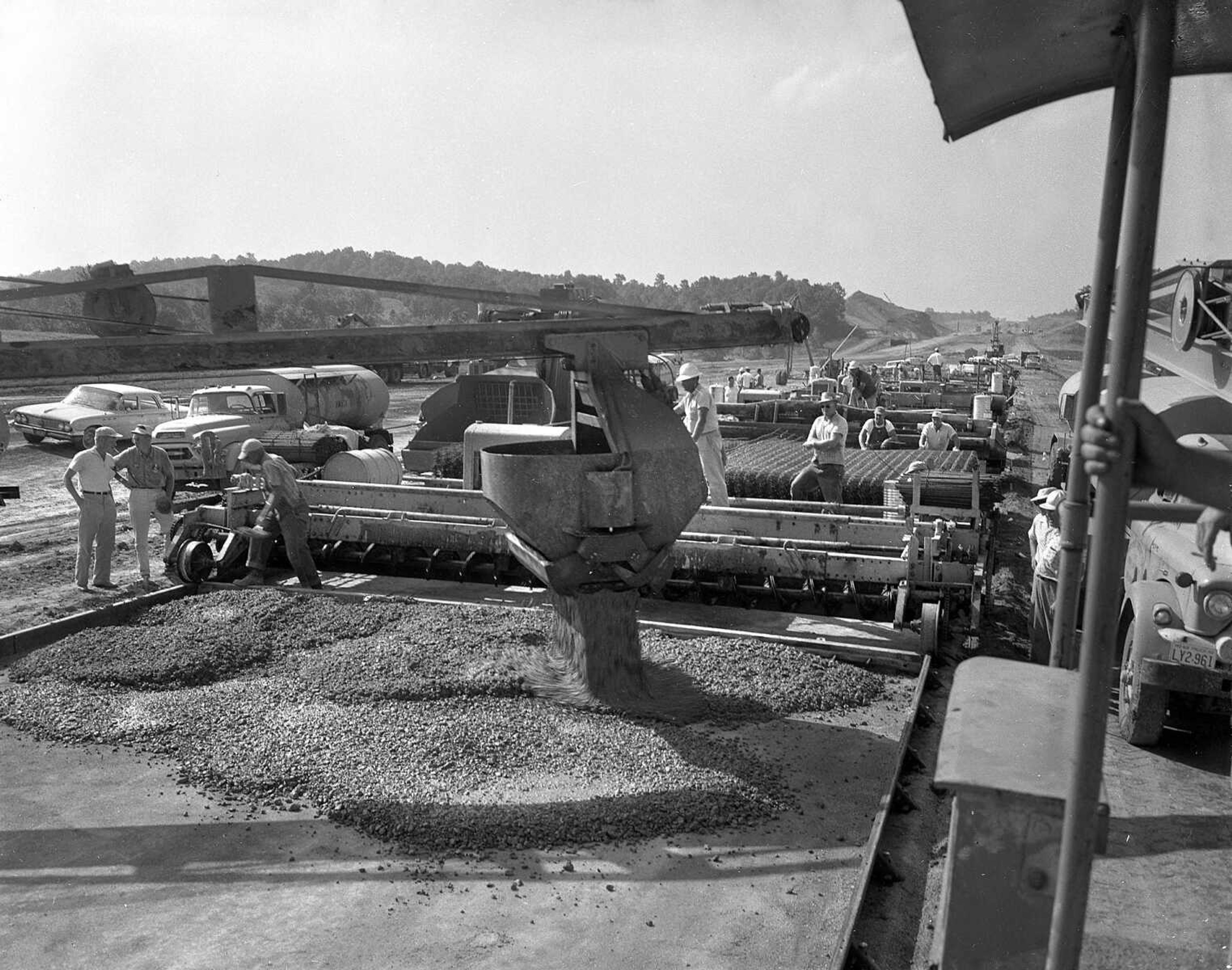
This is the first bucket of cement poured on the Cape Girardeau section of Interstate Highway 55. The site is two miles north of Wedekind Park at a point just north of Old McKendree Chapel. The construction train shown here is a concrete pavement assembly line. Rolling on tracks, the assembly pours the concrete, levels it, removes any air pockets, finishes it and leaves behind a complete porject. The contractor is shooting for a mile of paving a day in ghe continuous process. (Missourian archives, G.D. Fronabarger photo)
Published Tuesday, July 17, 1962, pg. 1 This is the first bucket of cement poured on the Cape Girardeau section of Interstate Highway 55. The site is two miles north of Wedekind Park at a point just north of Old McKendree Chapel. The construction train shown here is a concrete pavement assembly line. Rolling on tracks, the assembly pours the concrete, levels it, removes any air pockets, finishes it and leaves behind a complete porject. The contractor is shooting for a mile of paving a day in ghe continuous process. (Missourian archives, G.D. Fronabarger photo)
Published Wednesday, May 17, 1961
This view, looking south across Highway 61 just west of wedekind Park, shows the first actual construction work in Cape Girardeau County underway on the new Interstate Highway 55. Here the Potashnick-Harrison force is employing a huge pile driver to place steel pilings to form the bases for the big traffic interchange at this point. Piles of steel piling are visible in the center of the picture. Below is shown the same pile driver, a diesel powered outfit. The pilings are forced down to solid rock. (Missourian archives, G.D. Fronabarger photo)
Published Wednesday, May 17, 1961 This view, looking south across Highway 61 just west of wedekind Park, shows the first actual construction work in Cape Girardeau County underway on the new Interstate Highway 55. Here the Potashnick-Harrison force is employing a huge pile driver to place steel pilings to form the bases for the big traffic interchange at this point. Piles of steel piling are visible in the center of the picture. Below is shown the same pile driver, a diesel powered outfit. The pilings are forced down to solid rock. (Missourian archives, G.D. Fronabarger photo)
Published Wednesday, May 17, 1961
This view, looking south across Highway 61 just west of Wedekind Park, shows the first actual construction work in Cape Girardeau County underway on the new Interstate Highway 55. Here the Potashnick-Harrison force is employing a huge pile driver to place steel pilings to form the bases for the big traffic interchange at this point. Piles of steel piling are visible in the center of the picture... (Missourian archives, G.D. Fronabarger photo)
Published Wednesday, May 17, 1961 This view, looking south across Highway 61 just west of Wedekind Park, shows the first actual construction work in Cape Girardeau County underway on the new Interstate Highway 55. Here the Potashnick-Harrison force is employing a huge pile driver to place steel pilings to form the bases for the big traffic interchange at this point. Piles of steel piling are visible in the center of the picture... (Missourian archives, G.D. Fronabarger photo)
Published Wednesday, Sept. 19, 1962, pg. 1
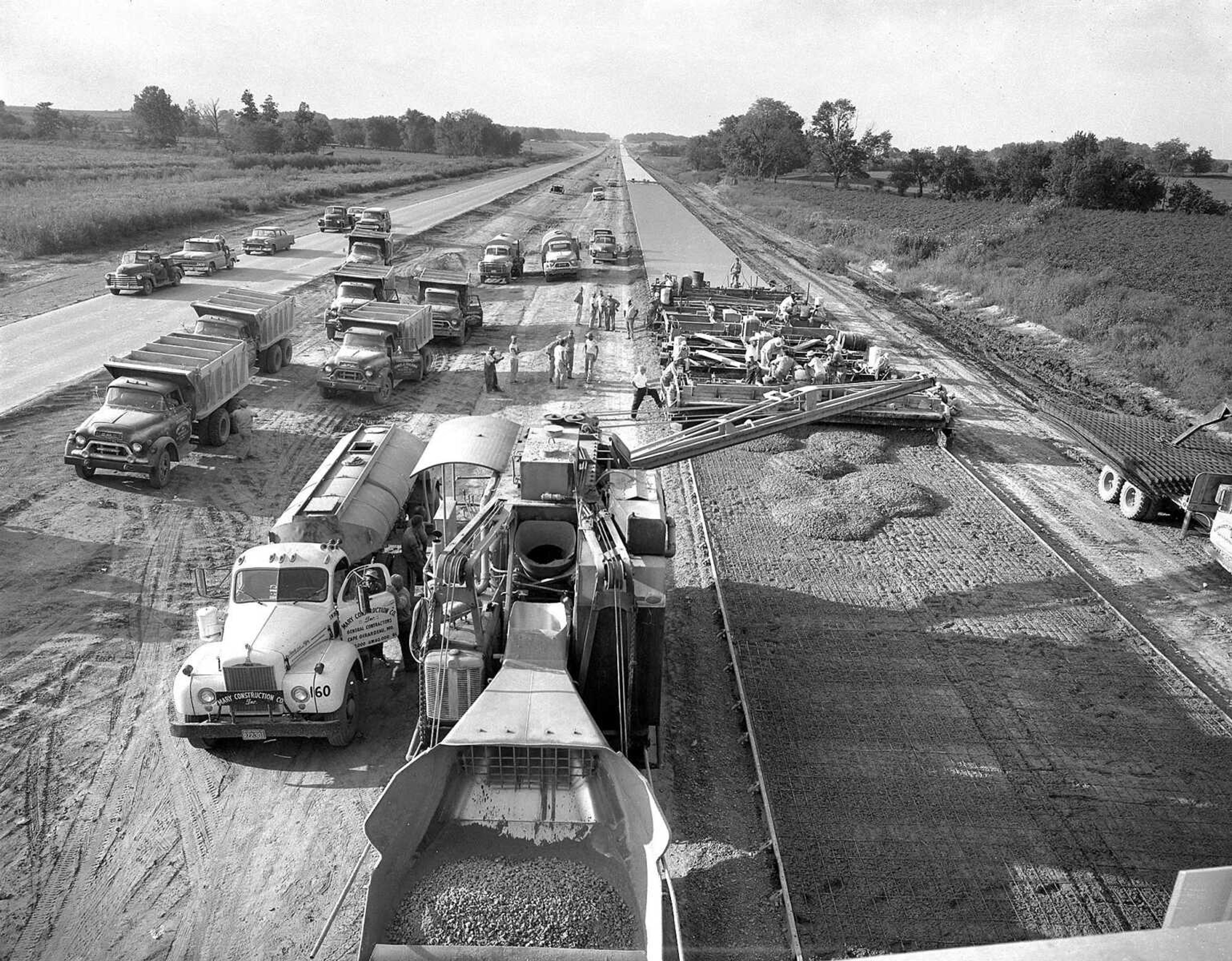
Men and machines, working in an outdoor assembly line, are nearing the end of paving of the divided Interstate Highway 55 from Fruitland south to Highway 74 in Cape Girardeau County. This photo, made Tuesday, shows the paving crew, headed south nearing the Bloomfield Road overpass. Potashnick company officials said more than a mile of this 24-foot concrete was laid Tuesday. If weather holds good, the contractor expects paving to be completed to Highway 74 in the next few days. (Missourian archives, G.D. Fronabarger photo)
Published Wednesday, Sept. 19, 1962, pg. 1 Men and machines, working in an outdoor assembly line, are nearing the end of paving of the divided Interstate Highway 55 from Fruitland south to Highway 74 in Cape Girardeau County. This photo, made Tuesday, shows the paving crew, headed south nearing the Bloomfield Road overpass. Potashnick company officials said more than a mile of this 24-foot concrete was laid Tuesday. If weather holds good, the contractor expects paving to be completed to Highway 74 in the next few days. (Missourian archives, G.D. Fronabarger photo)
Receive Daily Headlines FREESign up today!

View historical photos of the construction of I-55 in the 1960's.

Story Tags

Connect with the Southeast Missourian Newsroom:

For corrections to this story or other insights for the editor, click here. To submit a letter to the editor, click here. To learn about the Southeast Missourian’s AI Policy, click here.

Advertisement
Receive Daily Headlines FREESign up today!