

Pavement Ends
James Baughn was the webmaster of seMissourian.com and its sister newspapers for 20 years. On the side, he maintained even more sites, including Bridgehunter.com, LandmarkHunter.com, TheCapeRock.com, and Humorix. Baughn passed away in 2020 while doing one of the things he loved most: hiking in Southeast Missouri. Here is an archive of his writing about hiking and nature in our area.
- Email link
- Read comments (4)
- Share:


Magnolia Hollow: A nice diversion on the way to St. Louis
Posted Friday, October 10, 2008, at 5:12 PM
Last year, I wrote about places to visit along Highway 61 as an alternative to the boring interstate when travelling to St. Louis.
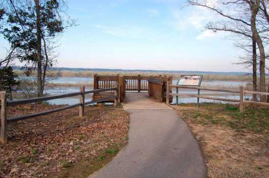
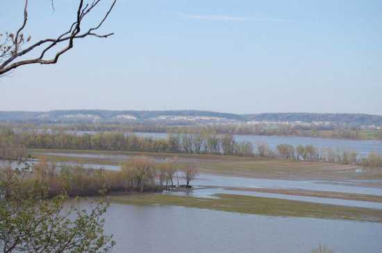
Here's one more: Magnolia Hollow Conservation Area near Bloomsdale in Ste. Genevieve County. Featuring a scenic overlook of the Mississippi River and a large swath of Illinois, this conservation area makes for a nice getaway from the orange barrels and truck traffic along I-55.
Near the overlook is the confluence of the Mississippi with Establishment Creek. The funny name is a corruption of the French word for "settlement," referring to a very early settlement that offered a campsite for those travelling to St. Louis.

Looking downstream offers a view toward Ste. Genevieve and the Holcim cement plant under construction:

Looking upstream offers a view of the tall bluffs near Prairie du Rocher, Illinois. Almost-but-not-quite visible is Fort de Chartres, a key site in southern Illinois history.
What Missouri overlook would be complete without a Lewis and Clark marker? They passed through here on December 4, 1803.

In addition to the overlook, Magnolia Hollow features trails through the surprisingly rugged river hills. A one-mile loop trail continues past the overlook and down to the mouth of Magnolia Hollow itself. Other trails and service roads snake through the 1,740-acre conservation area.
Forget about the I-55 rest area at Bloomsdale... Magnolia Hollow is a much better place to stretch your legs.
Driving directions
From Cape Girardeau, take I-55 Exit 154 (Route O) and turn right to reach Highway 61. Make a left, go two miles north, and then turn right on Route V. If coming from St. Louis, take the Bloomsdale exit, turn left to go through town, and then turn right on Highway 61 and drive south to the Route V intersection.
Follow Route V for about a mile and then turn left on White Sands Road. I didn't see any white sands along this road, but it does offer a scenic drive through the Establishment Creek valley. Most of the 5-mile road is paved. Eventually the pavement ends as the road leaves the valley and climbs a steep hill to reach the conservation area. Stop at the last parking area and take the short paved trail to the overlook.
- Email link
- Read comments (4)
- Share:
Trip Planner

Respond to this blog
Posting a comment requires a subscription.