

Pavement Ends
James Baughn was the webmaster of seMissourian.com and its sister newspapers for 20 years. On the side, he maintained even more sites, including Bridgehunter.com, LandmarkHunter.com, TheCapeRock.com, and Humorix. Baughn passed away in 2020 while doing one of the things he loved most: hiking in Southeast Missouri. Here is an archive of his writing about hiking and nature in our area.
- Email link
- Read comments (3)
- Share:


Visit Missouri's deepest natural pond
Posted Friday, February 29, 2008, at 10:59 AM
Winter can't last forever. Eventually the parade of ice and snow storms will be gone, making it safe again to go outdoors.
Blue Pond in Bollinger County is an excellent cure for cabin fever. It has everything for a daytrip: a scenic destination, wildlife activity, and a nice, level hike.

The pond is somewhat of an enigma because it is both a sinkhole and a spring. Sinkholes usually drain water from the surface into a cave system. Blue Pond works in reverse, with a spring at the bottom filling the pond and overflowing into a creek. With an explored depth of 66 feet, it's almost large enough to be called Blue Lake.

It's the deepest natural pond in Missouri and has been designated a State Natural Area.

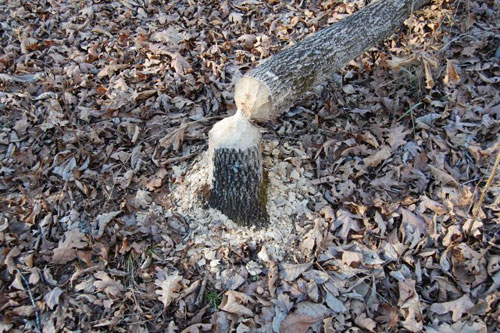
This setting provides the perfect habitat for beavers. A permanent beaver dam at the lower end of the pond pushes the water level even higher. Still, a fair amount of water flows across the dam into a series of tributaries, with more beaver dams located downstream.
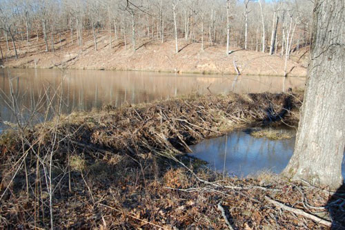
The area below the pond is littered with trees that have been toppled by the beavers. These beavers seem to be more interested in gnawing trees than constructing anything.
Blue Pond is a small part of the sprawling Castor River Conservation Area, featuring many miles of hiking and horseback riding trails. Other trails lead beyond the pond, so there's plenty of opportunity to stretch your legs.
Getting there
From Cape Girardeau, take Highway 34 through Jackson and Marble Hill and continue past Grassy. Make a left on Route Y before crossing Castor River. Follow this road until the pavement ends without much warning. Continue straight on County Road 708 for three miles and look for the small sign on the left that says "Natural Area." Take this short lane to the first parking area by the gate.
From Feb. 1 to Mar. 30 and May 15 to Sept. 1, the gate is open and it's possible to continue driving most of the way to the pond. Otherwise, park here and walk along the gravel lane until reaching the second parking lot.
Two trails begin at the second parking area and it's not very obvious which one to take. The trick is to walk past the gate on the right and ford across the creek.

Then bear left, following the wheel ruts across the open field.

The pond is located just beyond the edge of the field. The trail leads directly to the edge of the water and the beaver dam. It's possible to walk all the way around the pond, but the terrain is somewhat treacherous, especially along the right side.
Facts
Name: Blue Pond
Claim to fame: Deepest natural pond in Missouri
Where: Castor River Conservation Area in Bollinger County
Owner: Missouri Department of Conservation
Designation: Missouri Natural Area (1977)
GPS coordinates: 37.190490, -90.142991
Survey coordinates: Sec. 11, T. 29 N., R. 8 E.
Topographic quadrangle: Gipsy
Sources: Directory of Missouri Natural Areas; Geologic Wonders and Curiosities of Missouri (p. 181)
- Email link
- Read comments (3)
- Share:
Trip Planner

Respond to this blog
Posting a comment requires a subscription.