
- Email link
- Contact editor
- Report error
- Share:


2017 Flooding - May 6
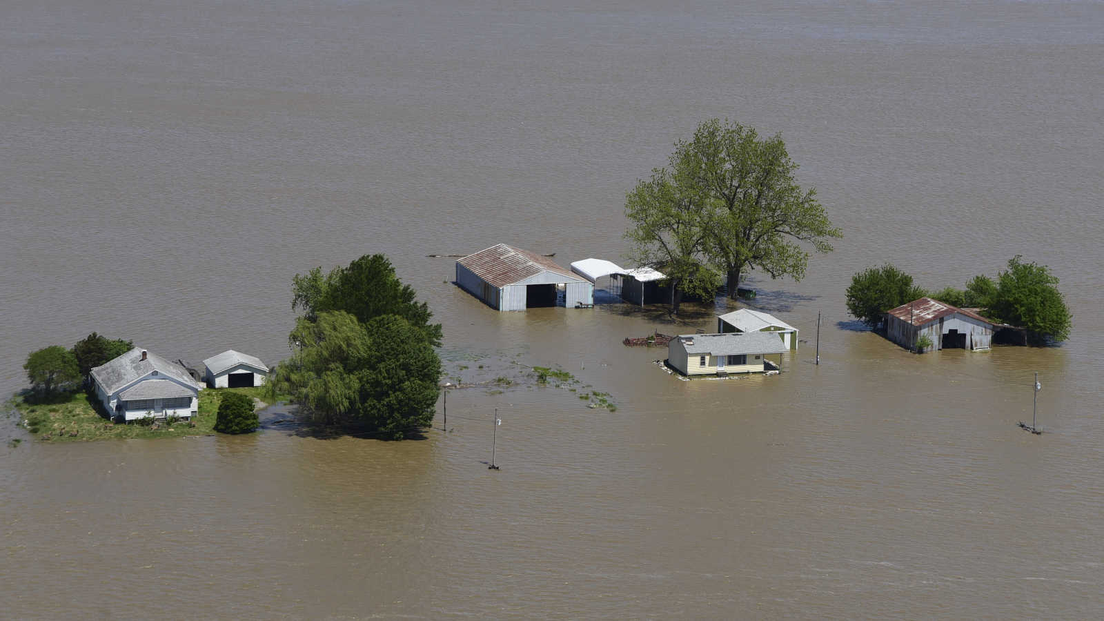
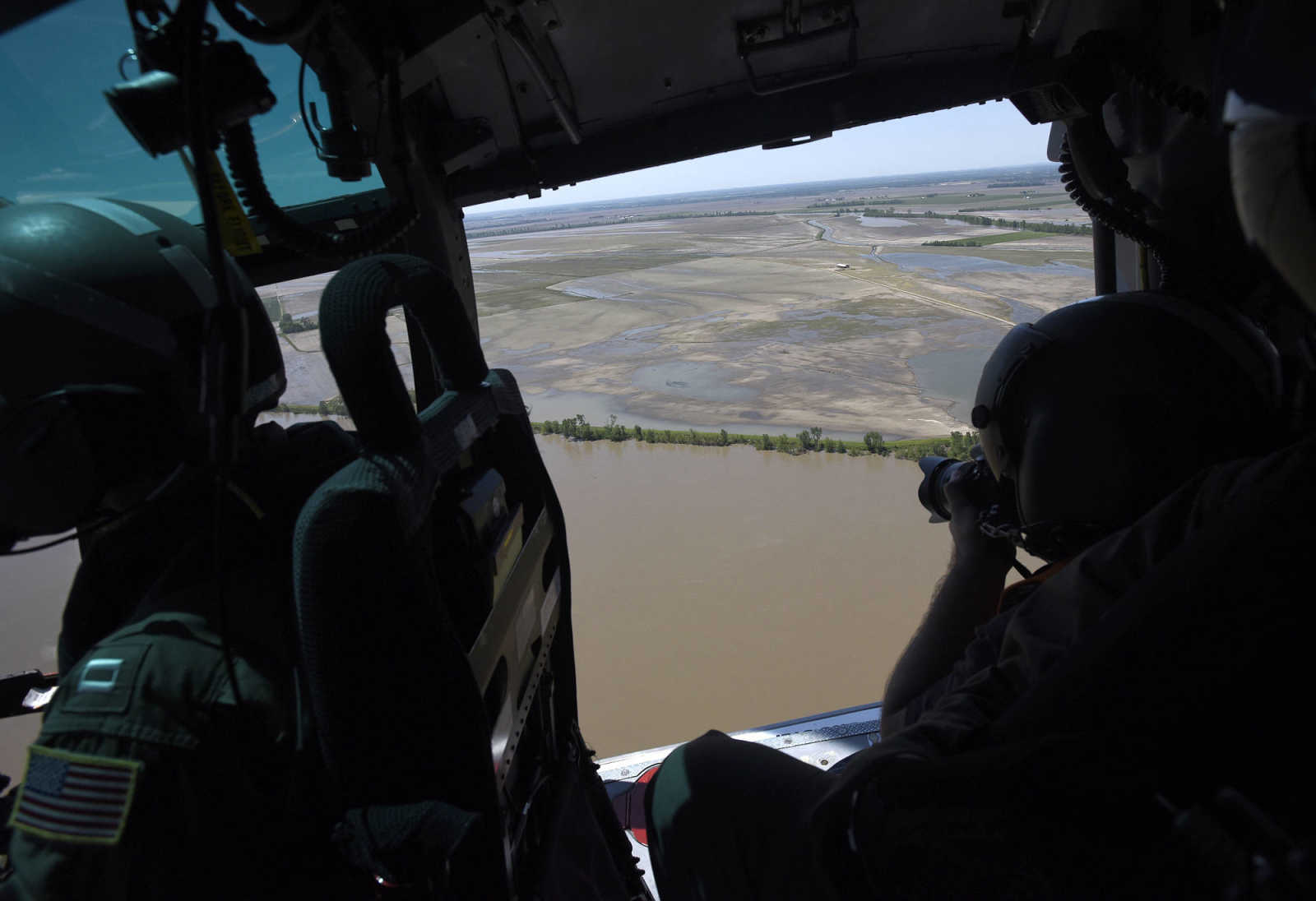
U. S. Coast Guard flight crew survey the flood area to look for possible flood breaches along the Mississippi River from Cape Girardeau to Cairo, Illinois on Saturday, May 6, 2017.
-
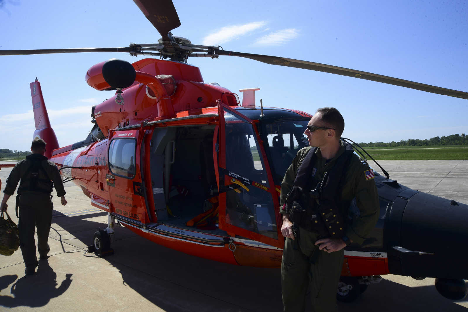
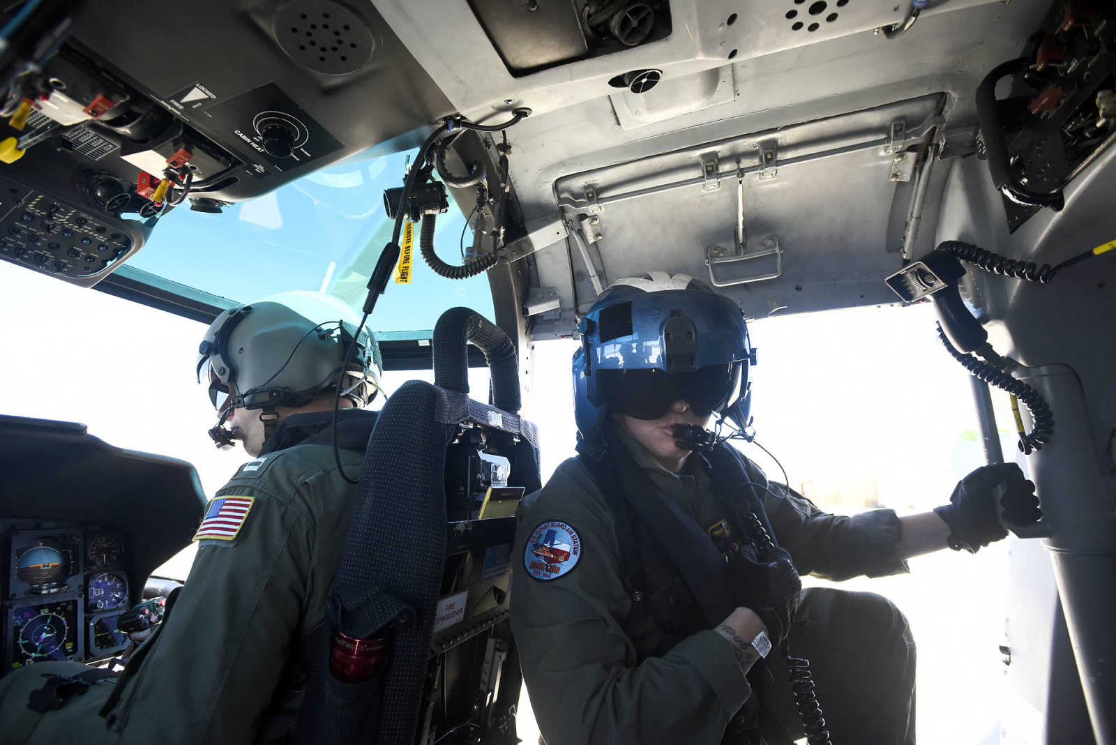
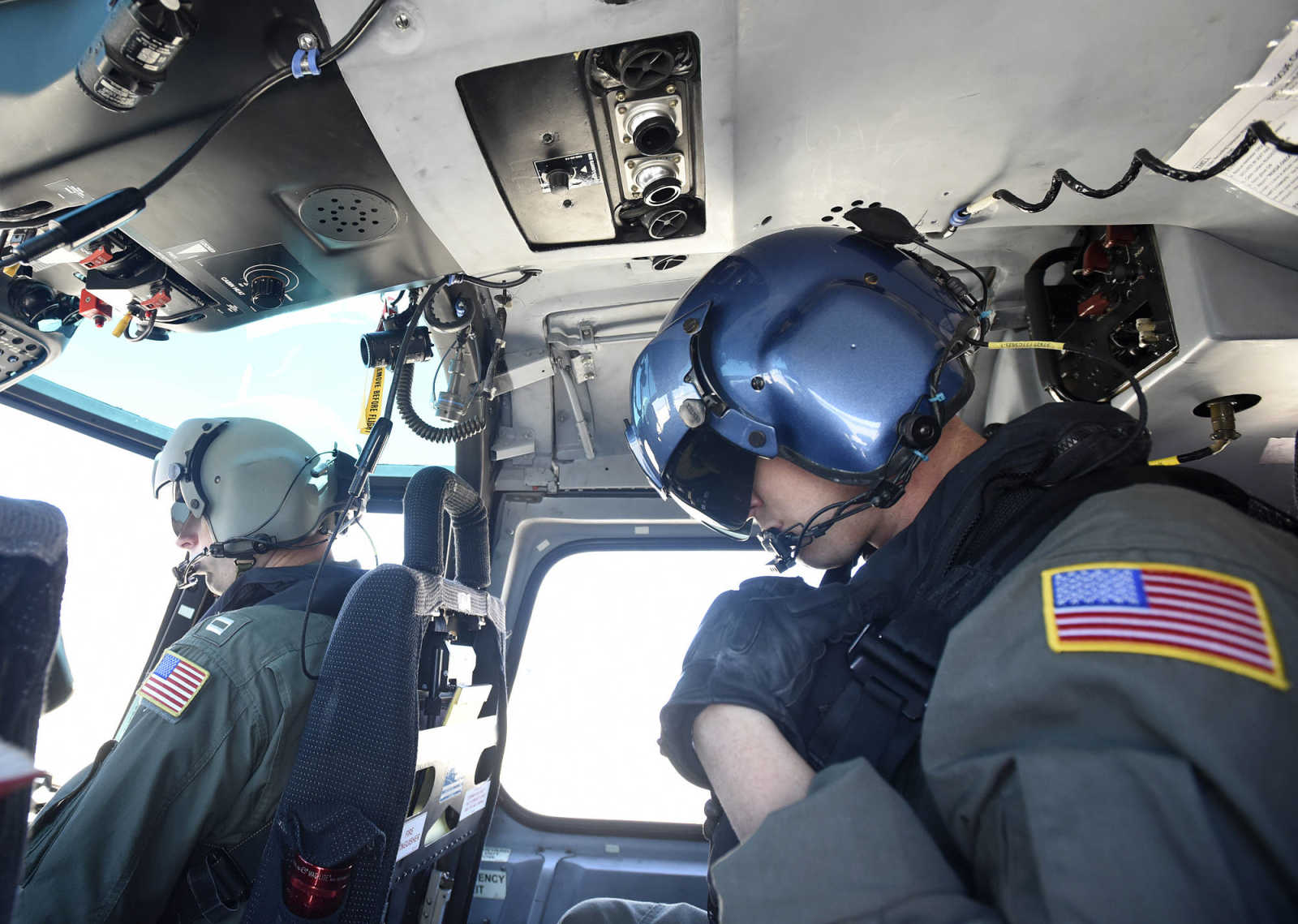
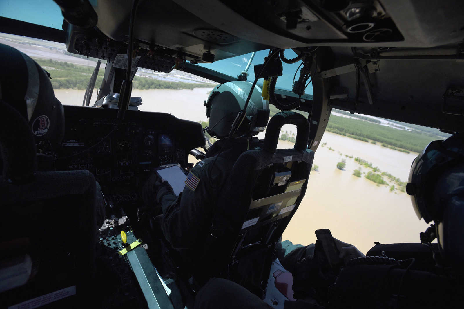 Lt. Daniel Crowley, left, Lt. Allan Carroll, center, and AMT2 Colin McFadden with the U.S. Coast Guard survey the flood zone along the Mississippi River on Saturday, May 6, 2017. (Laura Simon ~ Southeast Missourian)
 -
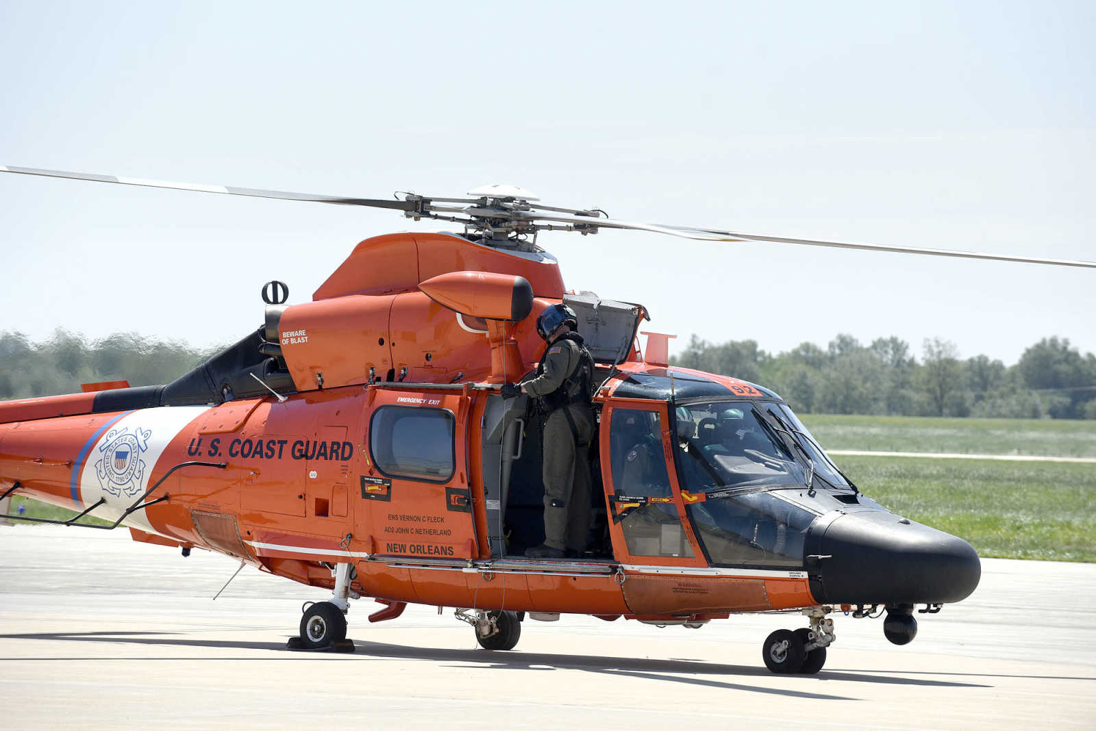
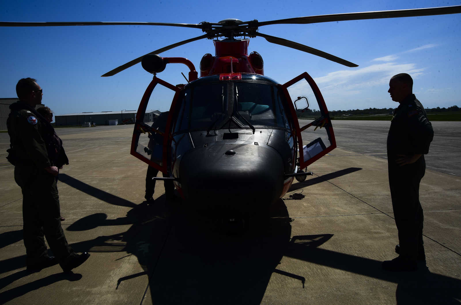 U. S. Coast Guard flight crew prepare to take off to survey the flood area to look for possible flood breaches along the Mississippi River from Cape Girardeau to Cairo, Illinois Saturday, May 6, 2017. (Andrew J. Whitaker ~ Southeast Missourian)
 -
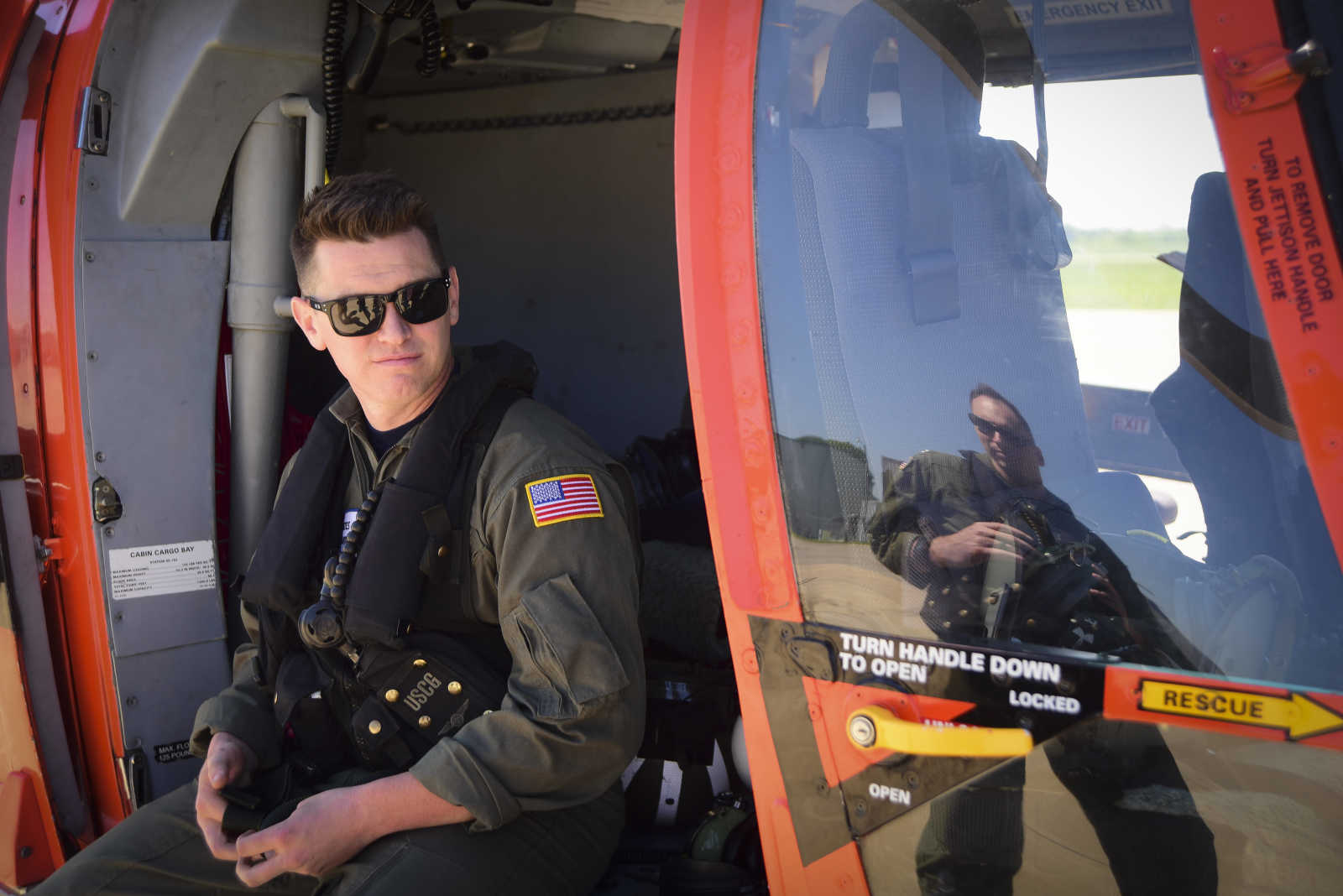 U.S. Coast Guard AMT 2 Colin McFadden waits to take off to survey the flood area to look for possible flood breaches along the Mississippi River from Cape Girardeau to Cairo, Illinois Saturday, May 6, 2017. (Andrew J. Whitaker ~ Southeast Missourian)
 -
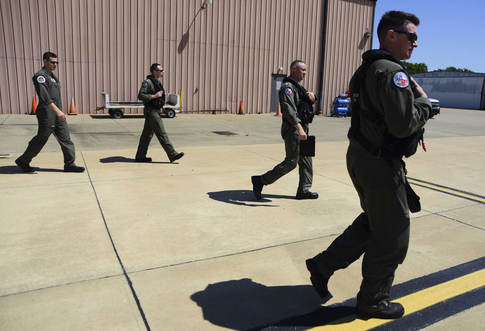 U. S. Coast Guard flight crew prepare to take off to survey the flood area to look for possible flood breaches along the Mississippi River from Cape Girardeau to Cairo, Illinois Saturday, May 6, 2017. (Andrew J. Whitaker ~ Southeast Missourian)
 -
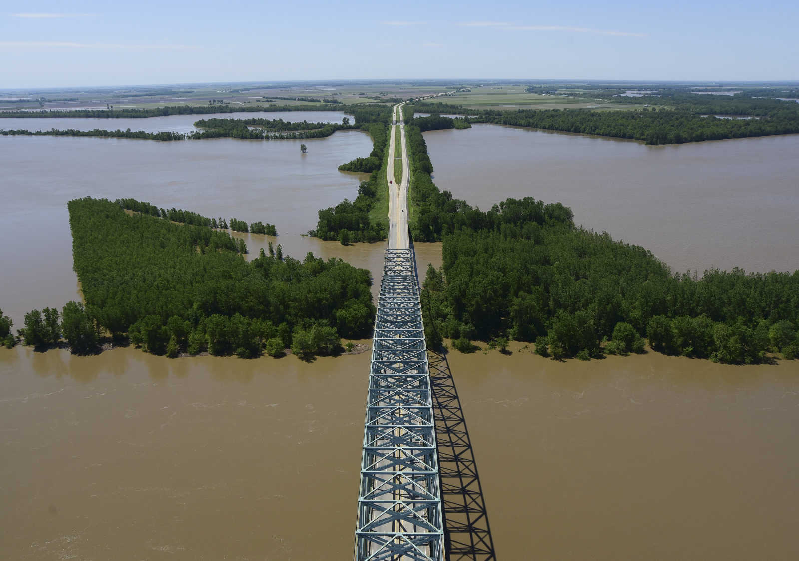
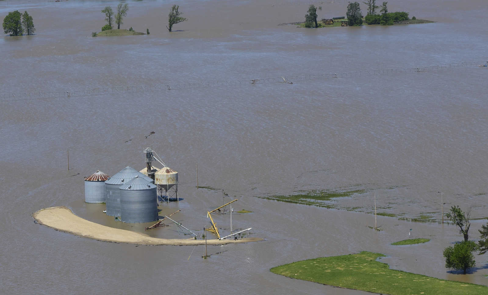
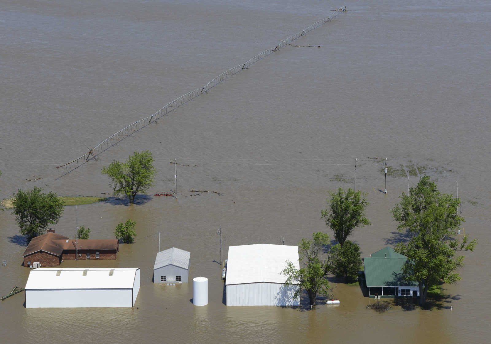
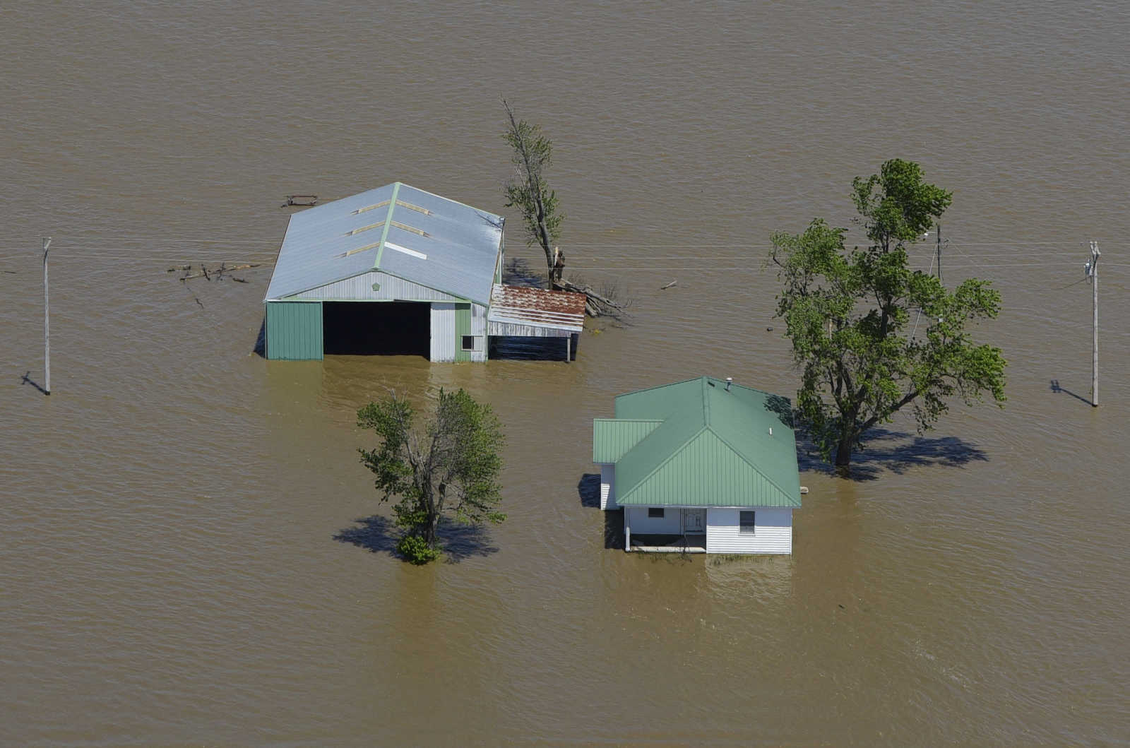
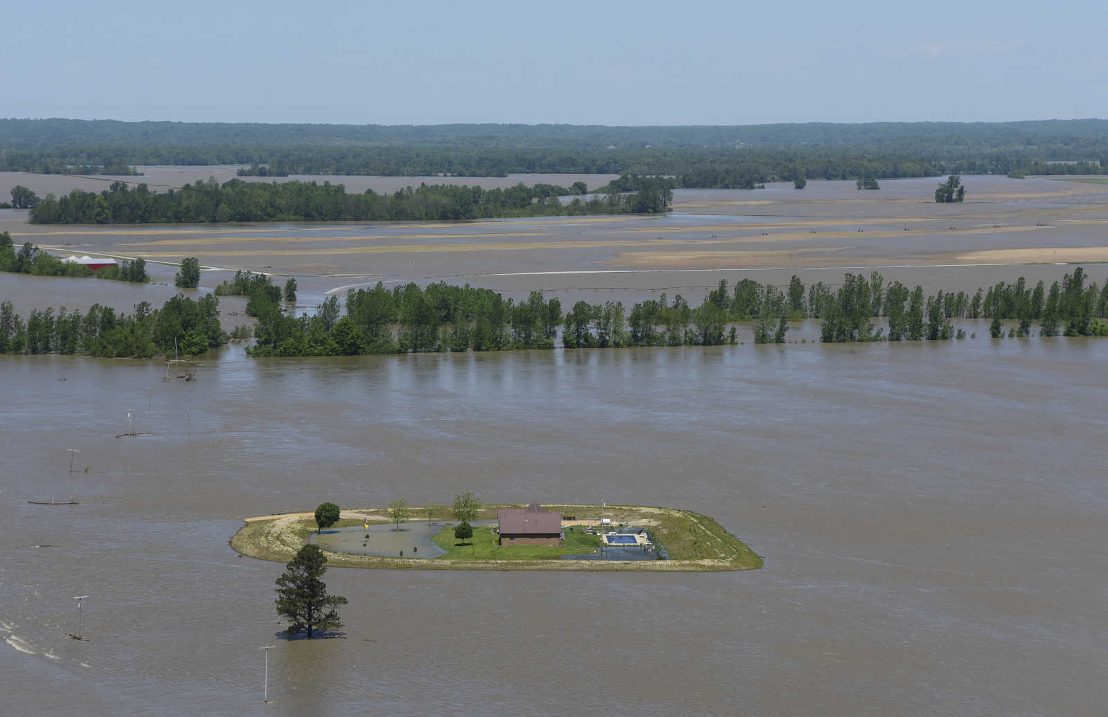
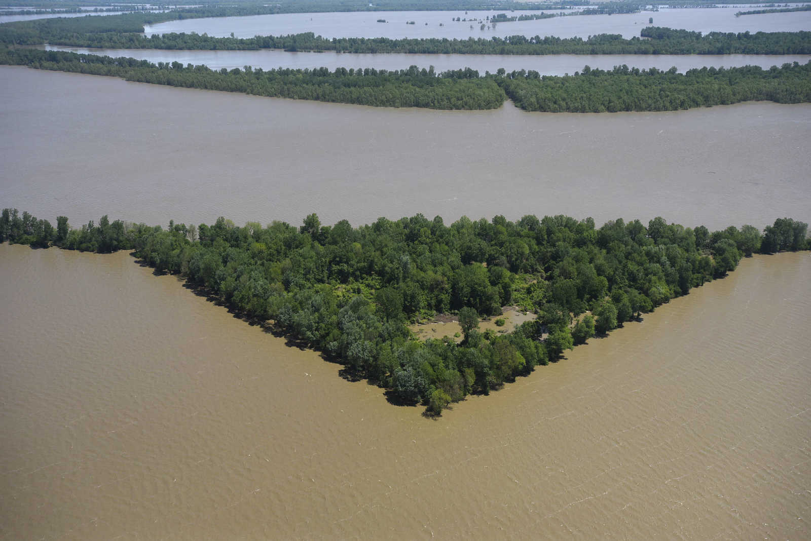
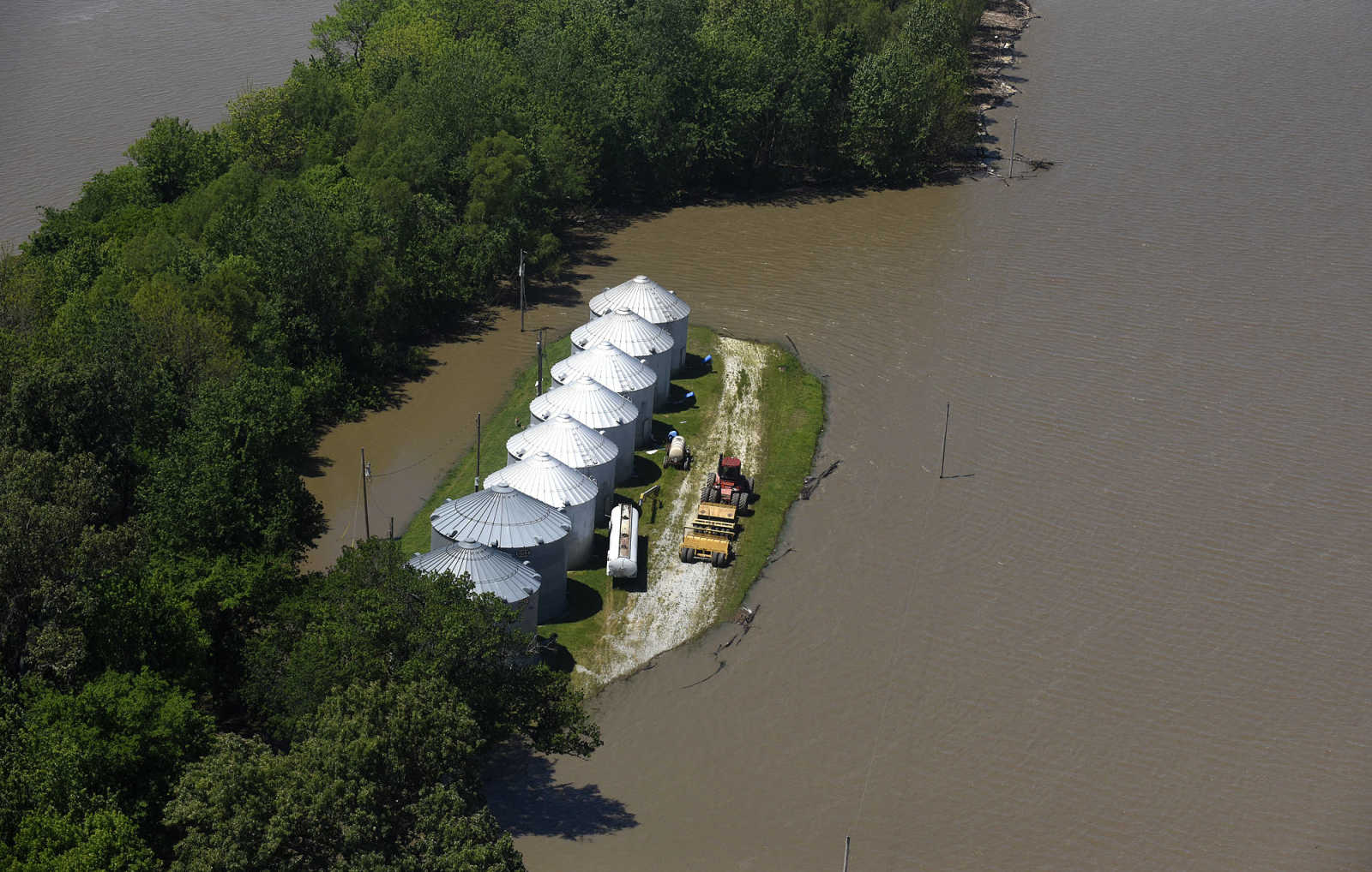
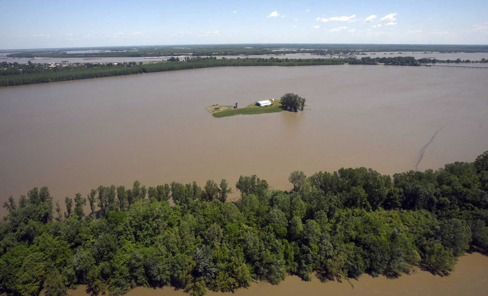
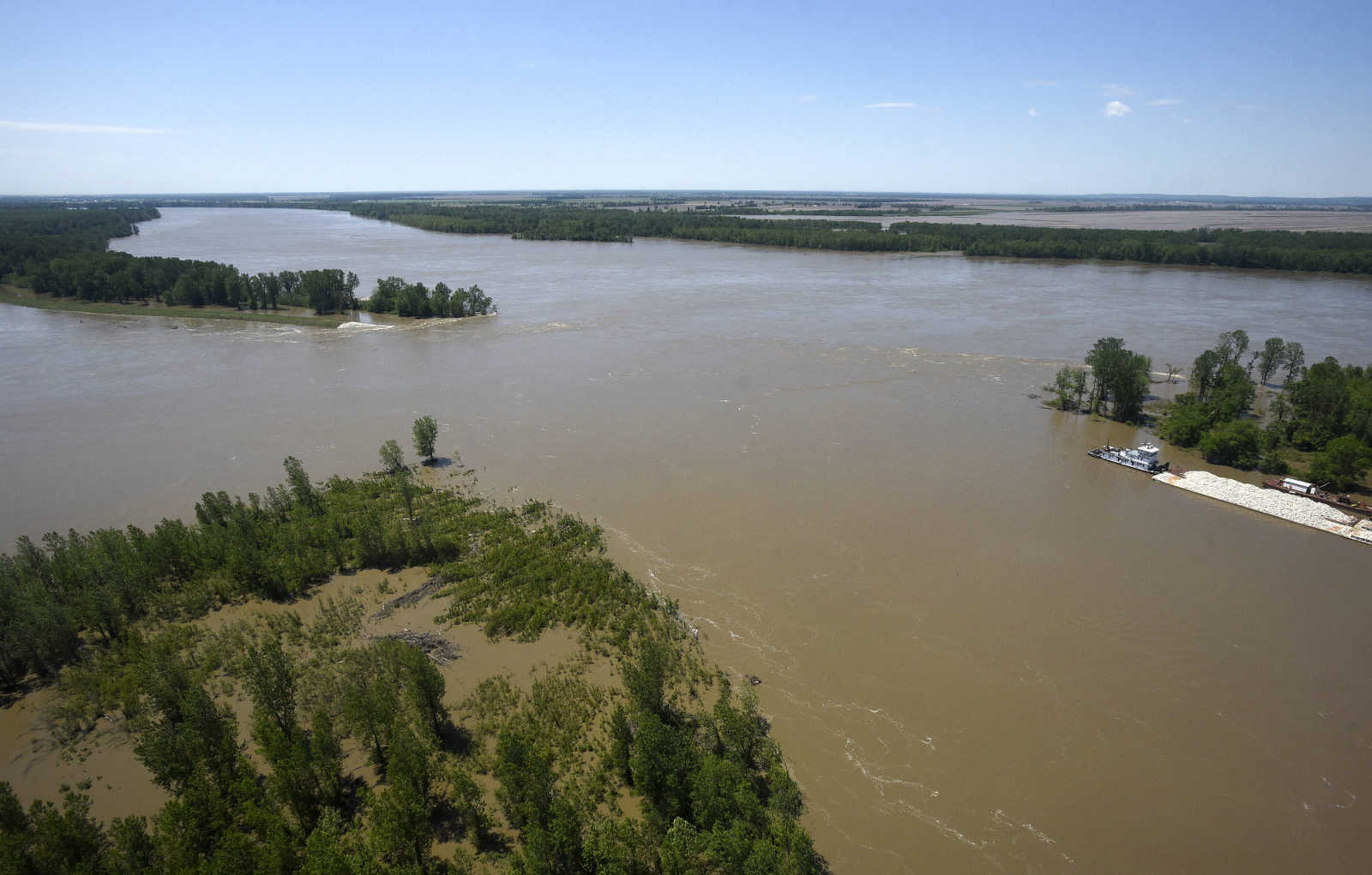
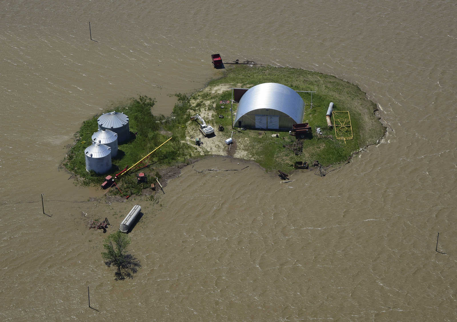 Flooded area is seen along the Mississippi River from Cape Girardeau to Cairo, Illinois Saturday, May 6, 2017. (Andrew J. Whitaker ~ Southeast Missourian)
 -
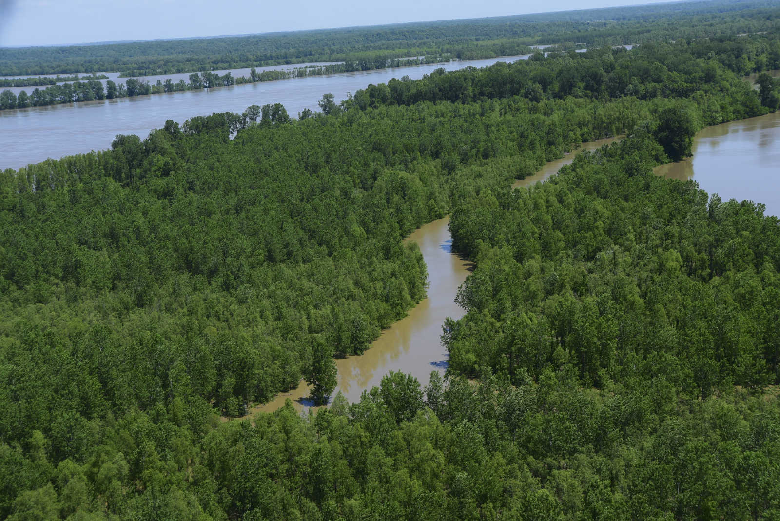
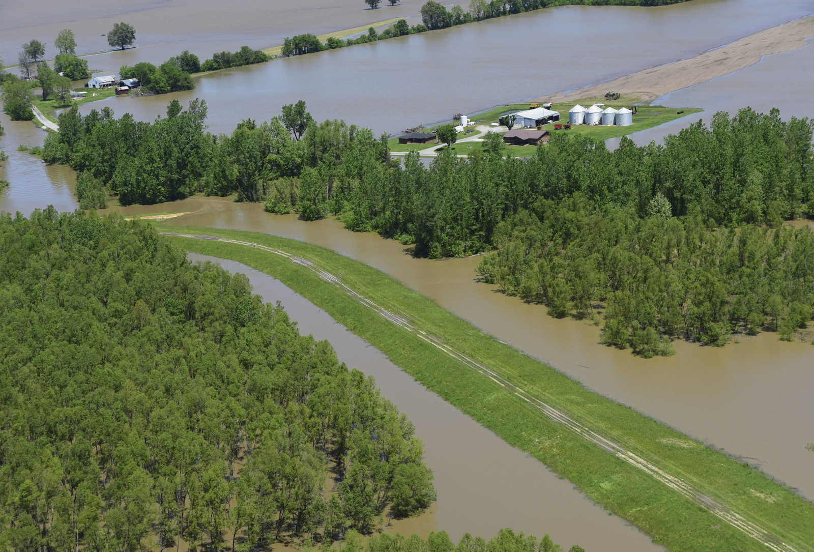
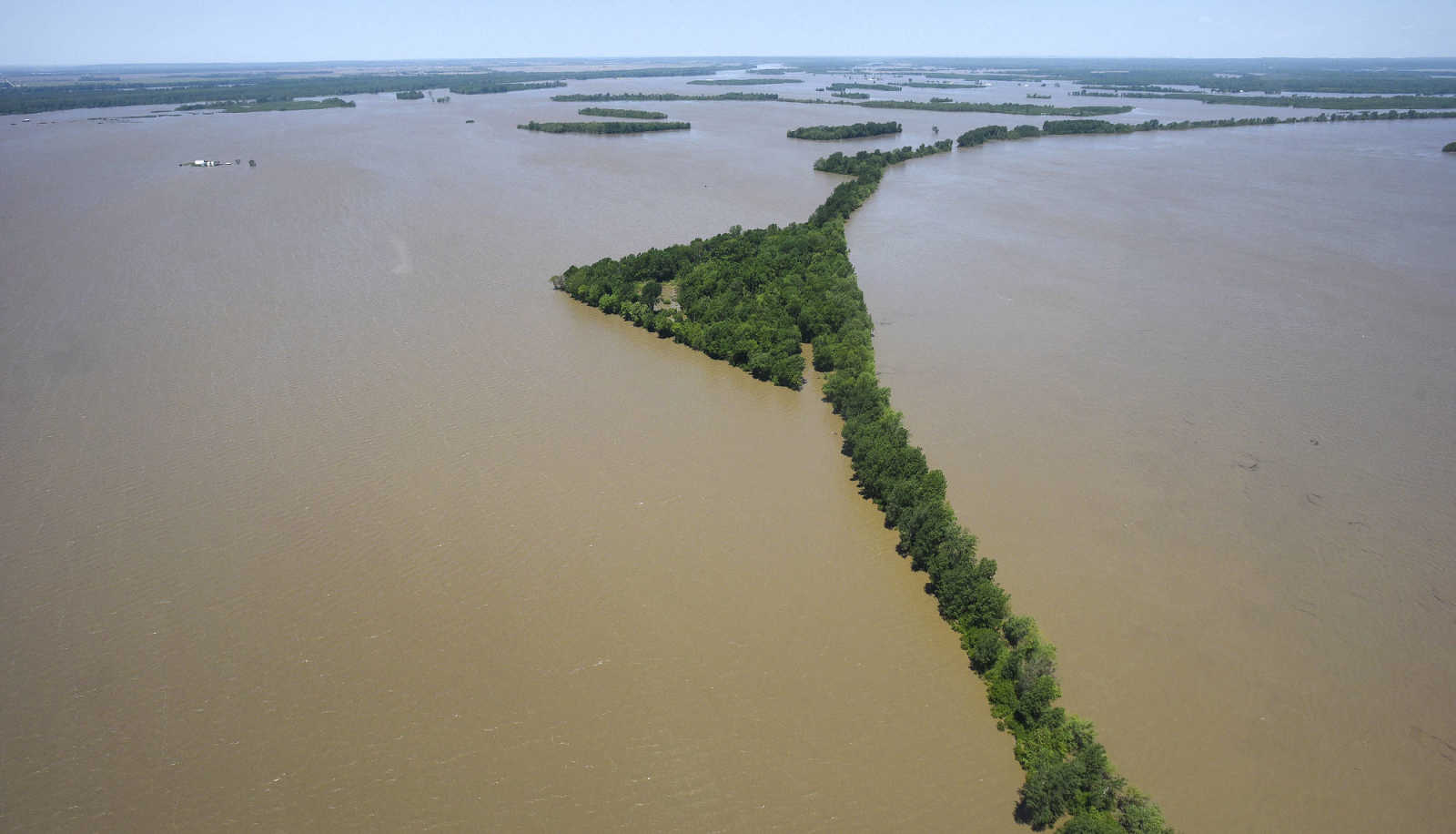
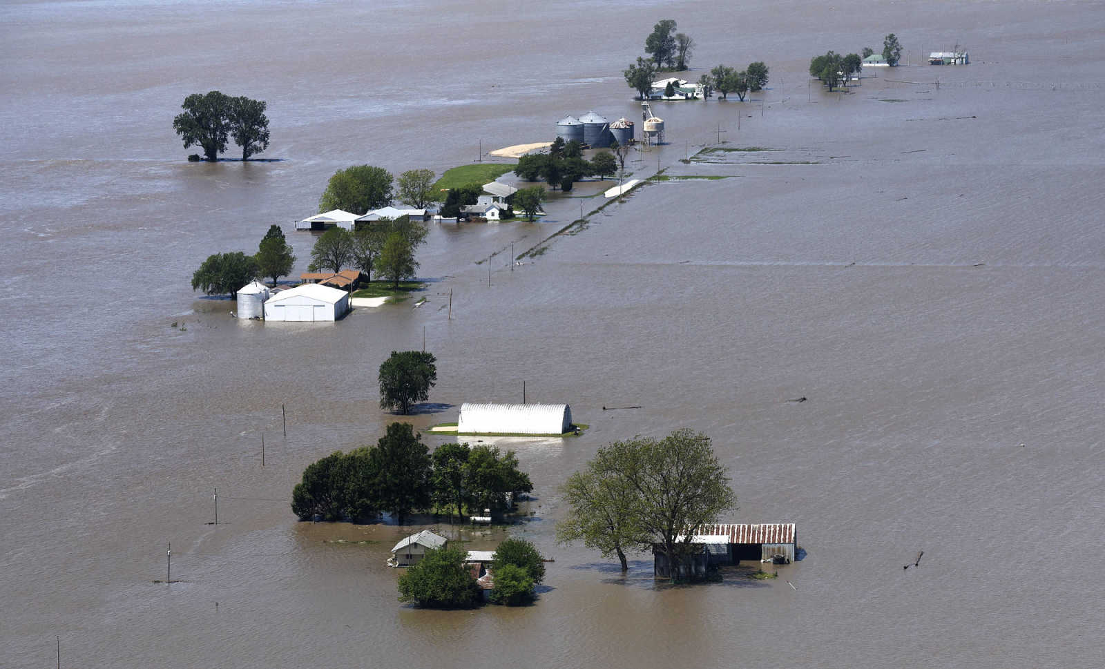
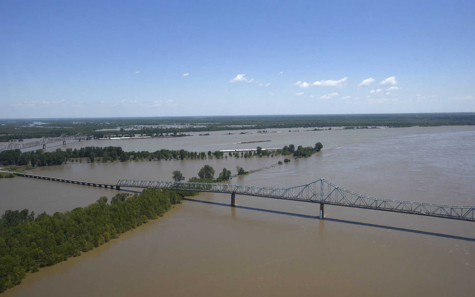
 Flooded area is seen along the Mississippi River from Cape Girardeau to Cairo, Illinois Saturday, May 6, 2017. (Andrew J. Whitaker ~ Southeast Missourian)
 -
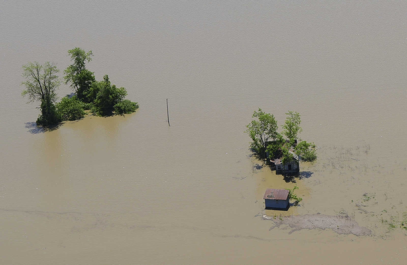
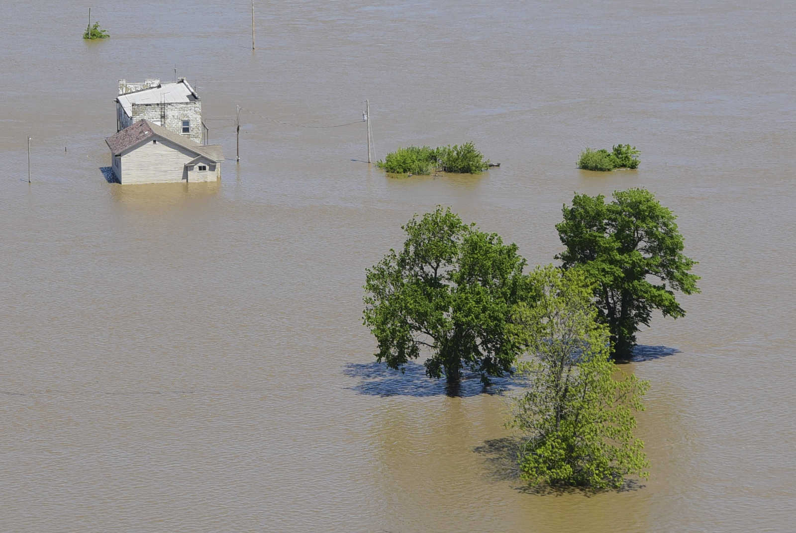
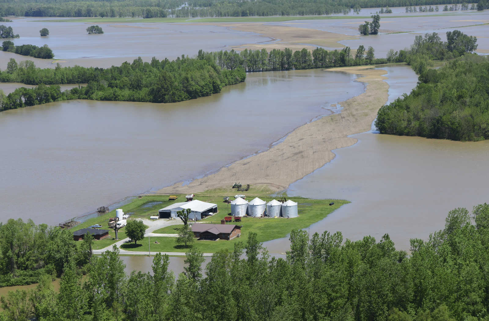
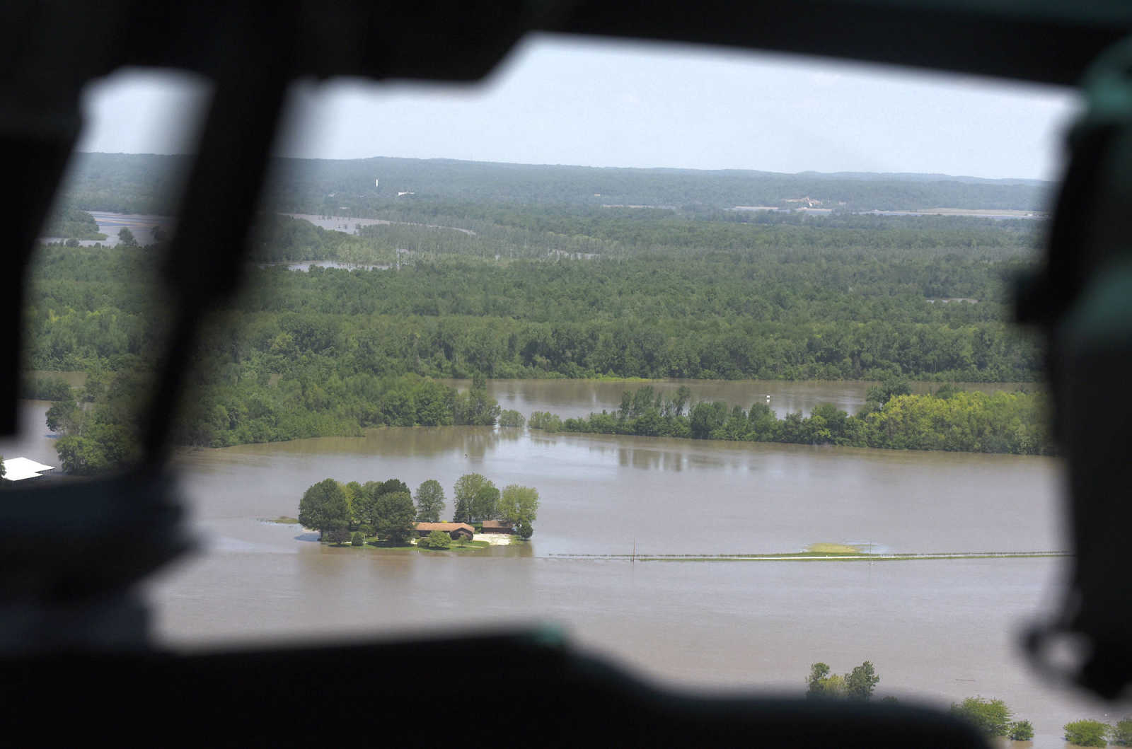
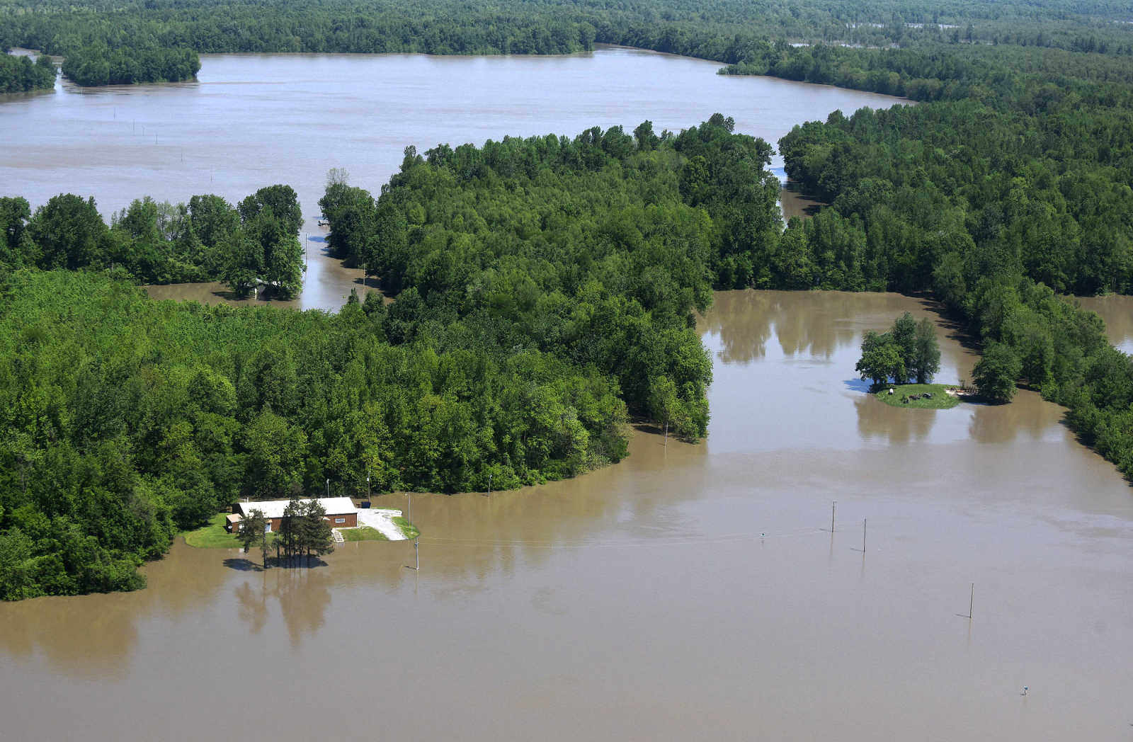
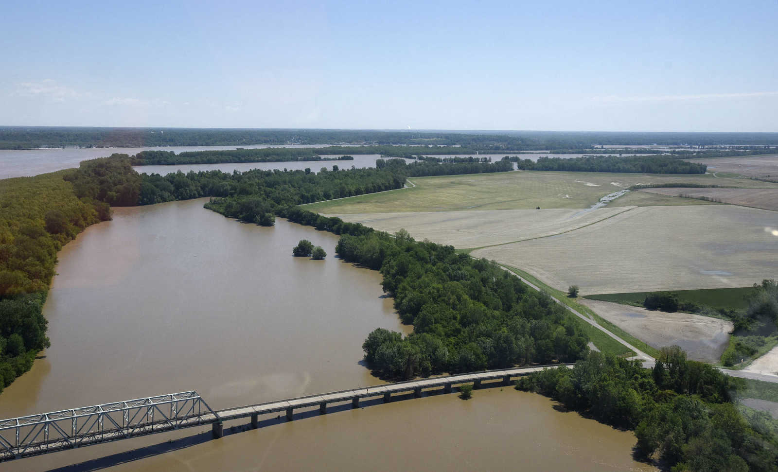
 Flooded area is seen along the Mississippi River from Cape Girardeau to Cairo, Illinois Saturday, May 6, 2017. (Andrew J. Whitaker ~ Southeast Missourian)
 -
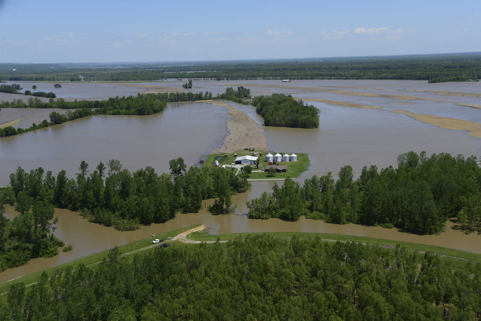
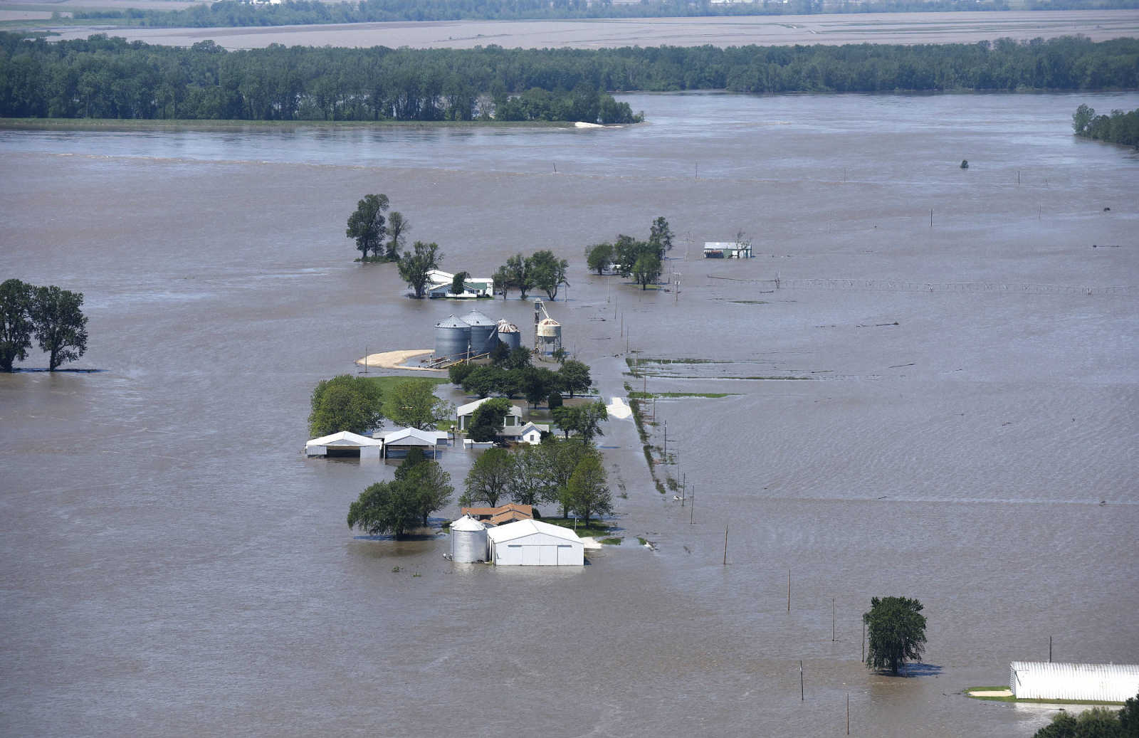
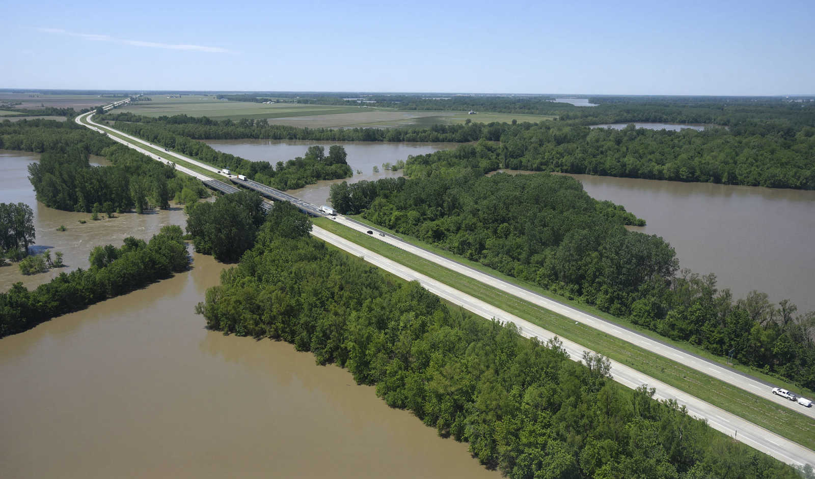
 Flooded area is seen along the Mississippi River from Cape Girardeau to Cairo, Illinois Saturday, May 6, 2017. (Andrew J. Whitaker ~ Southeast Missourian)
 -
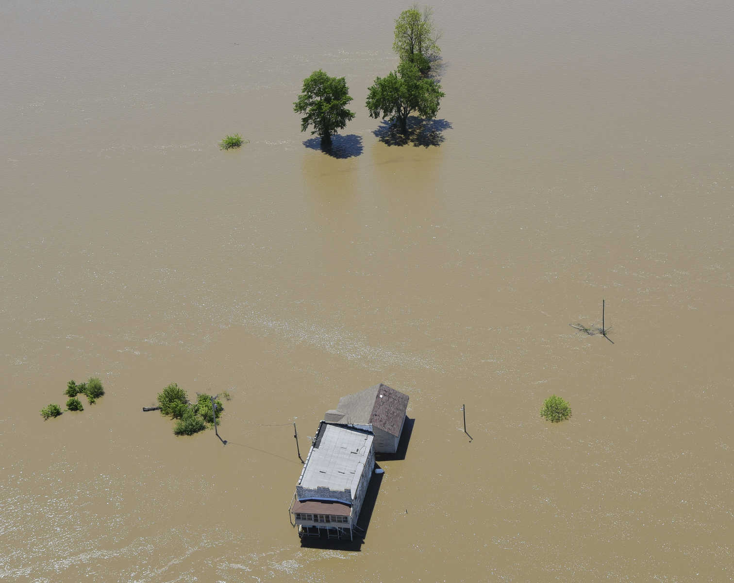
 Flooded area is seen along the Mississippi River from Cape Girardeau to Cairo, Illinois Saturday, May 6, 2017. (Andrew J. Whitaker ~ Southeast Missourian)
 -
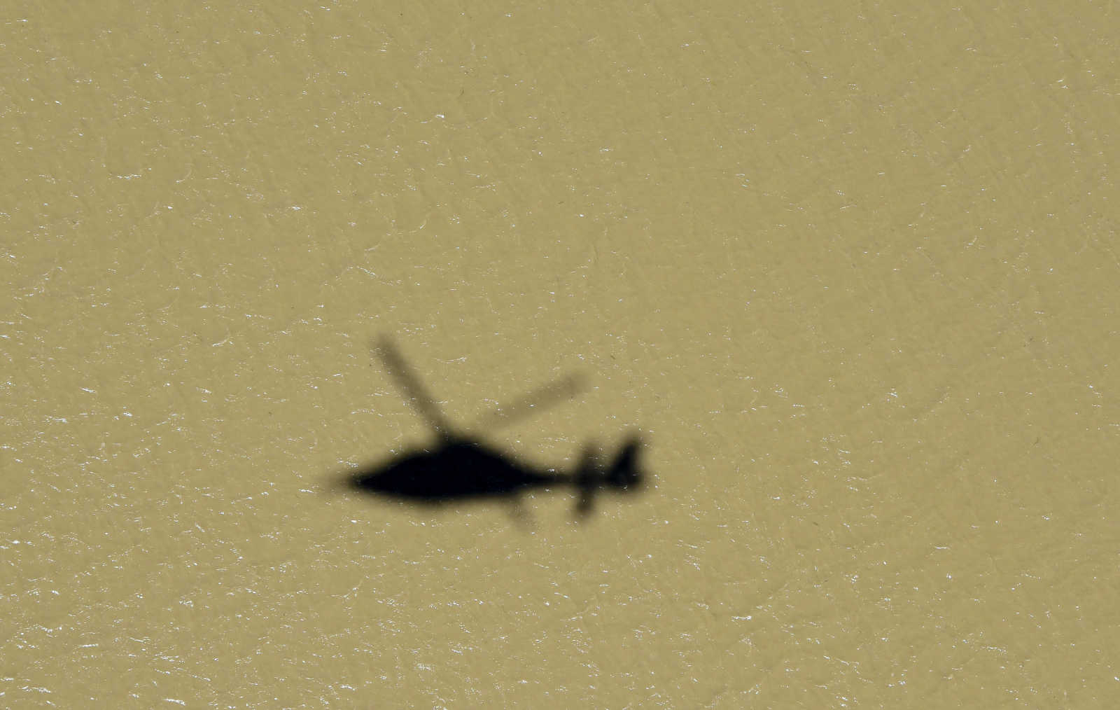 The Shadow of the U.S. Coast Guard helicopter flies along the Mississippi River from Cape Girardeau to Cairo, Illinois Saturday, May 6, 2017. (Andrew J. Whitaker ~ Southeast Missourian)
 -
 Flooded area is seen along the Mississippi River from Cape Girardeau to Cairo, Illinois Saturday, May 6, 2017. (Andrew J. Whitaker ~ Southeast Missourian)
 -
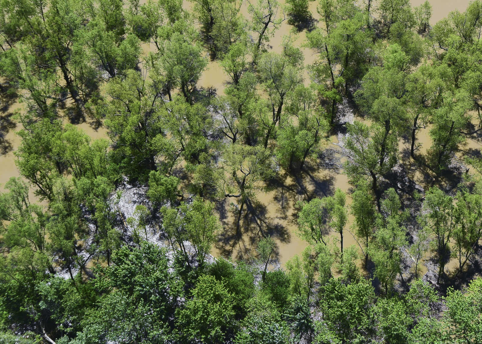
 Flooded area is seen along the Mississippi River from Cape Girardeau to Cairo, Illinois Saturday, May 6, 2017. (Andrew J. Whitaker ~ Southeast Missourian)
 -
 Flooded area is seen along the Mississippi River from Cape Girardeau to Cairo, Illinois Saturday, May 6, 2017. (Andrew J. Whitaker ~ Southeast Missourian)
 -
 Flooded area is seen along the Mississippi River from Cape Girardeau to Cairo, Illinois Saturday, May 6, 2017. (Andrew J. Whitaker ~ Southeast Missourian)
 -
 Flooded area is seen along the Mississippi River from Cape Girardeau to Cairo, Illinois Saturday, May 6, 2017. (Andrew J. Whitaker ~ Southeast Missourian)
 -
 Flooded area is seen along the Mississippi River from Cape Girardeau to Cairo, Illinois Saturday, May 6, 2017. (Andrew J. Whitaker ~ Southeast Missourian)
 -
 Flooded area is seen along the Mississippi River from Cape Girardeau to Cairo, Illinois Saturday, May 6, 2017. (Andrew J. Whitaker ~ Southeast Missourian)
 -
 Flooded area is seen along the Mississippi River from Cape Girardeau to Cairo, Illinois Saturday, May 6, 2017. (Andrew J. Whitaker ~ Southeast Missourian)
 -
 Flooded area is seen along the Mississippi River from Cape Girardeau to Cairo, Illinois Saturday, May 6, 2017. (Andrew J. Whitaker ~ Southeast Missourian)
 -
 Flooded area is seen along the Mississippi River from Cape Girardeau to Cairo, Illinois Saturday, May 6, 2017. (Andrew J. Whitaker ~ Southeast Missourian)
 -
 Flooded area is seen along the Mississippi River from Cape Girardeau to Cairo, Illinois Saturday, May 6, 2017. (Andrew J. Whitaker ~ Southeast Missourian)
 -
 Flooded area is seen from Thebes, Illinois while the U.S. Coast Guard surveys area along the Mississippi River from Cape Girardeau to Cairo, Illinois Saturday, May 6, 2017. (Andrew J. Whitaker ~ Southeast Missourian)
 -
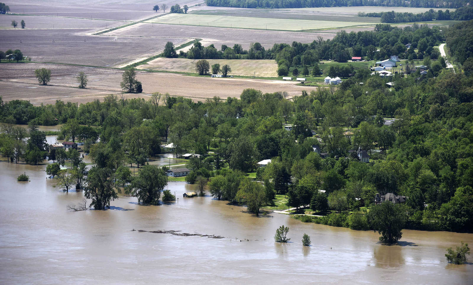
 Flooded area is seen from East Cape Girardeau, Illinois while the U.S. Coast Guard surveys area along the Mississippi River from Cape Girardeau to Cairo, Illinois Saturday, May 6, 2017. (Andrew J. Whitaker ~ Southeast Missourian)
 -
 Flooded area is seen from East Cape Girardeau, Illinois while the U.S. Coast Guard surveys area along the Mississippi River from Cape Girardeau to Cairo, Illinois Saturday, May 6, 2017. (Andrew J. Whitaker ~ Southeast Missourian)
 -
 Flooded area is seen from Cape Girardeau while the U.S. Coast Guard surveys area along the Mississippi River from Cape Girardeau to Cairo, Illinois Saturday, May 6, 2017. (Andrew J. Whitaker ~ Southeast Missourian)
 -
 Flooded area is seen from Cape Girardeau while the U.S. Coast Guard surveys area along the Mississippi River from Cape Girardeau to Cairo, Illinois Saturday, May 6, 2017. (Andrew J. Whitaker ~ Southeast Missourian)
 -
 U. S. Coast Guard flight crew prepare to take off to survey the flood area to look for possible flood breaches along the Mississippi River from Cape Girardeau to Cairo, Illinois Saturday, May 6, 2017. (Andrew J. Whitaker ~ Southeast Missourian)
 -
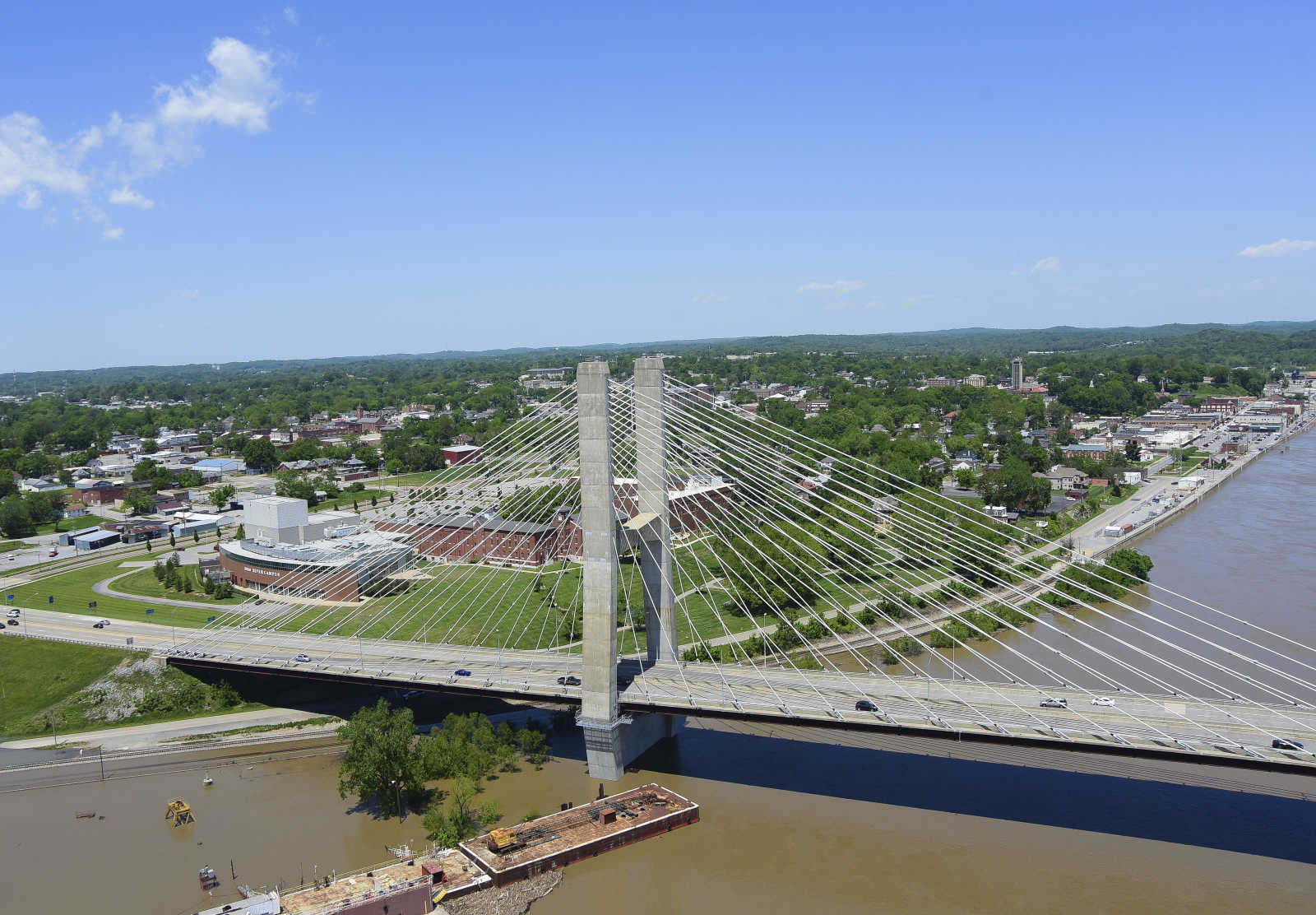
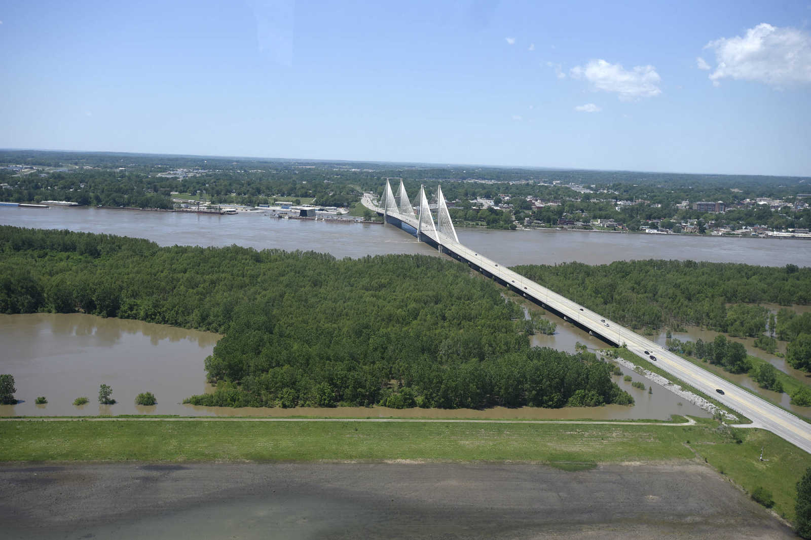
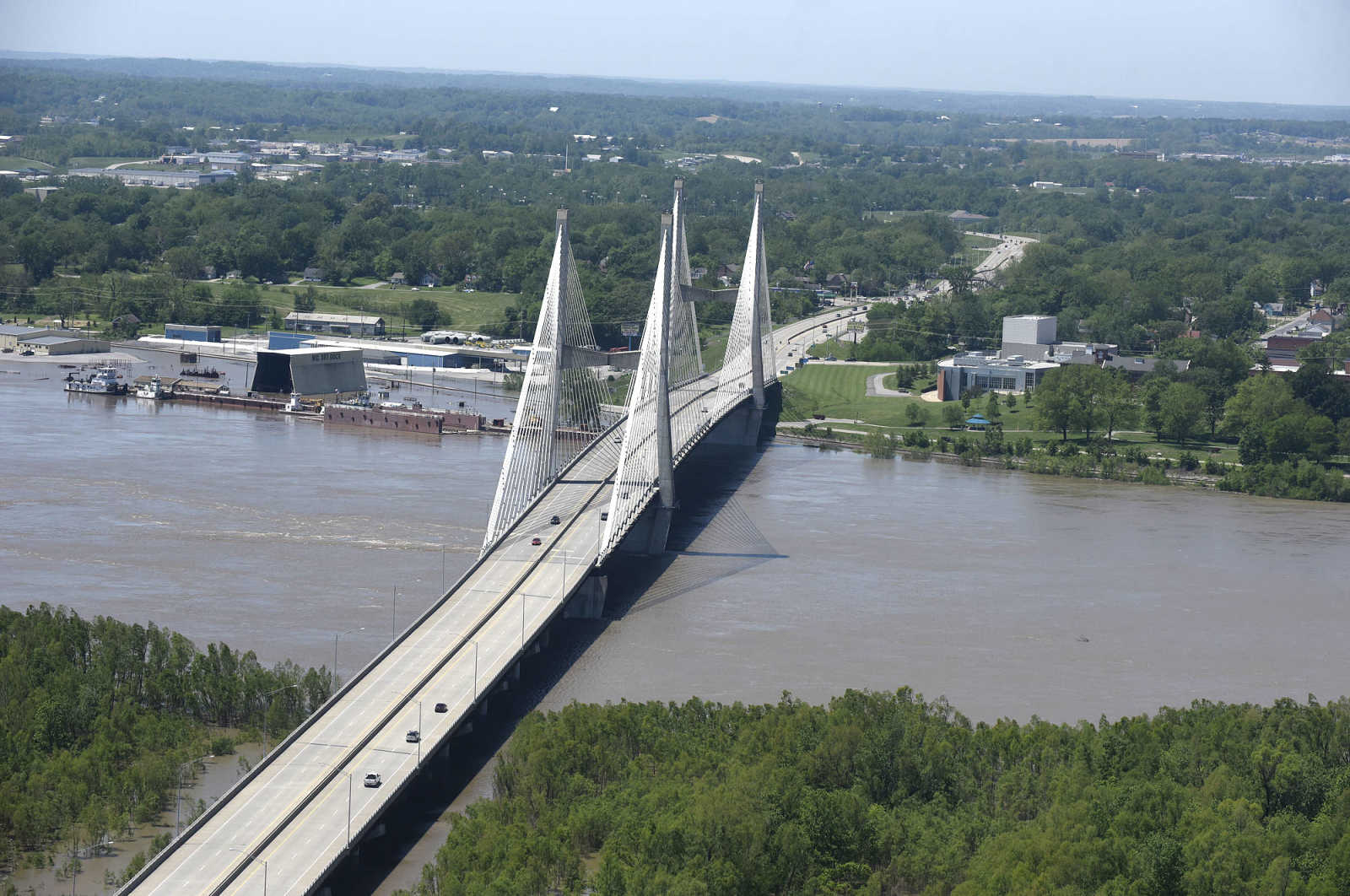
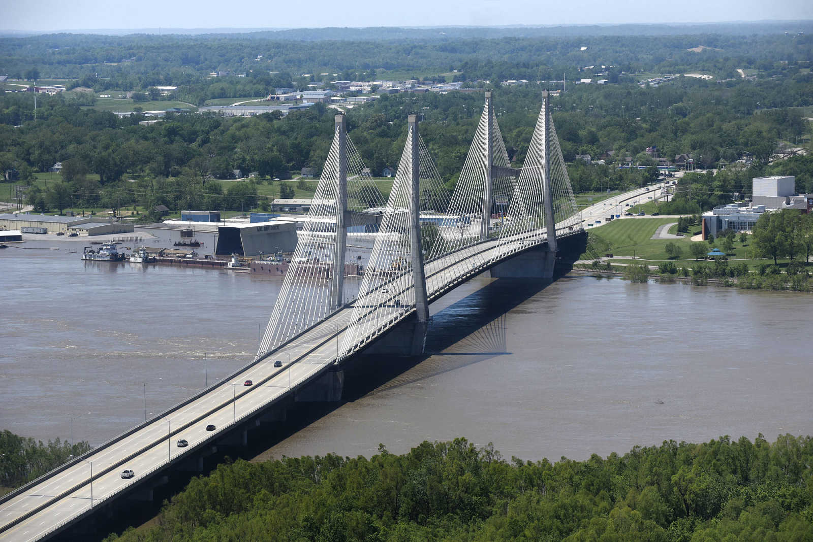
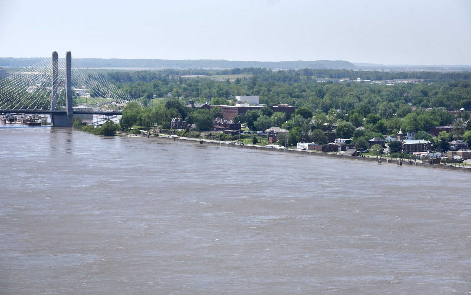
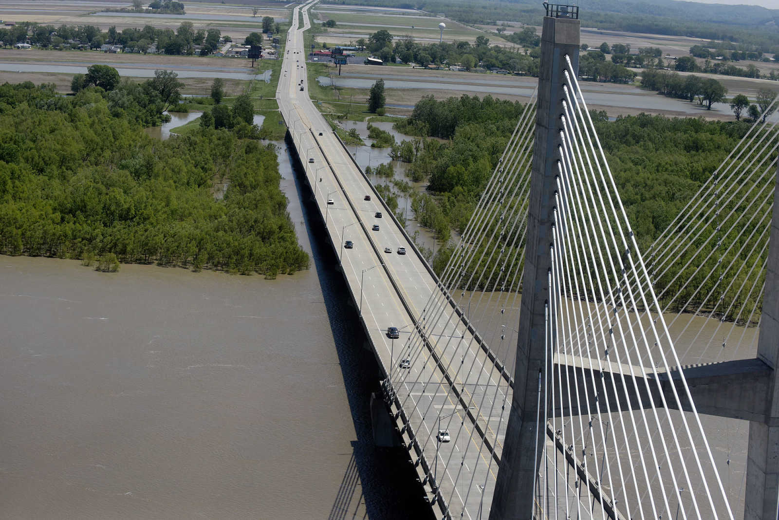
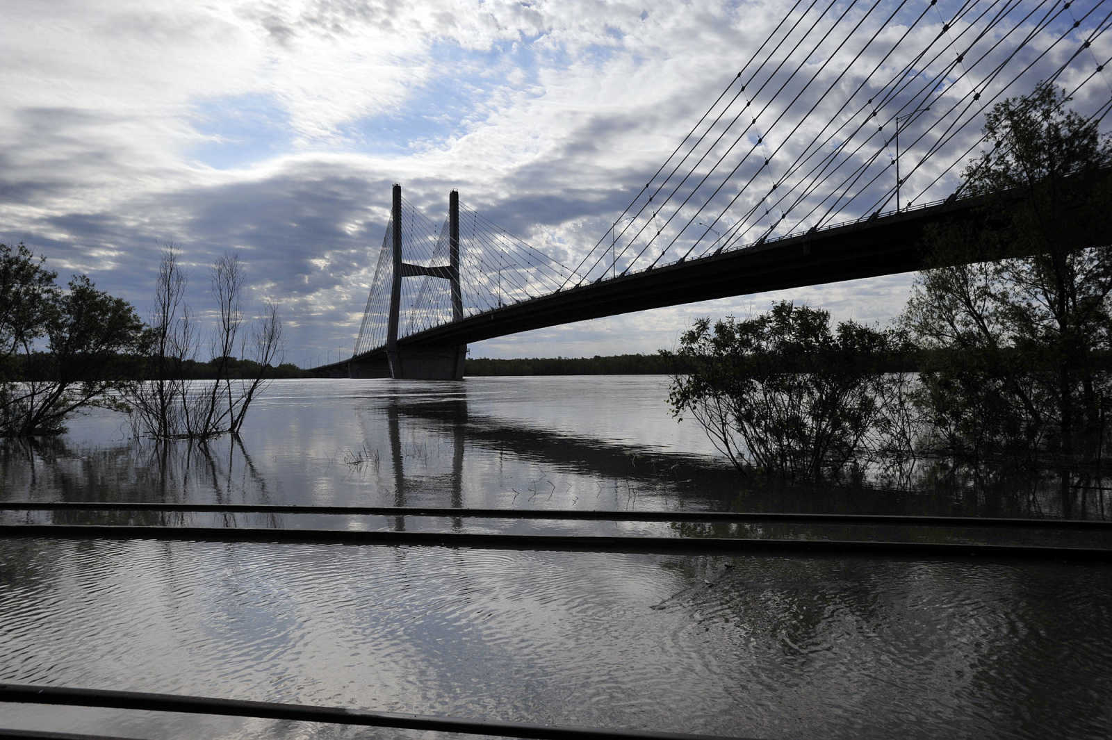
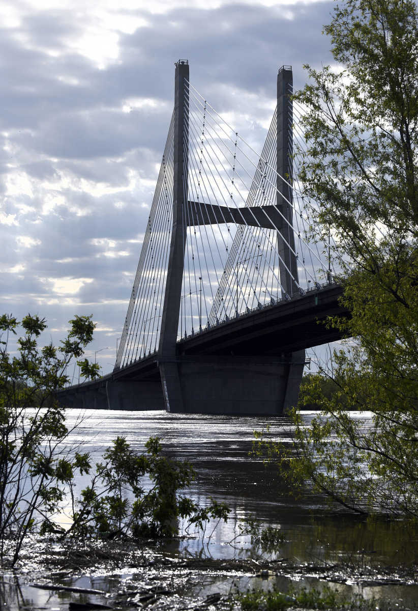
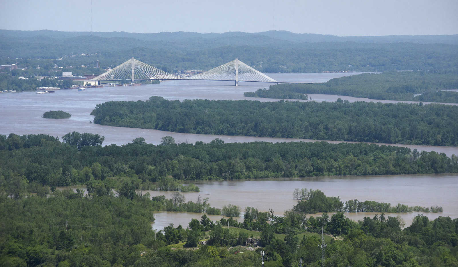
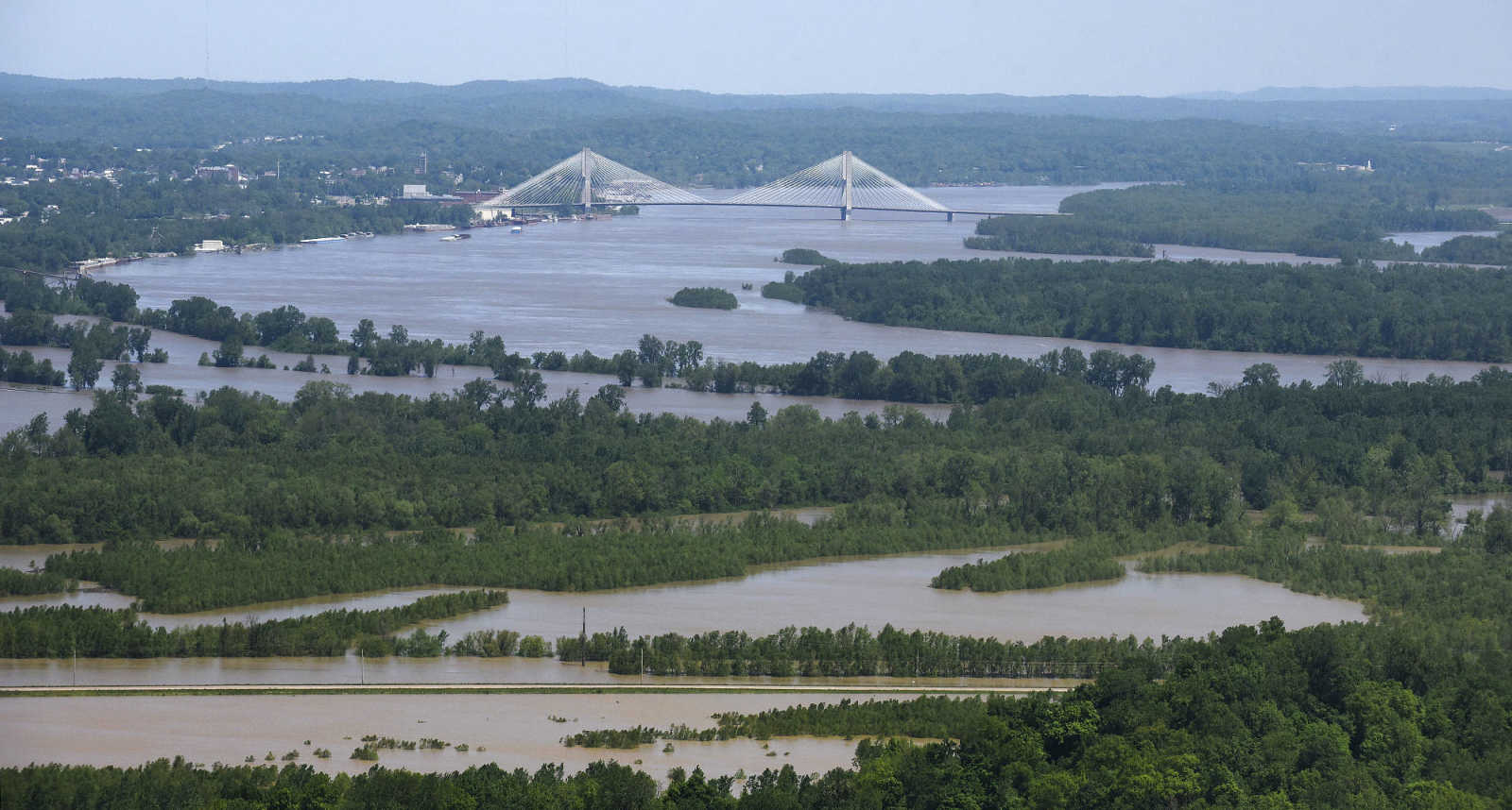
 The Bill Emerson Memorial Bridge in Cape Girardeau rises high above the swollen Mississippi River on Saturday, May 6, 2017. (Laura Simon ~ Southeast Missourian)
 -
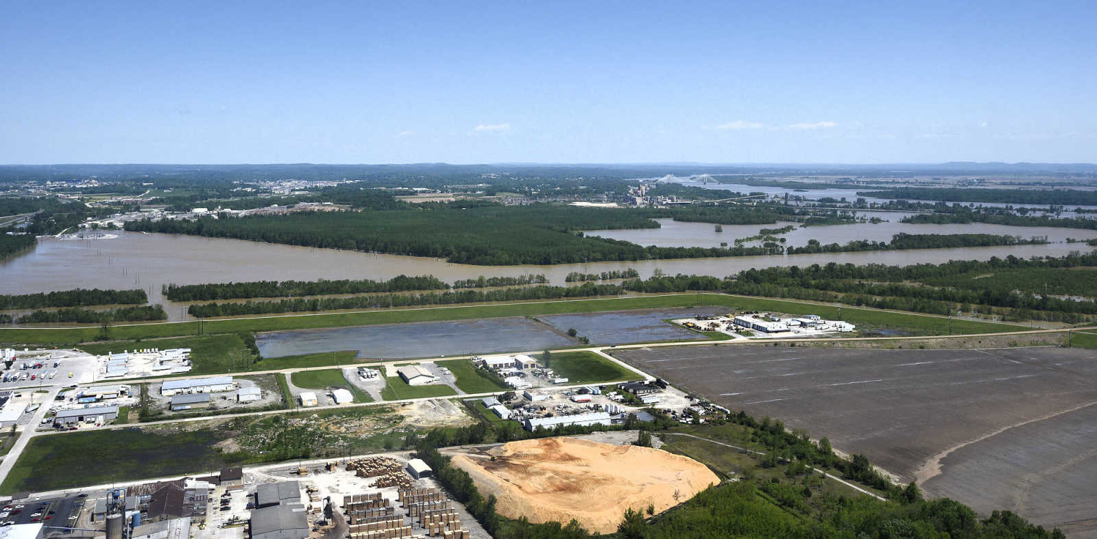
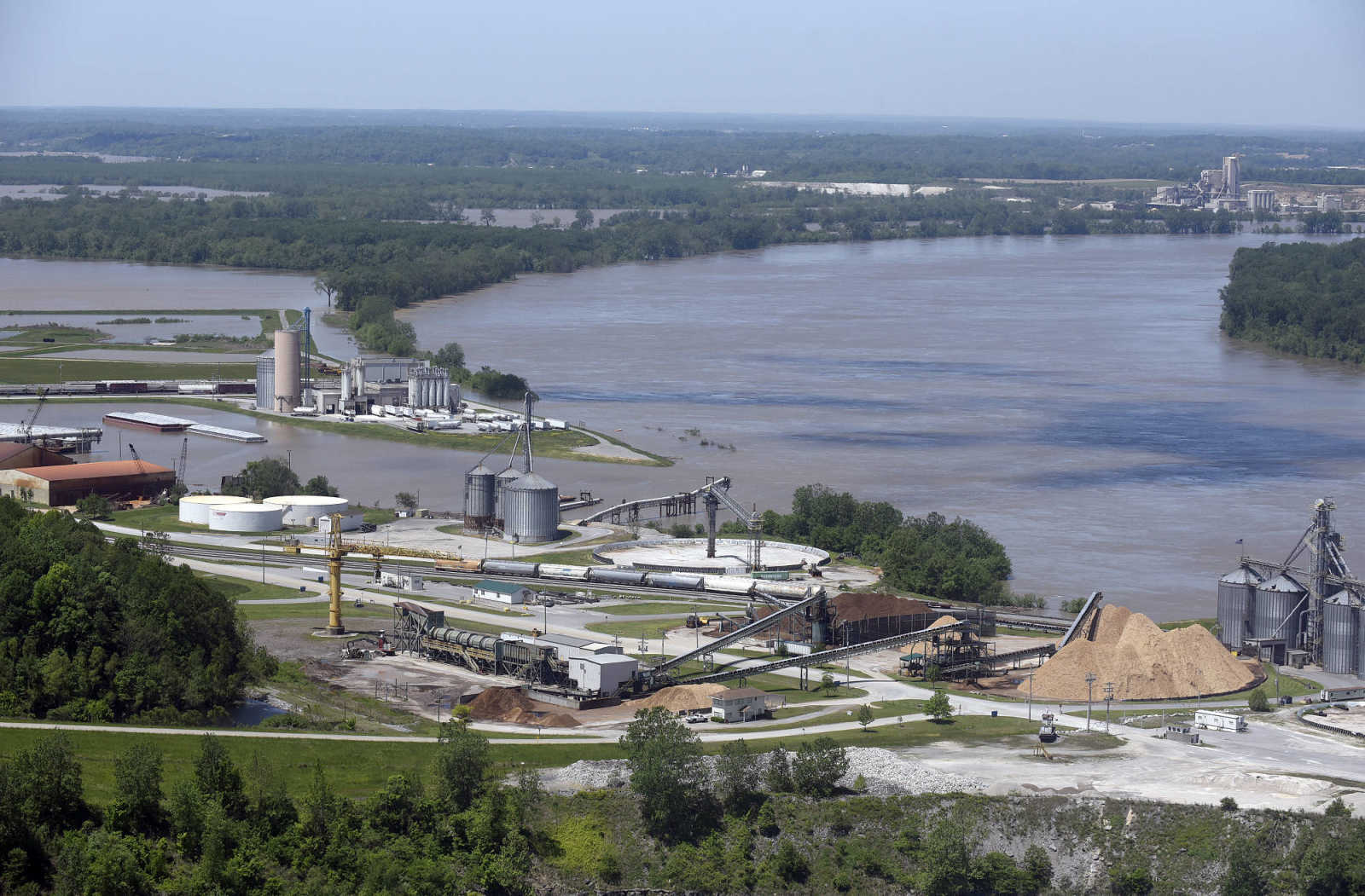 The swollen Mississippi River is seen along the SEMO Port on Saturday, May 6, 2017. (Laura Simon ~ Southeast Missourian)
 -
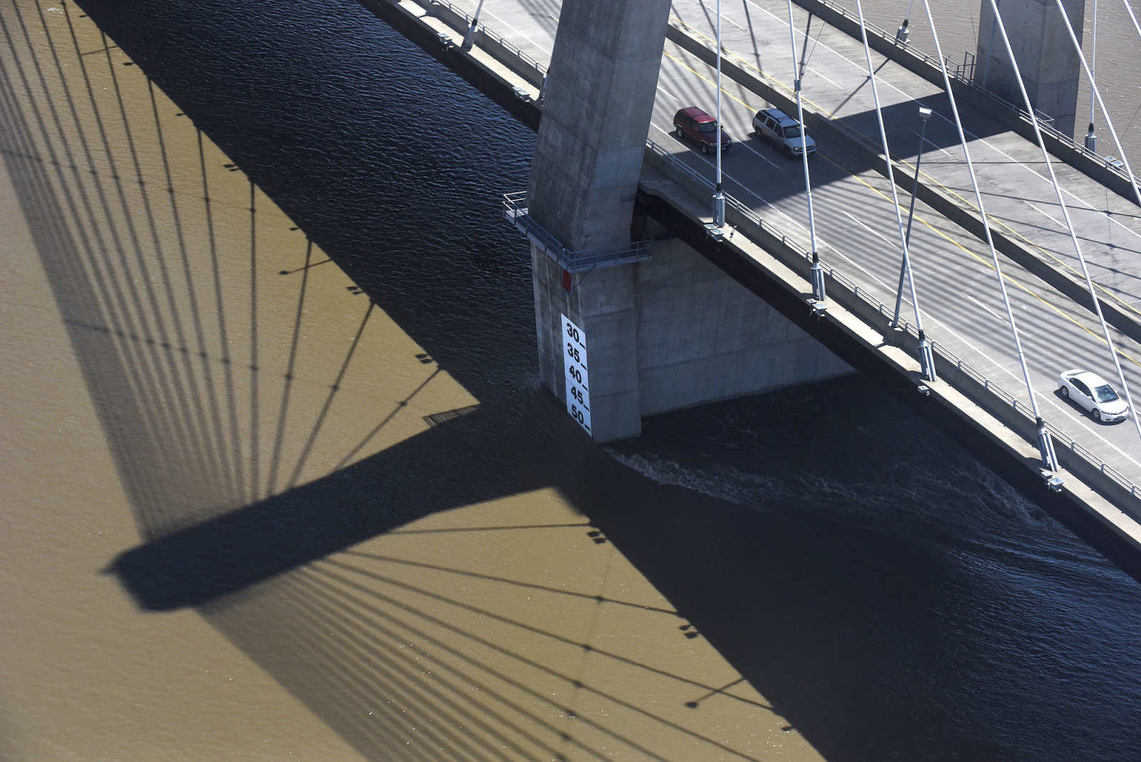
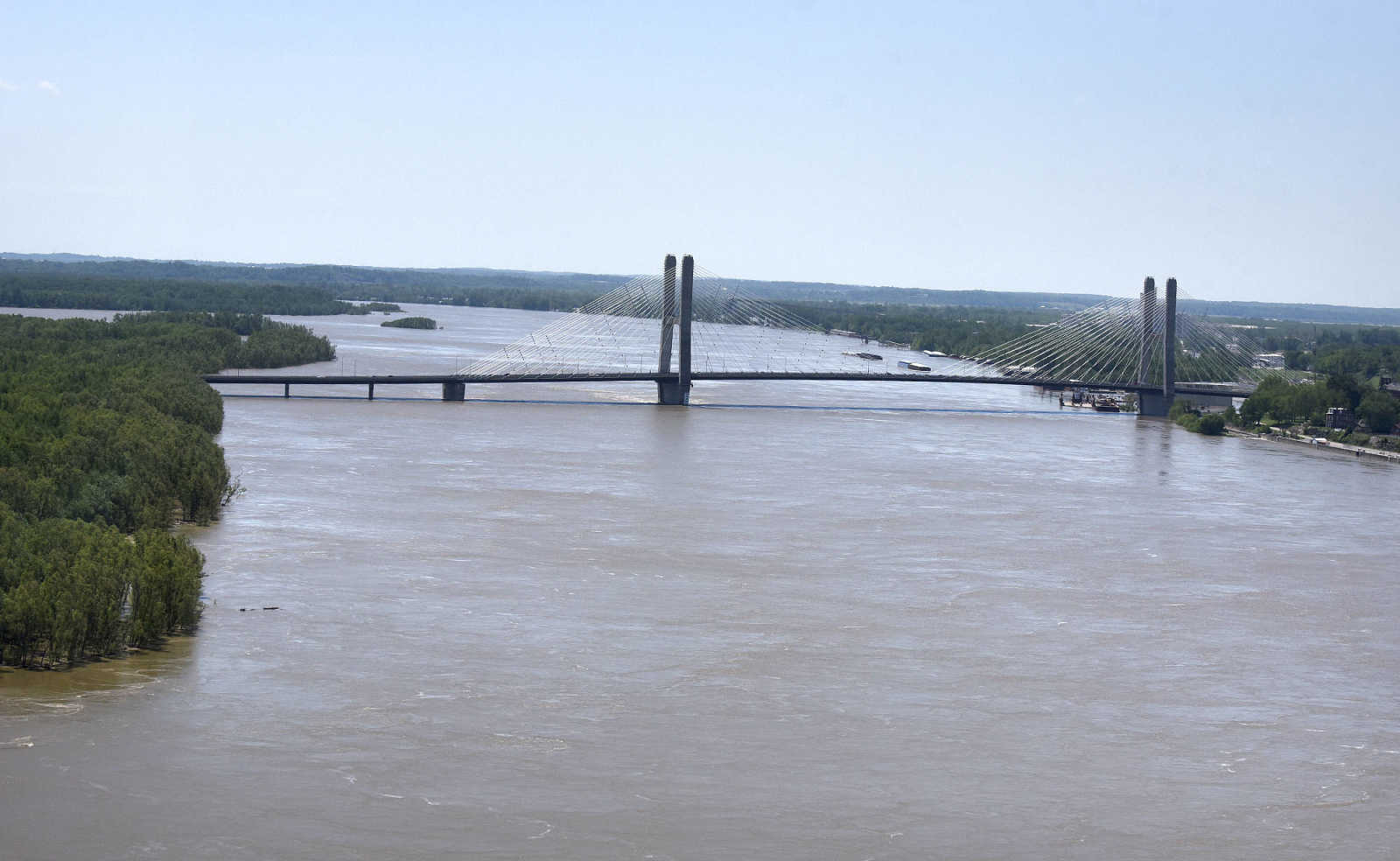
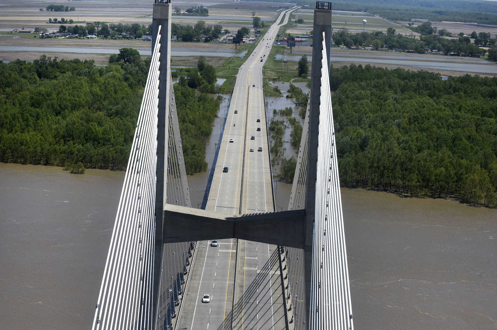
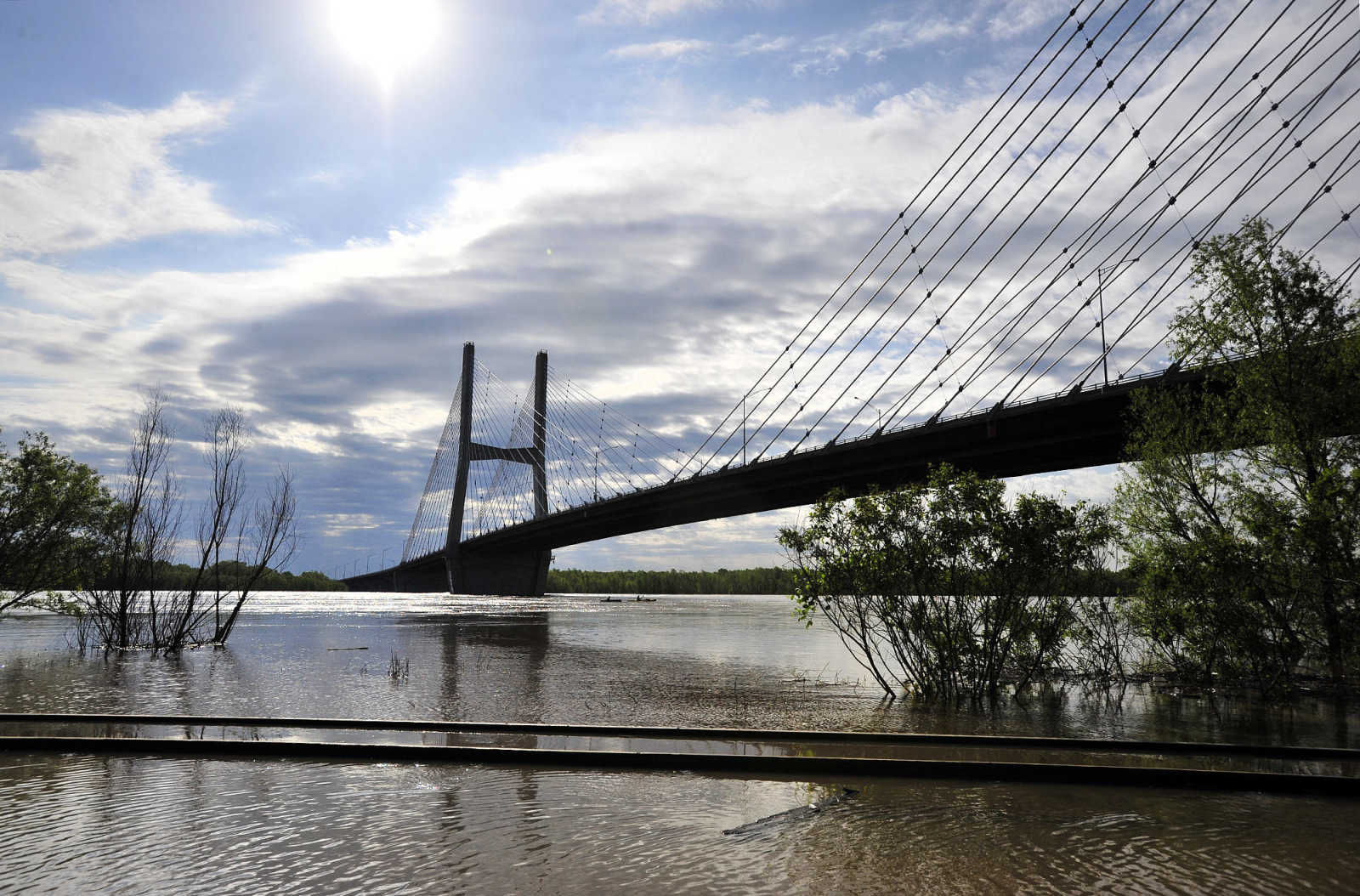
 The Bill Emerson Memorial Bridge in Cape Girardeau rises high above the swollen Mississippi River on Saturday, May 6, 2017. (Laura Simon ~ Southeast Missourian)
 -
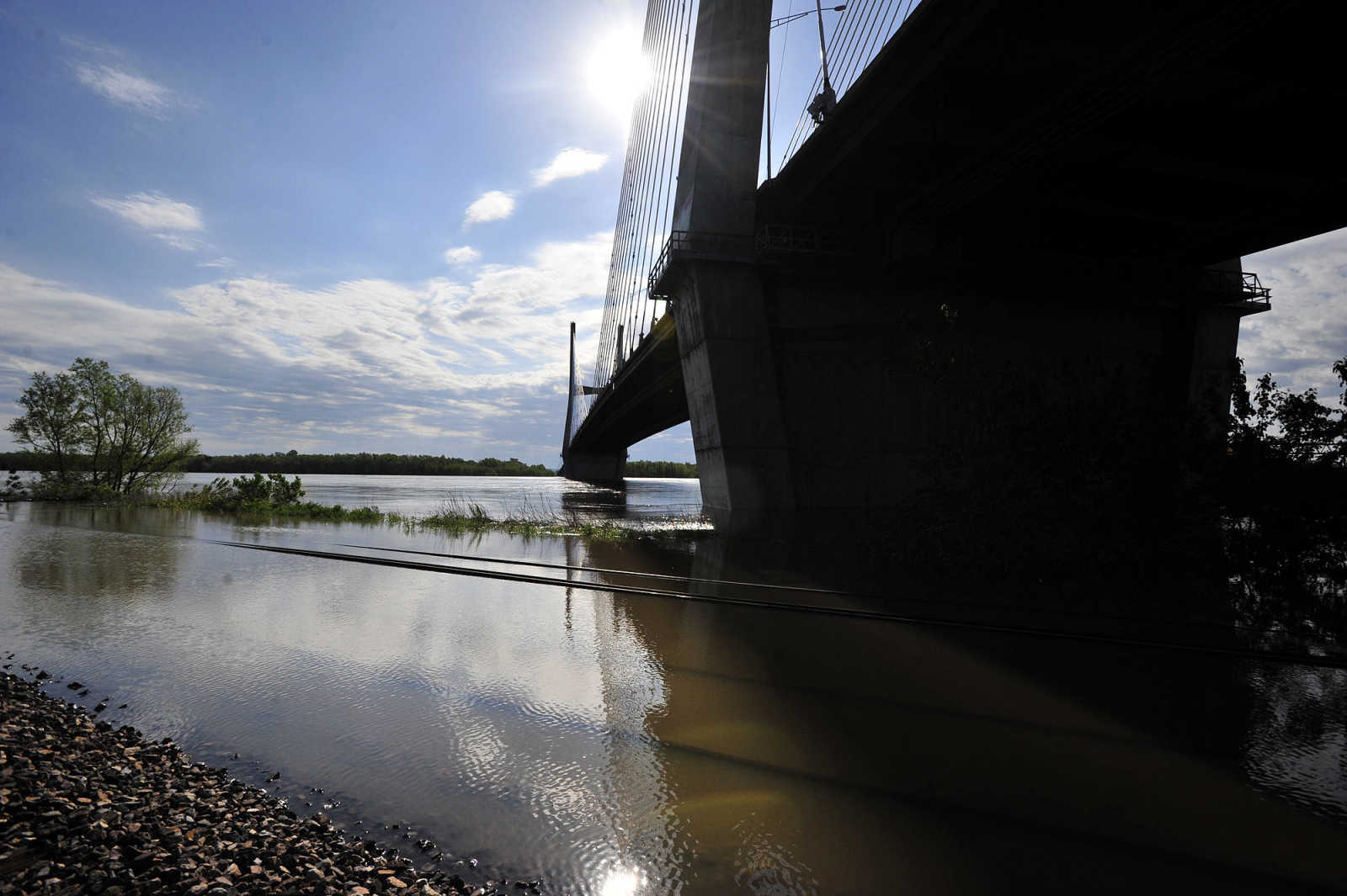
 The Bill Emerson Memorial Bridge in Cape Girardeau rises high above the swollen Mississippi River on Saturday, May 6, 2017. (Laura Simon ~ Southeast Missourian)
 -
 The Bill Emerson Memorial Bridge in Cape Girardeau rises high above the swollen Mississippi River on Saturday, May 6, 2017. (Laura Simon ~ Southeast Missourian)
 -
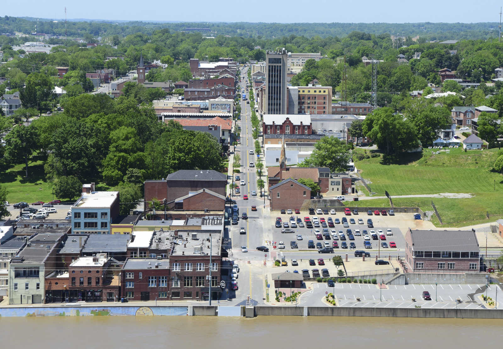
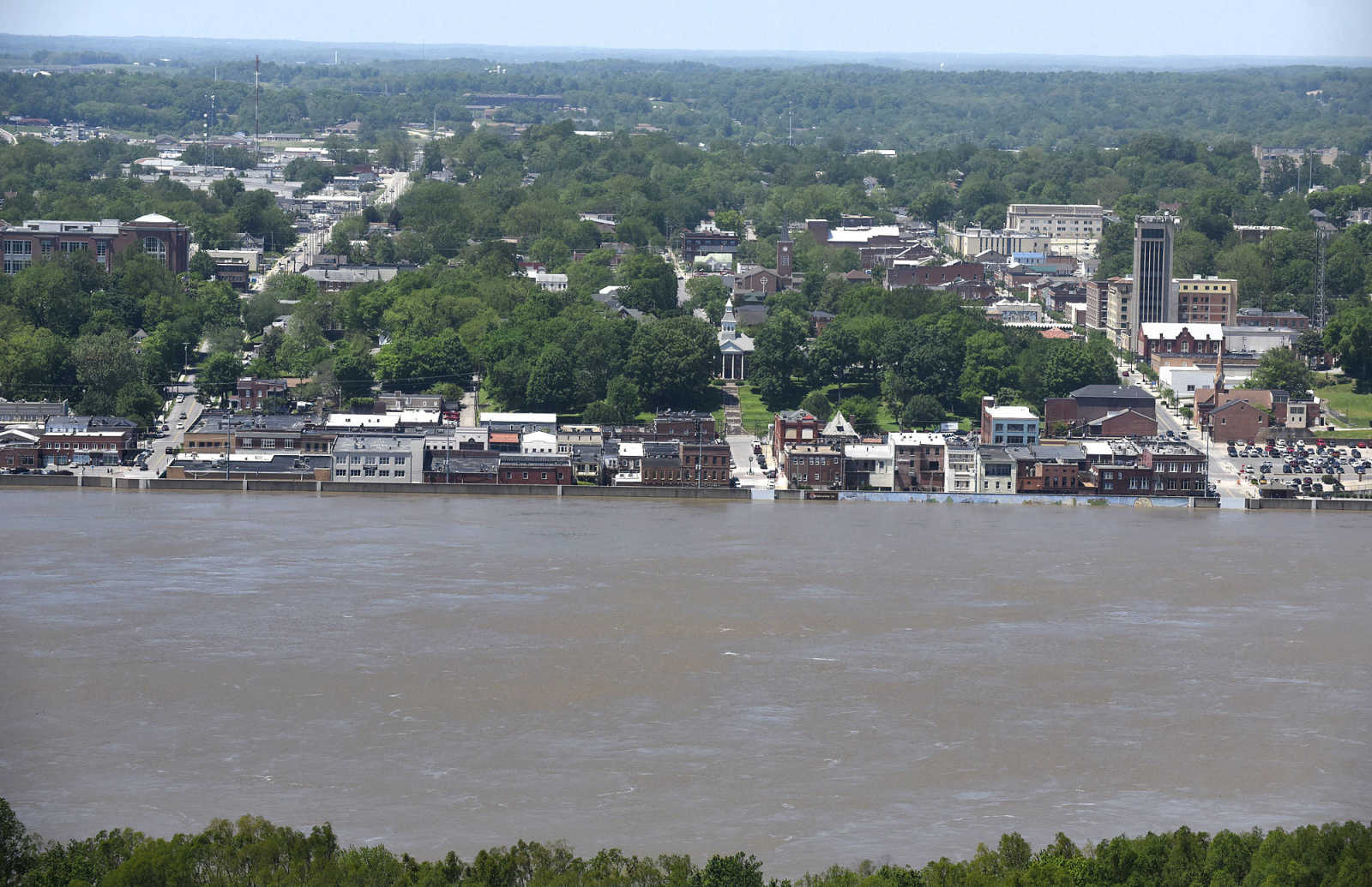
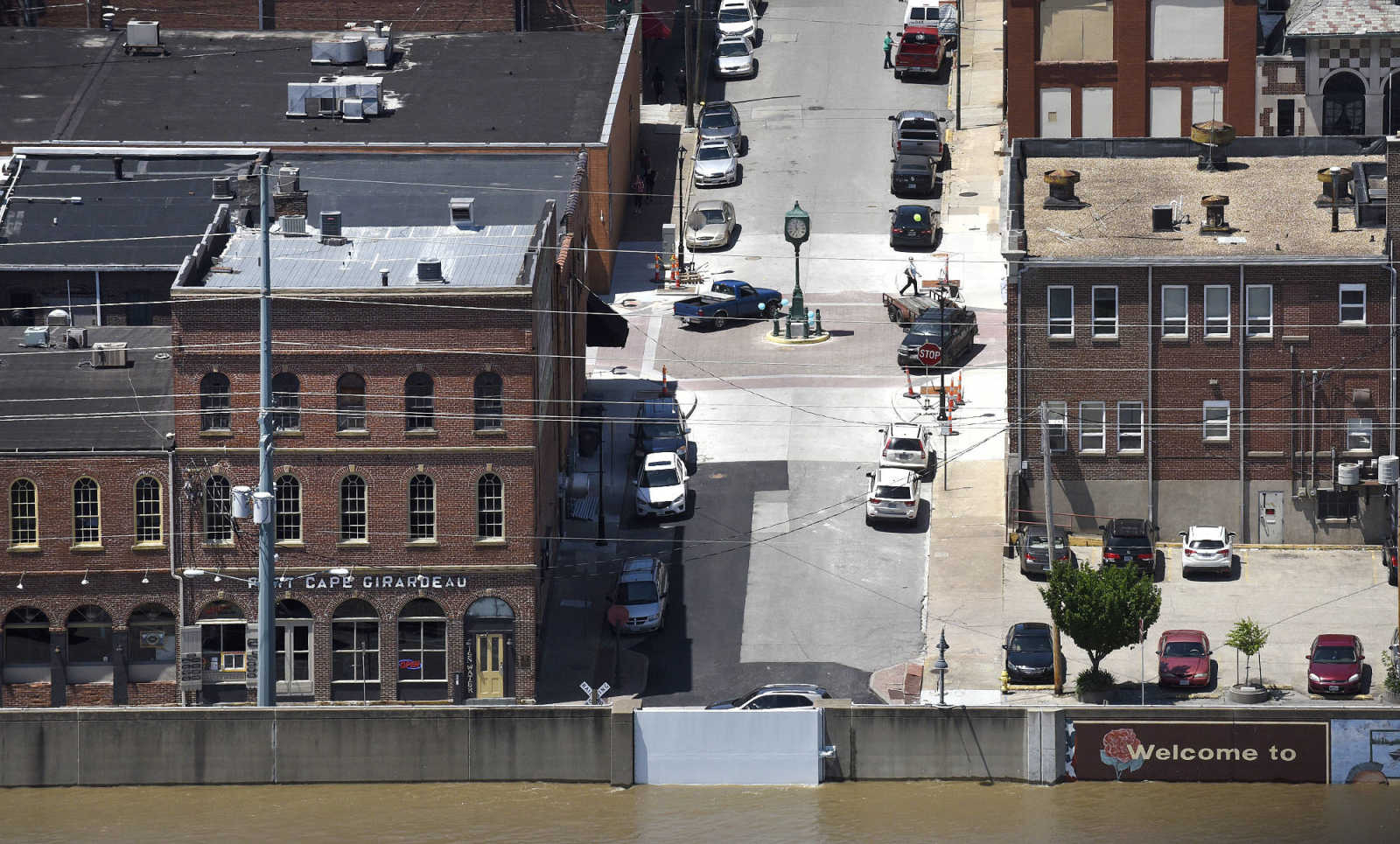
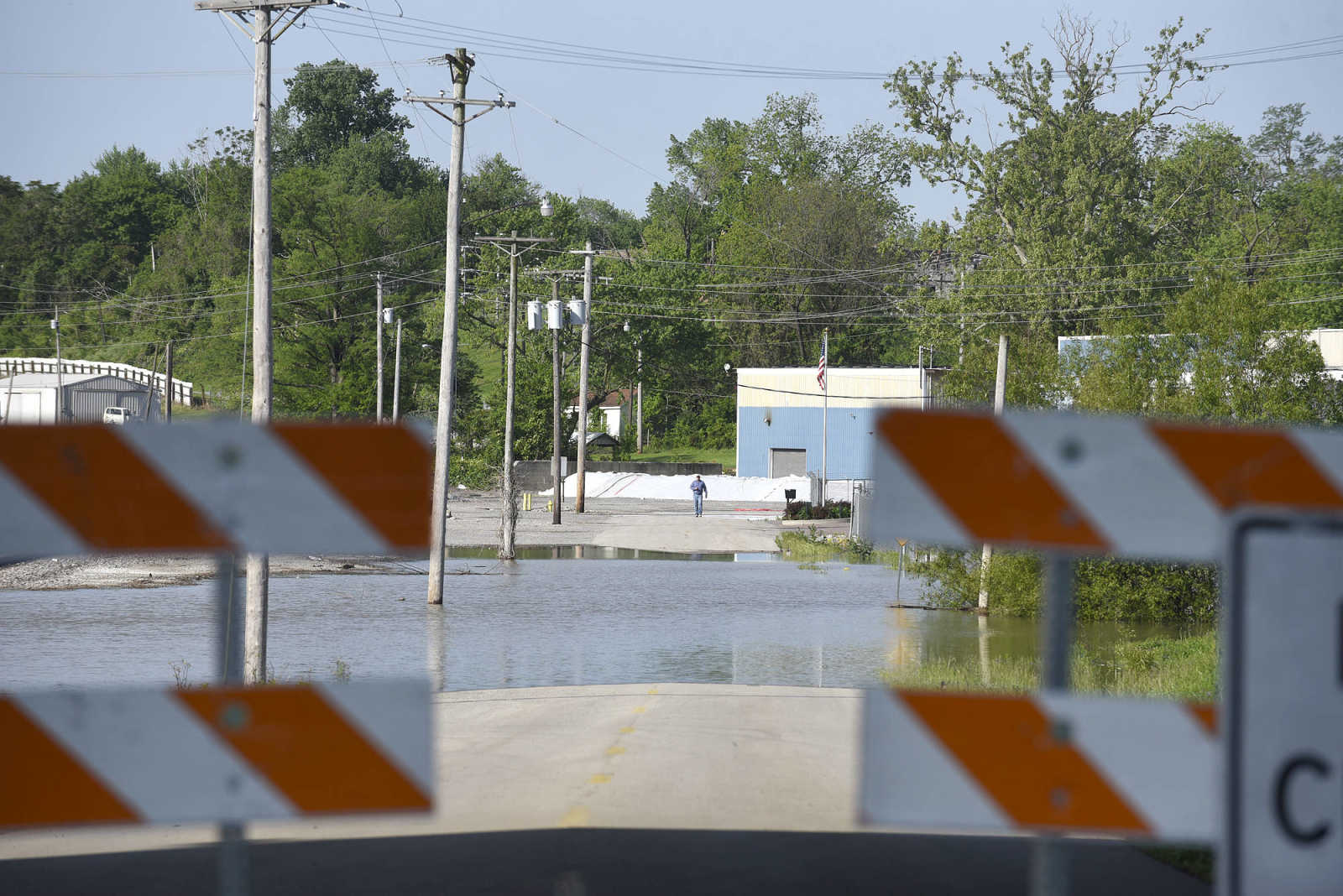
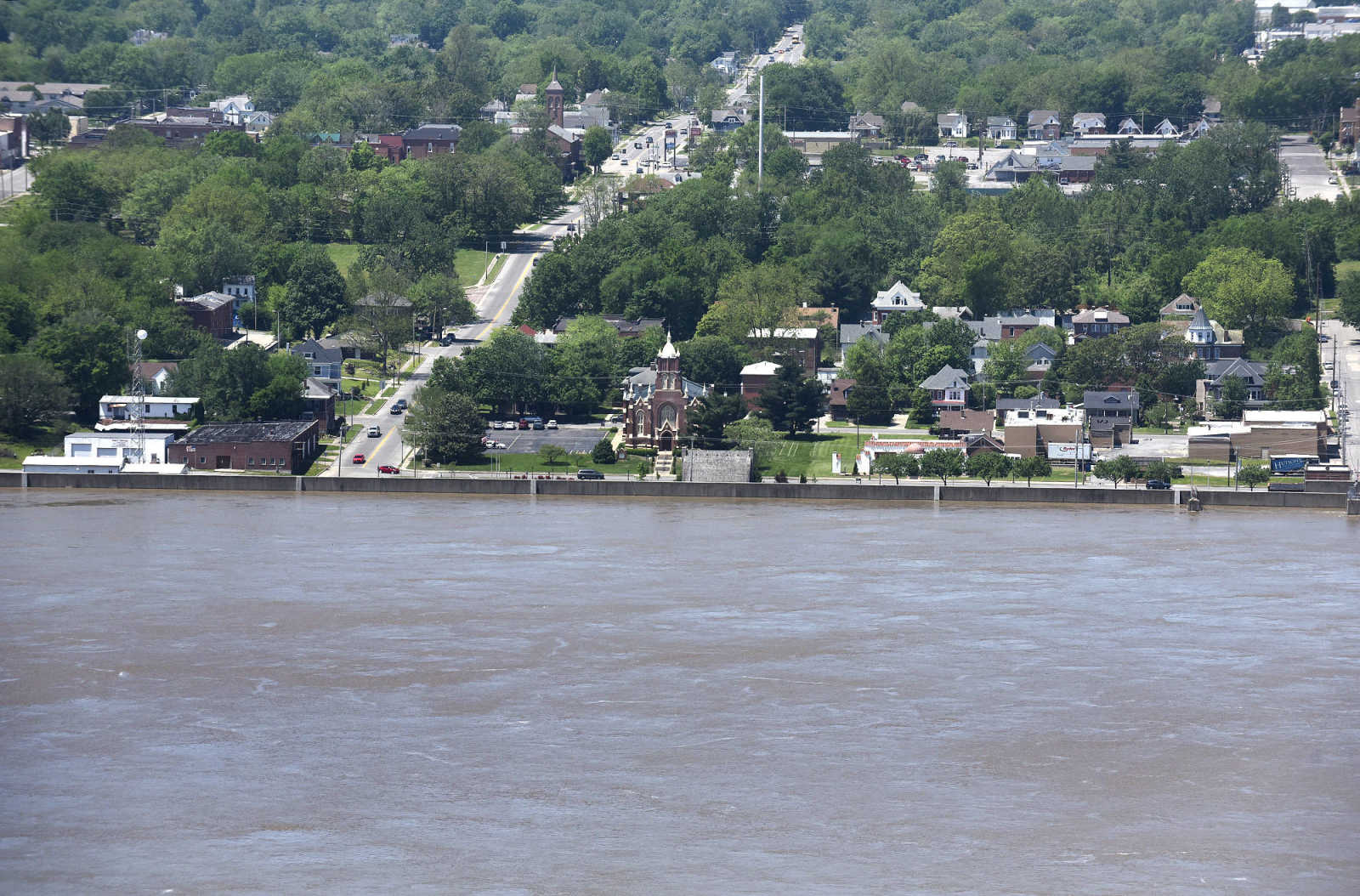 Downtown Cape Girardeau is seen behind the flood wall that is protecting the town from the flooded Mississippi River on Saturday, May 6, 2017. (Laura Simon ~ Southeast Missourian)
 -
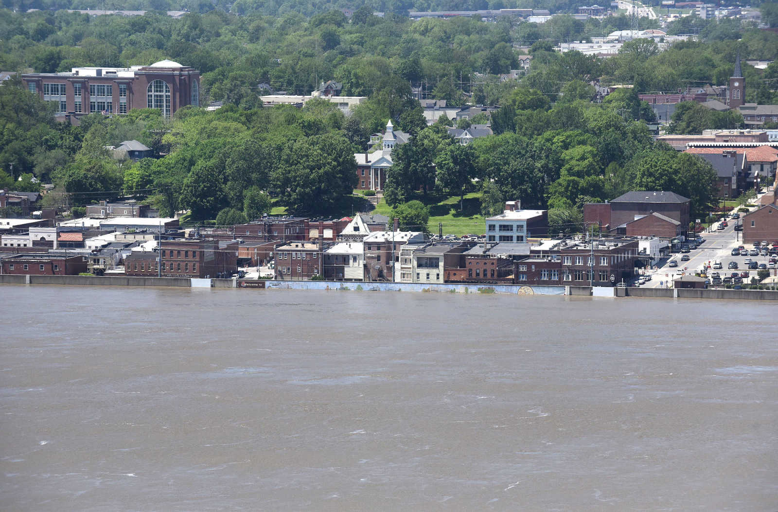
 Downtown Cape Girardeau is seen behind the flood wall that is protecting the town from the flooded Mississippi River on Saturday, May 6, 2017. (Laura Simon ~ Southeast Missourian)
 -
 Downtown Cape Girardeau is seen behind the flood wall that is protecting the town from the flooded Mississippi River on Saturday, May 6, 2017. (Laura Simon ~ Southeast Missourian)
 -
 Downtown Cape Girardeau is seen behind the flood wall that is protecting the town from the flooded Mississippi River on Saturday, May 6, 2017. (Laura Simon ~ Southeast Missourian)
 -
 The Bill Emerson Memorial Bridge in Cape Girardeau rises high above the swollen Mississippi River on Saturday, May 6, 2017. (Laura Simon ~ Southeast Missourian)
 -
 The Bill Emerson Memorial Bridge in Cape Girardeau rises high above the swollen Mississippi River on Saturday, May 6, 2017. (Laura Simon ~ Southeast Missourian)
 -
 Downtown Cape Girardeau is seen behind the flood wall that is protecting the town from the flooded Mississippi River on Saturday, May 6, 2017. (Laura Simon ~ Southeast Missourian)
 -
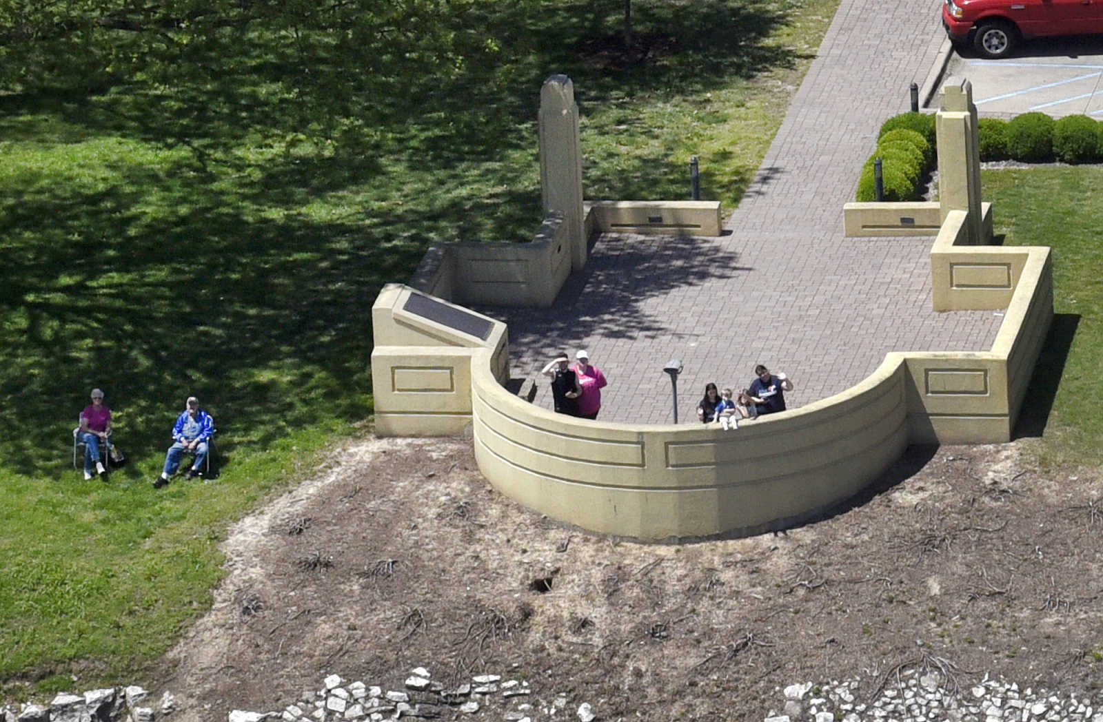 People are seen at the Mississippi River overlook in Cape Girardeau on Saturday, May 6, 2017. (Laura Simon ~ Southeast Missourian)
 -
 The Bill Emerson Memorial Bridge in Cape Girardeau rises high above the swollen Mississippi River on Saturday, May 6, 2017. (Laura Simon ~ Southeast Missourian)
 -
 The Bill Emerson Memorial Bridge in Cape Girardeau rises high above the swollen Mississippi River on Saturday, May 6, 2017. (Laura Simon ~ Southeast Missourian)
 -
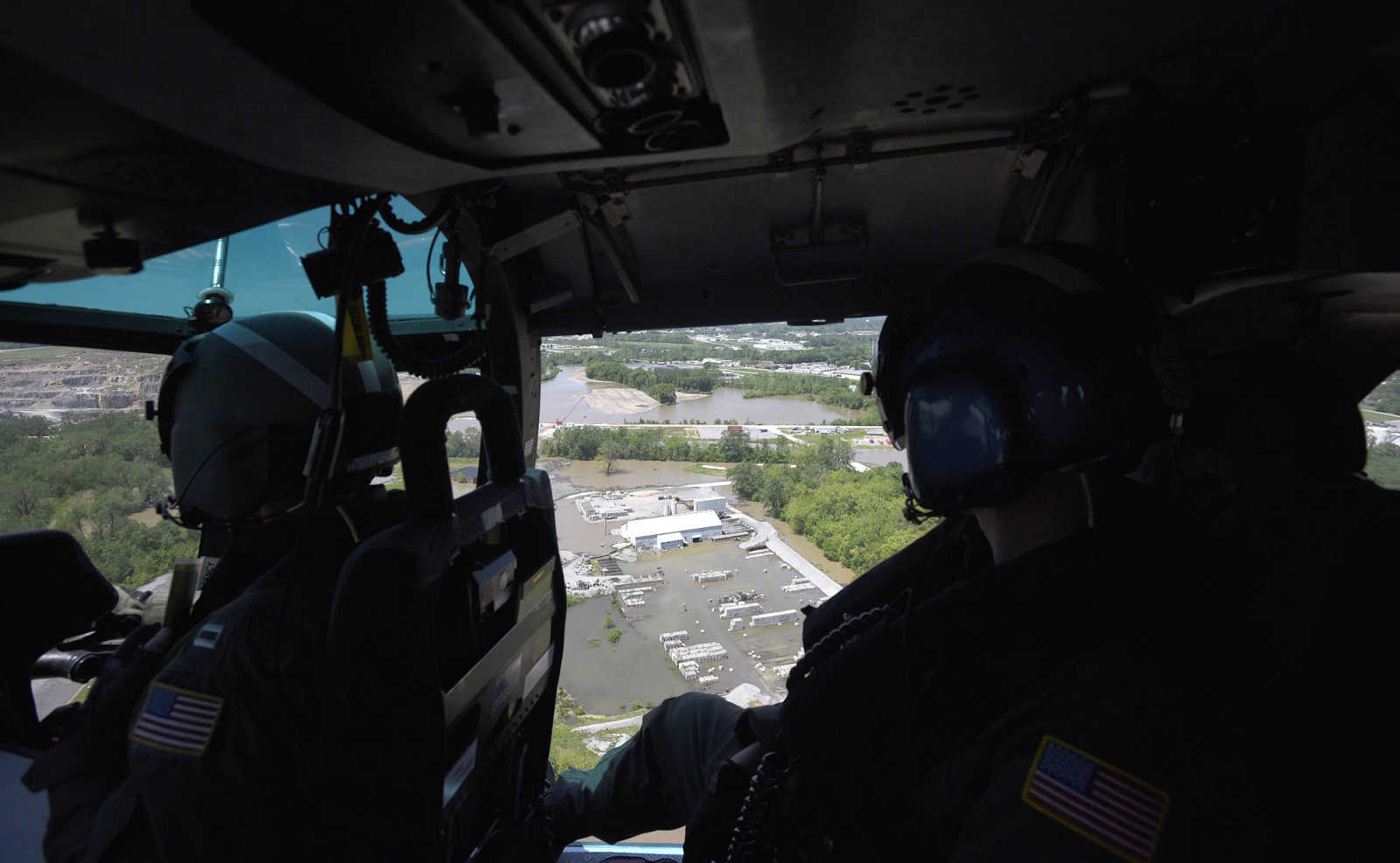 Lt. Allan Carroll, left, and AMT2 Colin McFadden with the U.S. Coast Guard survey the flood zone along the Mississippi River on Saturday, May 6, 2017. (Laura Simon ~ Southeast Missourian)
 -
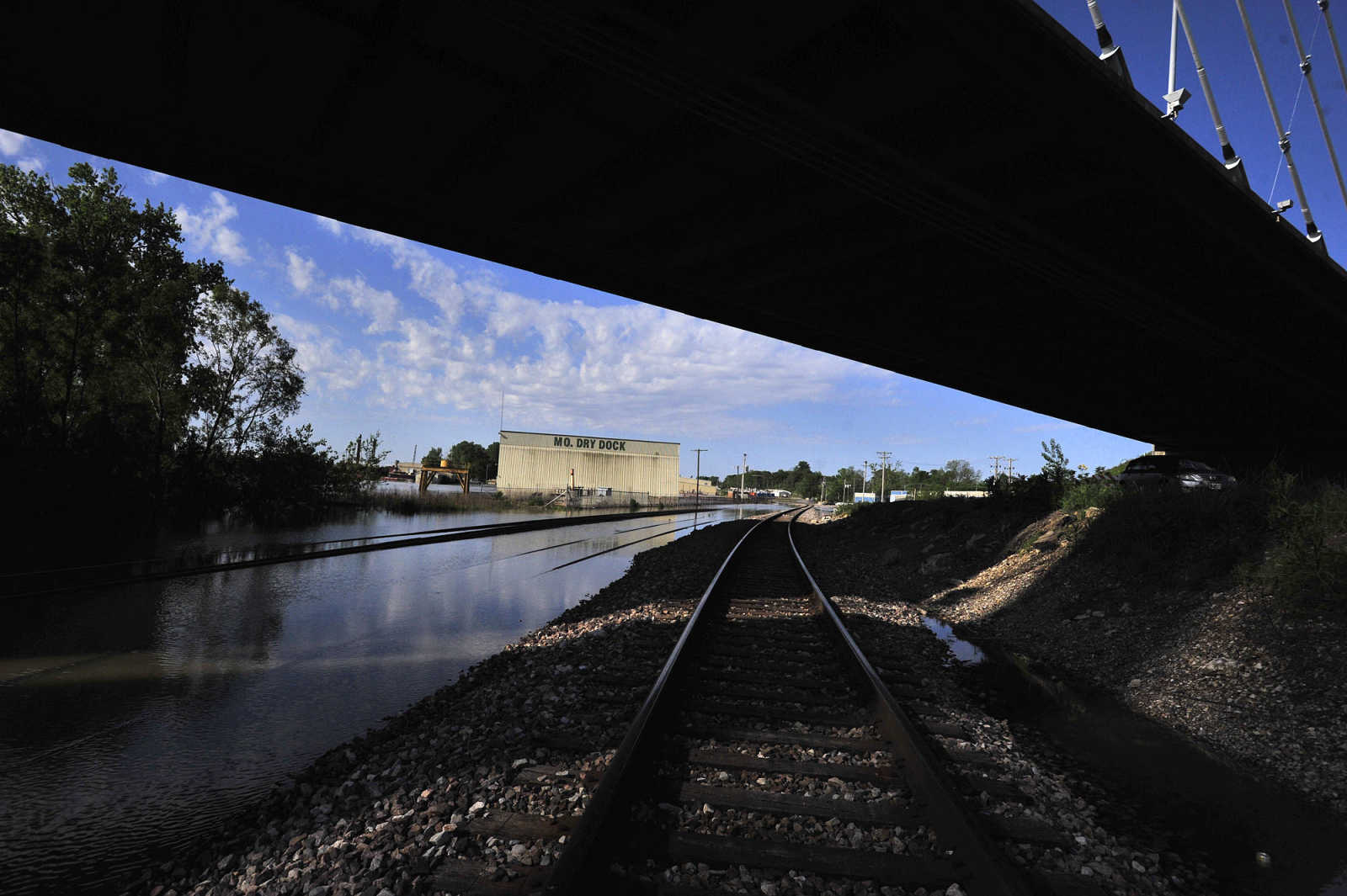
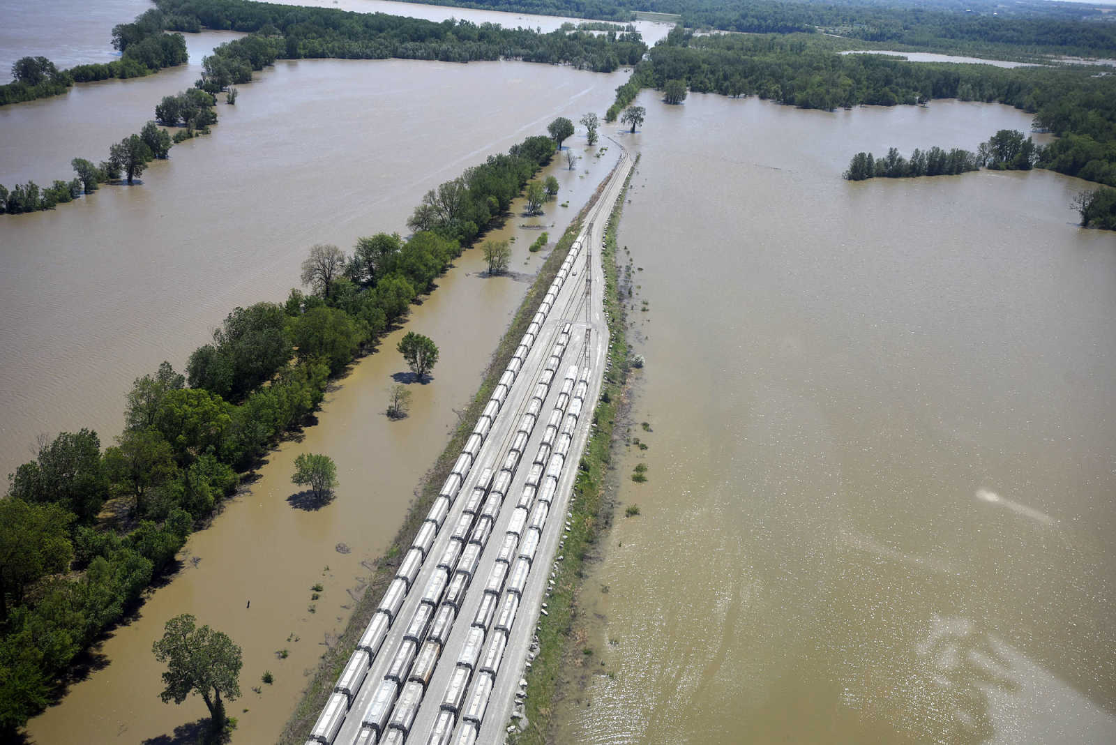 Rail cars sits on a section of track not covered with floodwater from the Mississippi River on Saturday, May 6, 2017. (Laura Simon ~ Southeast Missourian)
 -
 East Cape Girardeau is seen on Saturday, May 6, 2017. (Laura Simon ~ Southeast Missourian)
 -
 The Bill Emerson Memorial Bridge in Cape Girardeau rises high above the swollen Mississippi River on Saturday, May 6, 2017. (Laura Simon ~ Southeast Missourian)
 -
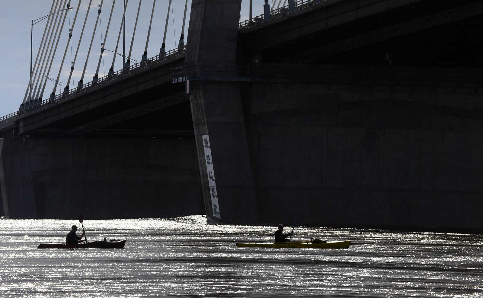
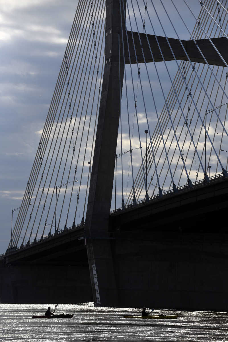
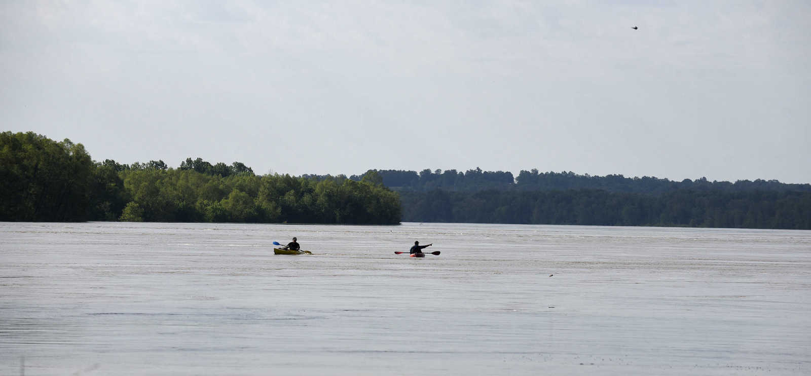
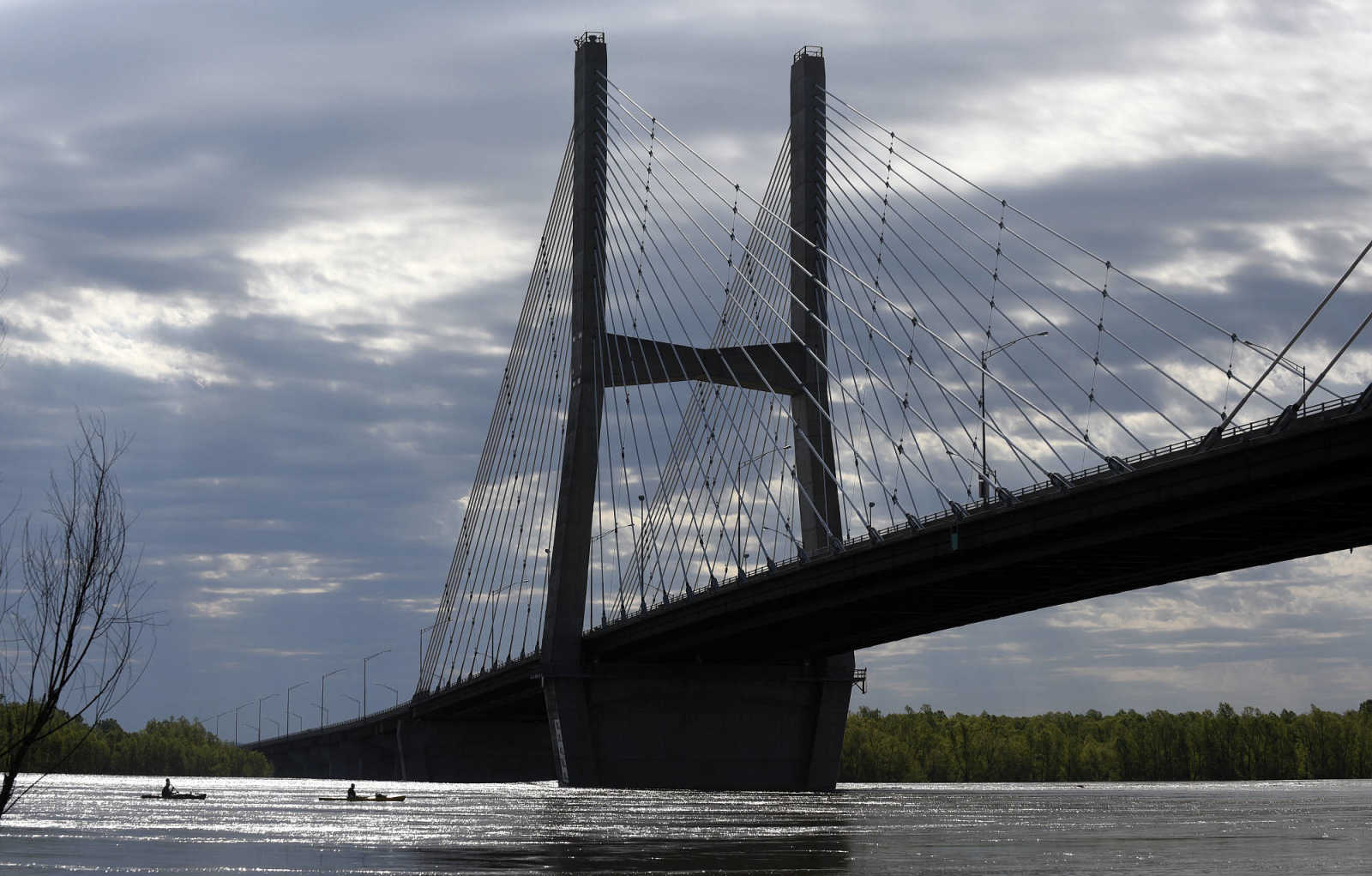 Ken Keller and Dave Knapp navigate the flooded Mississippi River on their kayaks on Saturday, May 6, 2017, in Cape Girardeau. (Laura Simon ~ Southeast Missourian)
 -
 Ken Keller and Dave Knapp navigate the flooded Mississippi River on their kayaks on Saturday, May 6, 2017, in Cape Girardeau. (Laura Simon ~ Southeast Missourian)
 -
 Ken Keller and Dave Knapp navigate the flooded Mississippi River on their kayaks on Saturday, May 6, 2017, in Cape Girardeau. (Laura Simon ~ Southeast Missourian)
 -
 Ken Keller and Dave Knapp navigate the flooded Mississippi River on their kayaks on Saturday, May 6, 2017, in Cape Girardeau. (Laura Simon ~ Southeast Missourian)
 -
 The Bill Emerson Memorial Bridge in Cape Girardeau rises high above the swollen Mississippi River on Saturday, May 6, 2017. (Laura Simon ~ Southeast Missourian)
 -
 Floodwater from the Mississippi River surrounds the Missouri Dry Dock on Saturday, May 6, 2017, in Cape Girardeau. (Laura Simon ~ Southeast Missourian)
 -
 Floodwater from the Mississippi River surrounds the Missouri Dry Dock on Saturday, May 6, 2017, in Cape Girardeau. (Laura Simon ~ Southeast Missourian)
 -
 AMT2 Colin McFadden helps prepare the U.S. Coast Guard for flight to survey the flood zone along the Mississippi River on Saturday, May 6, 2017. (Laura Simon ~ Southeast Missourian)
 -
 The Bill Emerson Memorial Bridge in Cape Girardeau rises high above the swollen Mississippi River on Saturday, May 6, 2017. (Laura Simon ~ Southeast Missourian)
 -
 Lt. Allan Carroll, left, and AMT2 Colin McFadden board a U.S. Coast Guard helicopter on Saturday, May 6, 2017, to survey the flood zone along the Mississippi River. (Laura Simon ~ Southeast Missourian)
 -
 Lt. Allan Carroll, left, and AMT2 Colin McFadden board a U.S. Coast Guard helicopter on Saturday, May 6, 2017, to survey the flood zone along the Mississippi River. (Laura Simon ~ Southeast Missourian)
 -
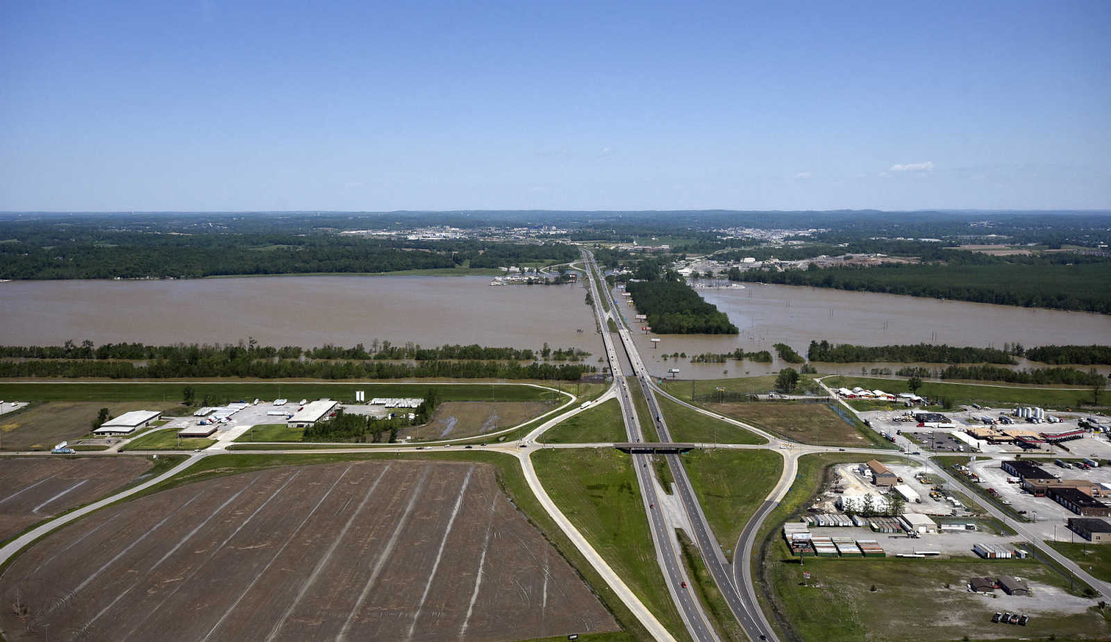 The Interstate 55 Airport Road exit and the Diversion Channel are seen on Saturday, May 6, 2017. (Laura Simon ~ Southeast Missourian)
 -
 Floodwater from the Mississippi River stretches across the landscape to the Diversion Channel on Saturday, May 6, 2017. (Laura Simon ~ Southeast Missourian)
 -
 The Bill Emerson Memorial Bridge in Cape Girardeau rises high above the swollen Mississippi River on Saturday, May 6, 2017. (Laura Simon ~ Southeast Missourian)
 -
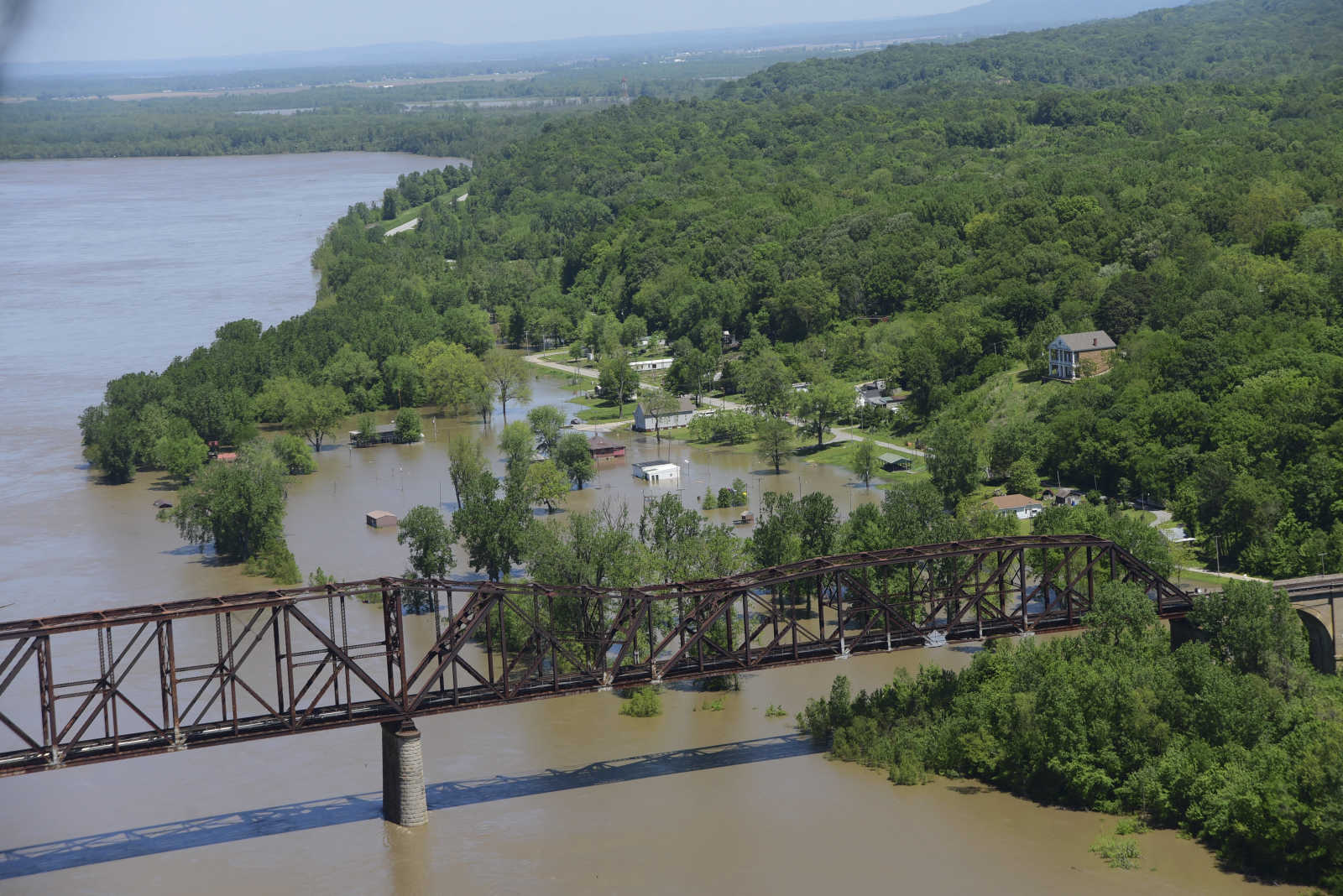
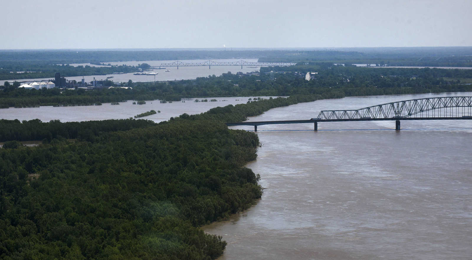
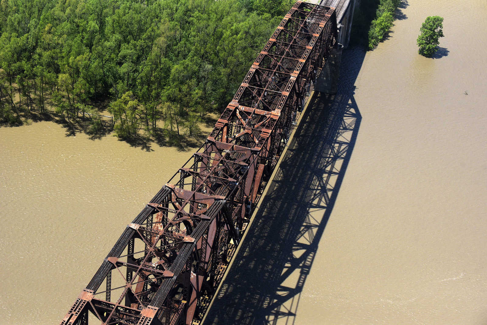
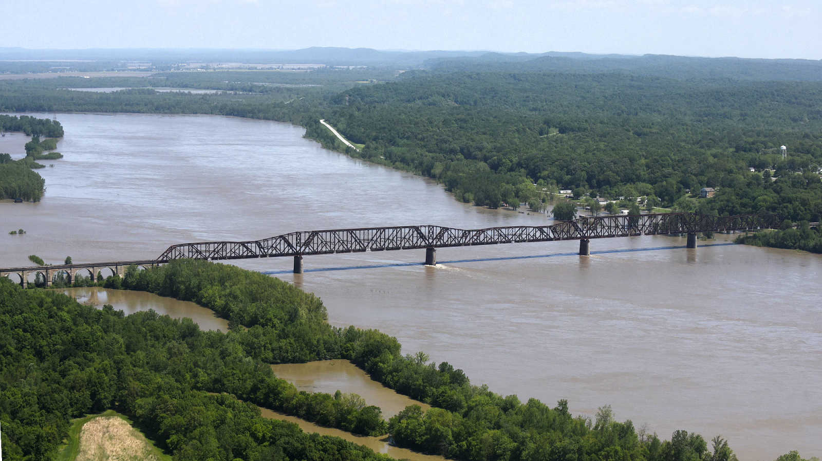 The Thebes, Illinois railroad bridge is seen on Saturday, May 6, 2017. (Laura Simon ~ Southeast Missourian)
 -
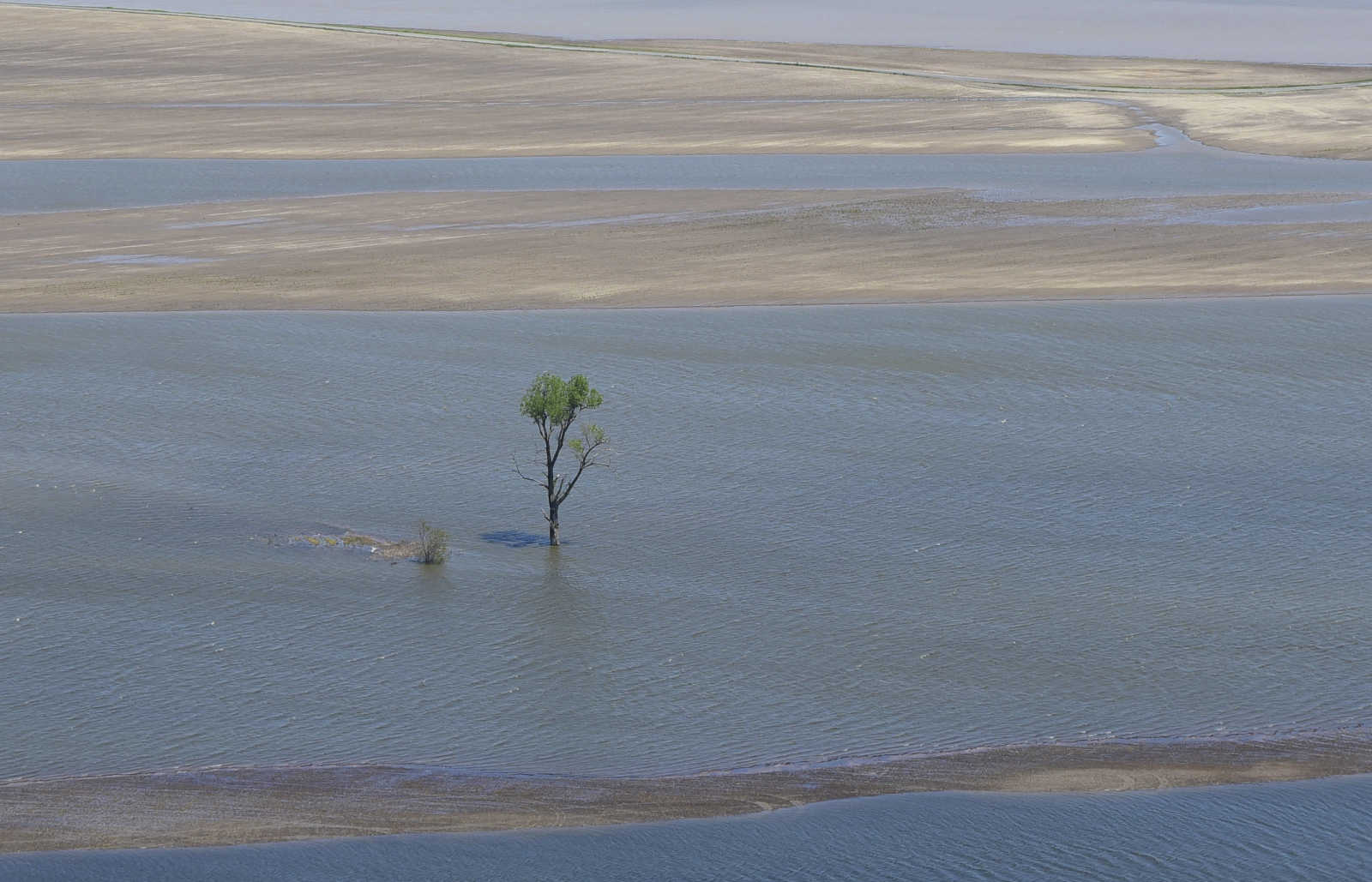
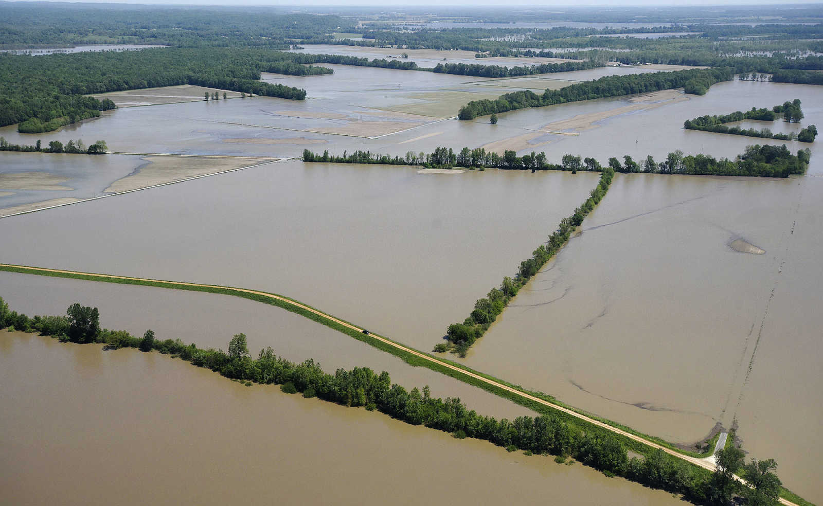
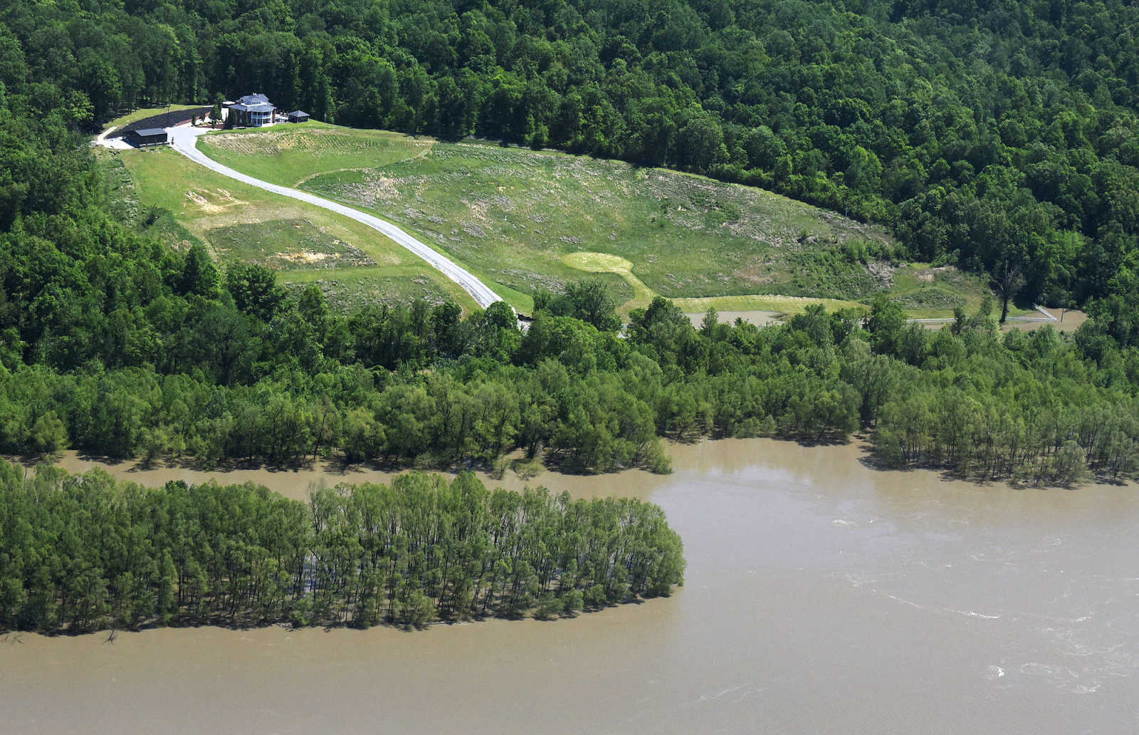 Floodwater stretches across the landscape of Southern Illinois between Thebes and Cairo, as seen on Saturday, May 6, 2017. (Laura Simon ~ Southeast Missourian)
 -
 Lt. Allan Carroll with the U.S. Coast Guard pilots a helicopter over the Mississippi River floodway on Saturday, May 6, 2017. (Laura Simon ~ Southeast Missourian)
 -
 Floodwater stretches across the landscape of Southern Illinois between Thebes and Cairo, as seen on Saturday, May 6, 2017. (Laura Simon ~ Southeast Missourian)
 -
 Floodwater stretches across the landscape of Southern Illinois between Thebes and Cairo, as seen on Saturday, May 6, 2017. (Laura Simon ~ Southeast Missourian)
 -
 Floodwater stretches across the landscape of Southern Illinois between Thebes and Cairo, as seen on Saturday, May 6, 2017. (Laura Simon ~ Southeast Missourian)
 -
 Floodwater stretches across the landscape of Southern Illinois between Thebes and Cairo, as seen on Saturday, May 6, 2017. (Laura Simon ~ Southeast Missourian)
 -
 Floodwater stretches across the landscape of Southern Illinois between Thebes and Cairo, as seen on Saturday, May 6, 2017. (Laura Simon ~ Southeast Missourian)
 -
 Floodwater stretches across the landscape of Southern Illinois between Thebes and Cairo, as seen on Saturday, May 6, 2017. (Laura Simon ~ Southeast Missourian)
 -
 Floodwater stretches across the landscape of Southern Illinois between Thebes and Cairo, as seen on Saturday, May 6, 2017. (Laura Simon ~ Southeast Missourian)
 -
 Floodwater stretches across the landscape of Southern Illinois between Thebes and Cairo, as seen on Saturday, May 6, 2017. (Laura Simon ~ Southeast Missourian)
 -
 Floodwater from the Mississippi River is seen near Cairo, Illinois on Saturday, May 6, 2017. (Laura Simon ~ Southeast Missourian)
 -
 Floodwater from the Mississippi River is seen near Cairo, Illinois on Saturday, May 6, 2017. (Laura Simon ~ Southeast Missourian)
 -
 Floodwater from the Mississippi River is seen near Cairo, Illinois on Saturday, May 6, 2017. (Laura Simon ~ Southeast Missourian)
 -
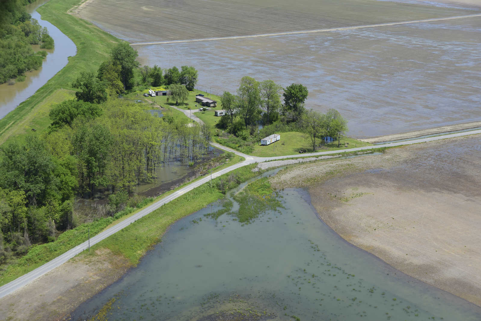
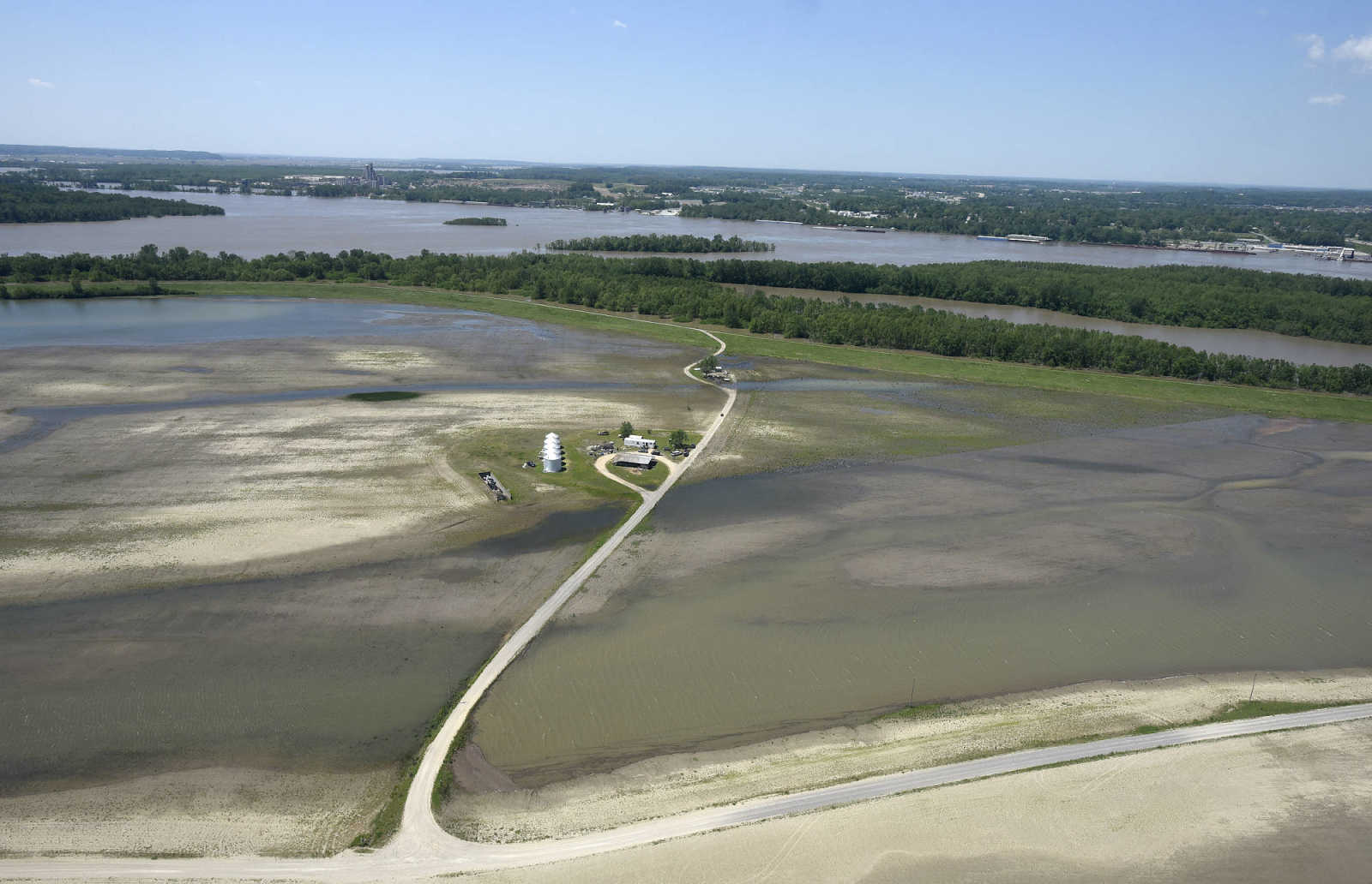
 A flooded Mississippi River is held back by the Birds Point Levee in Mississippi County on Saturday, May 6, 2017. (Laura Simon ~ Southeast Missourian)
 -
 Floodwater from the Mississippi River surrounds the Highway 60/Interstate 57 bridge on Saturday, May 6, 2017. (Laura Simon ~ Southeast Missourian)
 -
 Floodwater stretches across the landscape of Southern Illinois between Thebes and Cairo, as seen on Saturday, May 6, 2017. (Laura Simon ~ Southeast Missourian)
 -
 Floodwater stretches across the landscape of Southern Illinois between Thebes and Cairo, as seen on Saturday, May 6, 2017. (Laura Simon ~ Southeast Missourian)
 -
 Floodwater from the Mississippi River stretches into Commerce, Missouri on Saturday, May 6, 2017. (Laura Simon ~ Southeast Missourian)
 -
 The Thebes, Illinois railroad bridge is seen on Saturday, May 6, 2017. (Laura Simon ~ Southeast Missourian)
- Email link
- Contact editor
- Report error
- Share: