custom ad
NewsApril 12, 2008

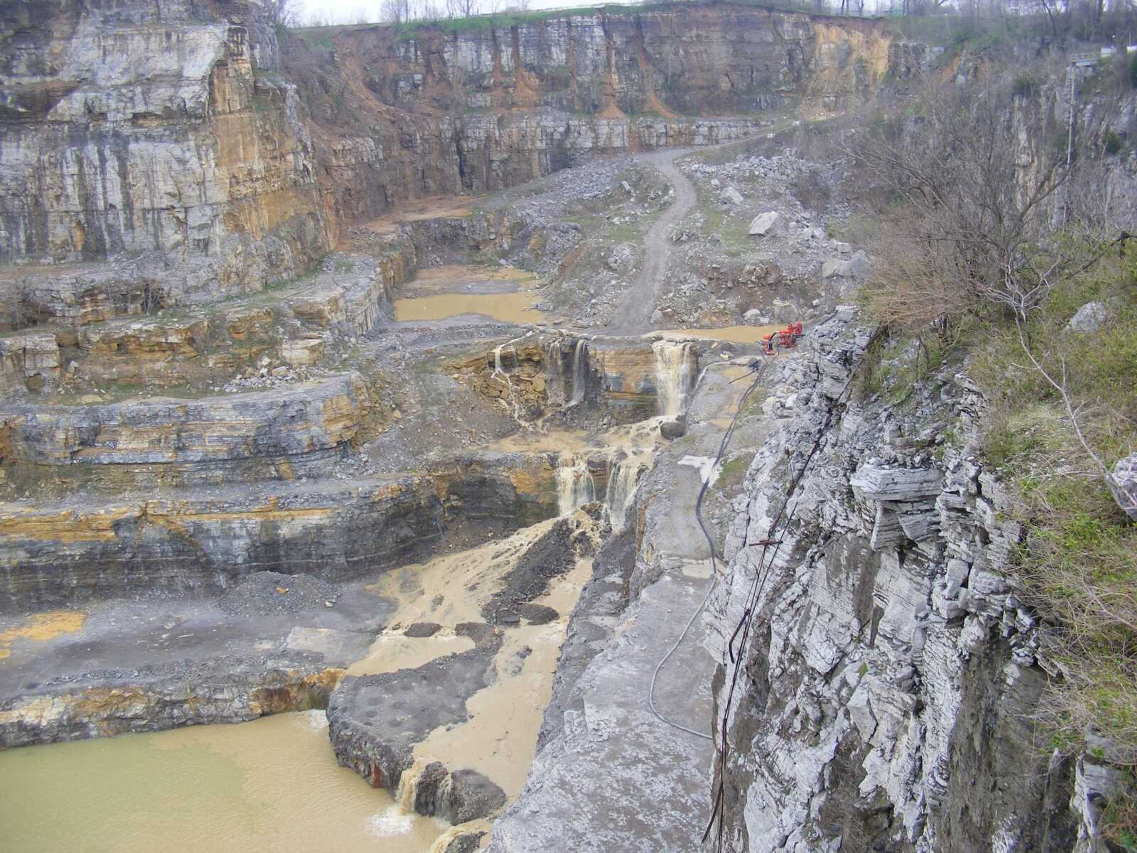
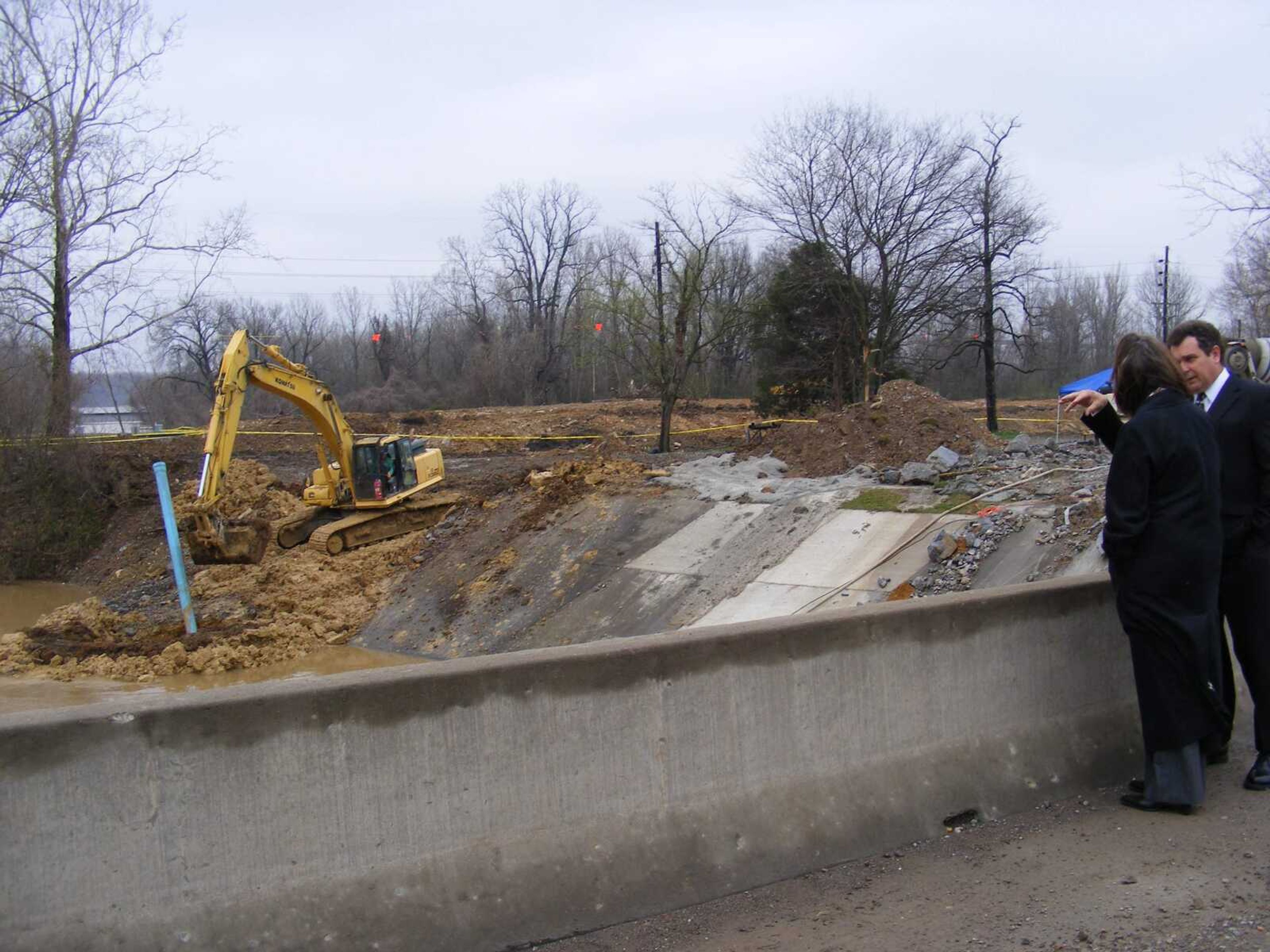
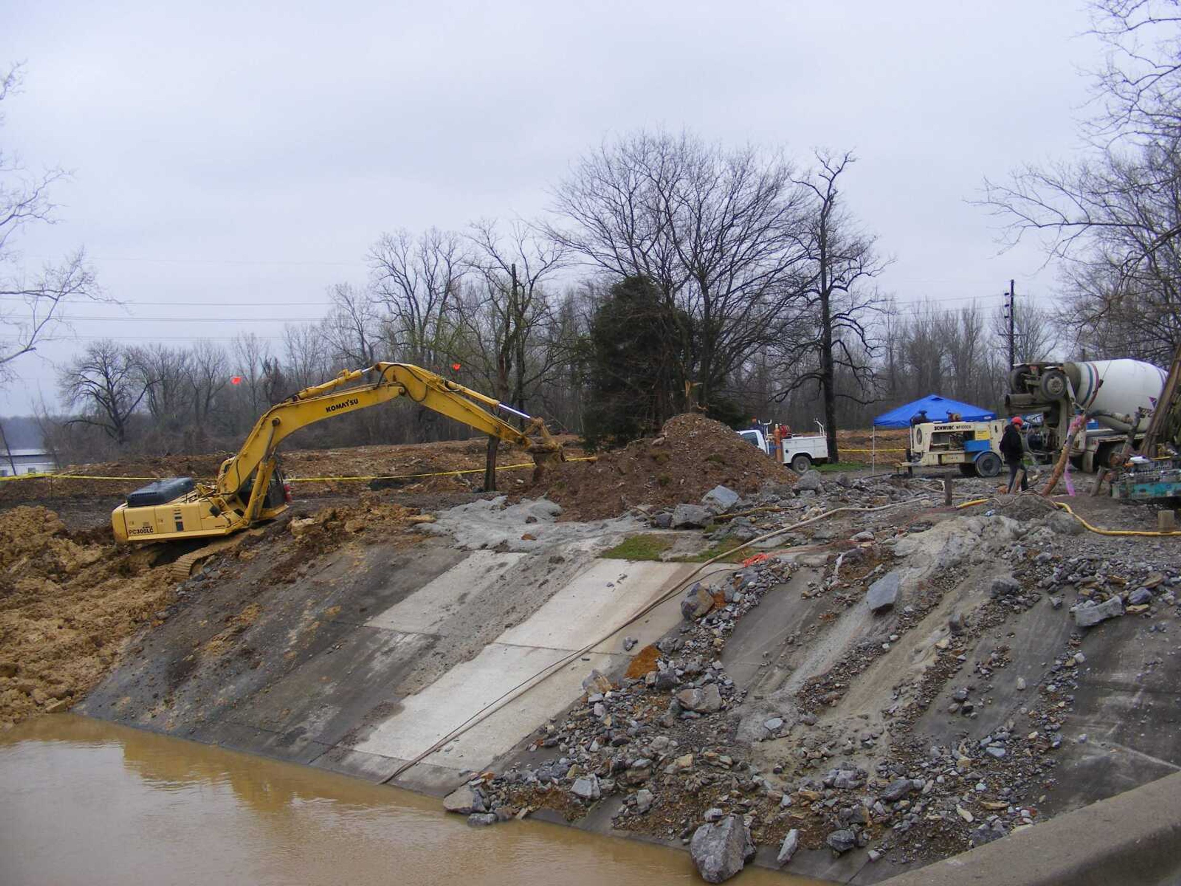
These photos were taken on April 4 near the South Sprigg Street bridge, an area of the city where 20 sinkholes have developed.

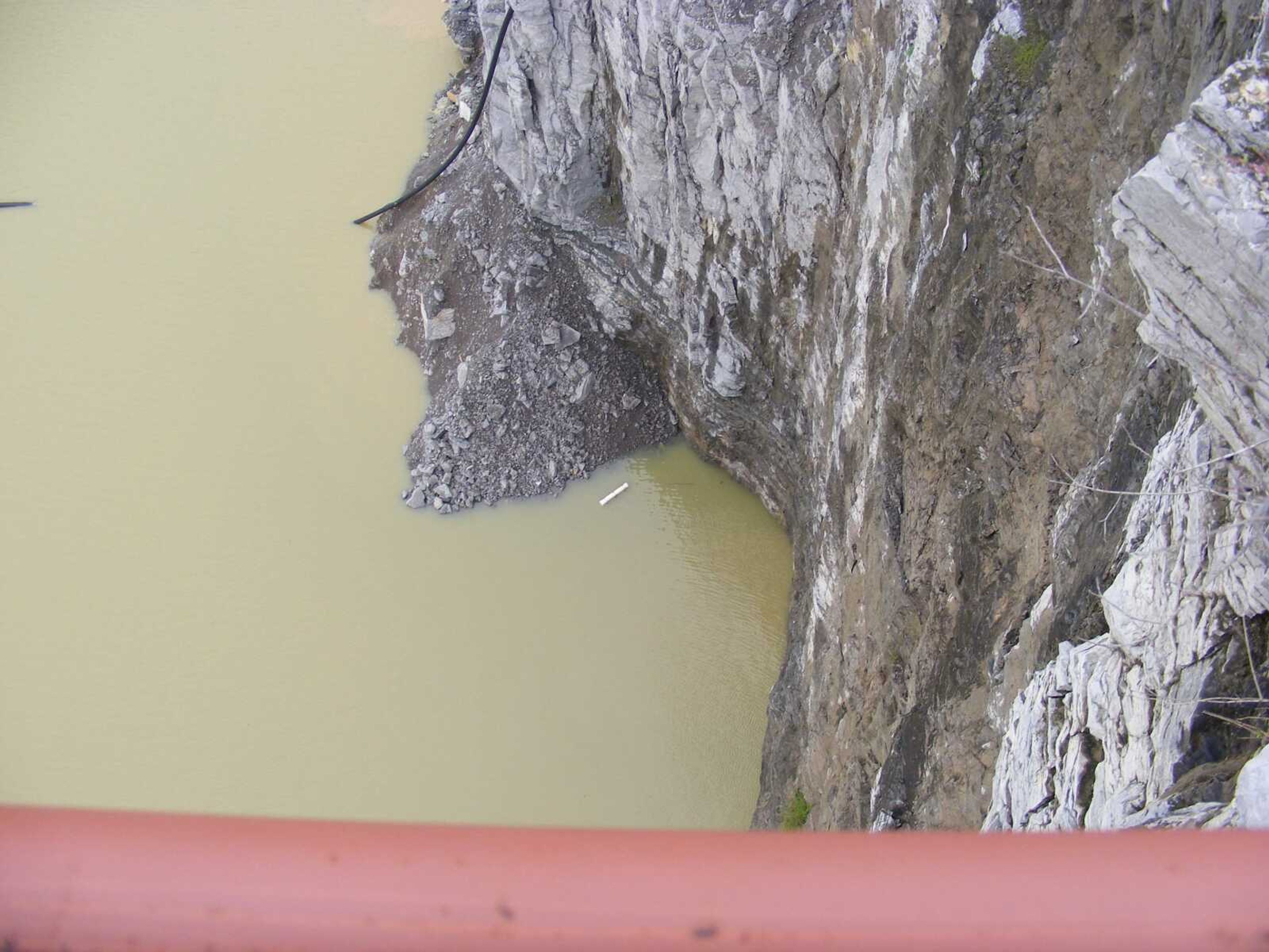
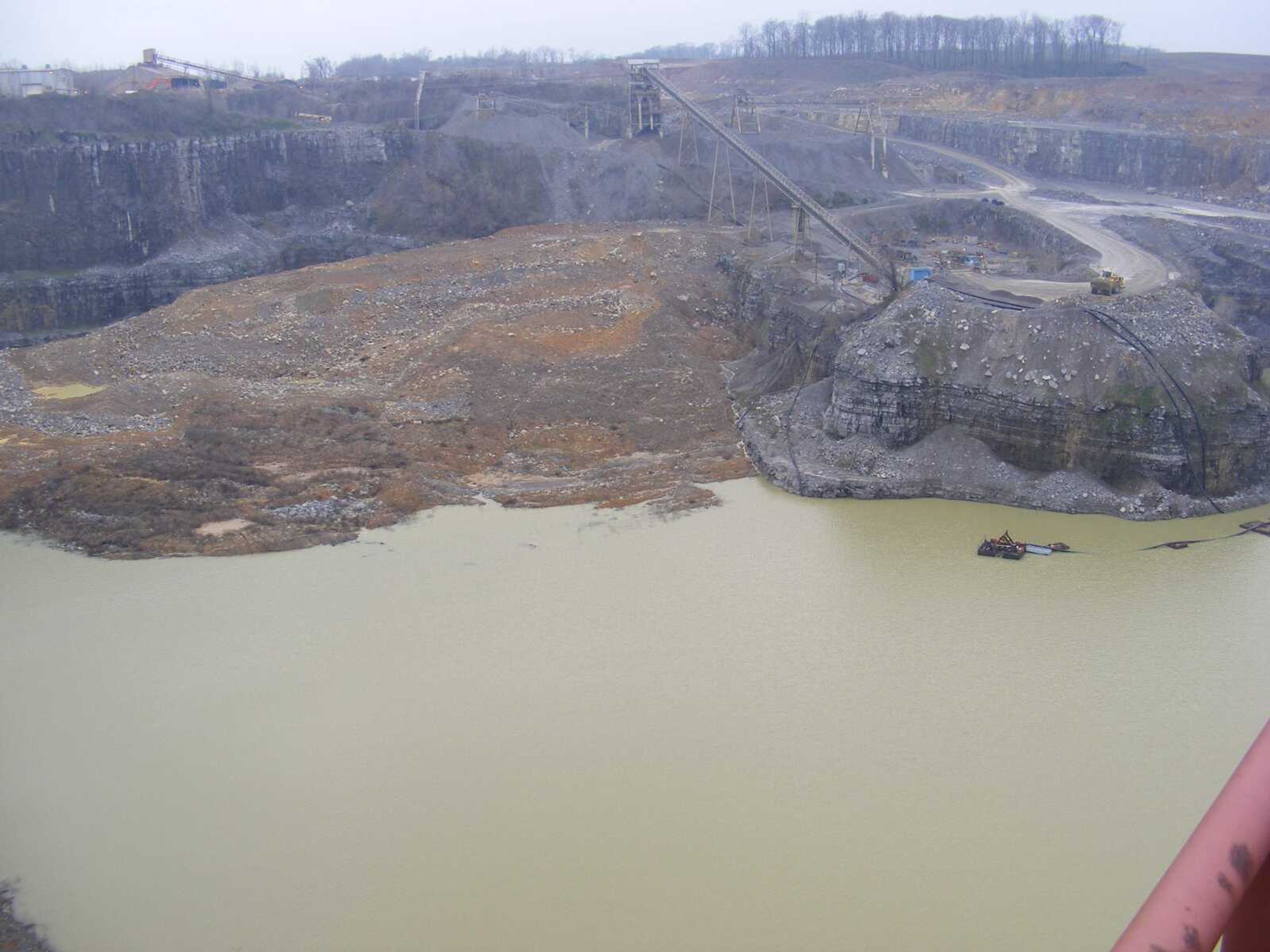
This northern corner of the quarry is closest to Cape LaCroix Creek. Gravity causes water to fill openings  to equal levels. In this case the openings are Cape LaCroix Creek, the Mississippi River and the 300-foot-deep Buzzi Unicem quarry.
This northern corner of the quarry is closest to Cape LaCroix Creek. Gravity causes water to fill openings to equal levels. In this case the openings are Cape LaCroix Creek, the Mississippi River and the 300-foot-deep Buzzi Unicem quarry.
story image illustation
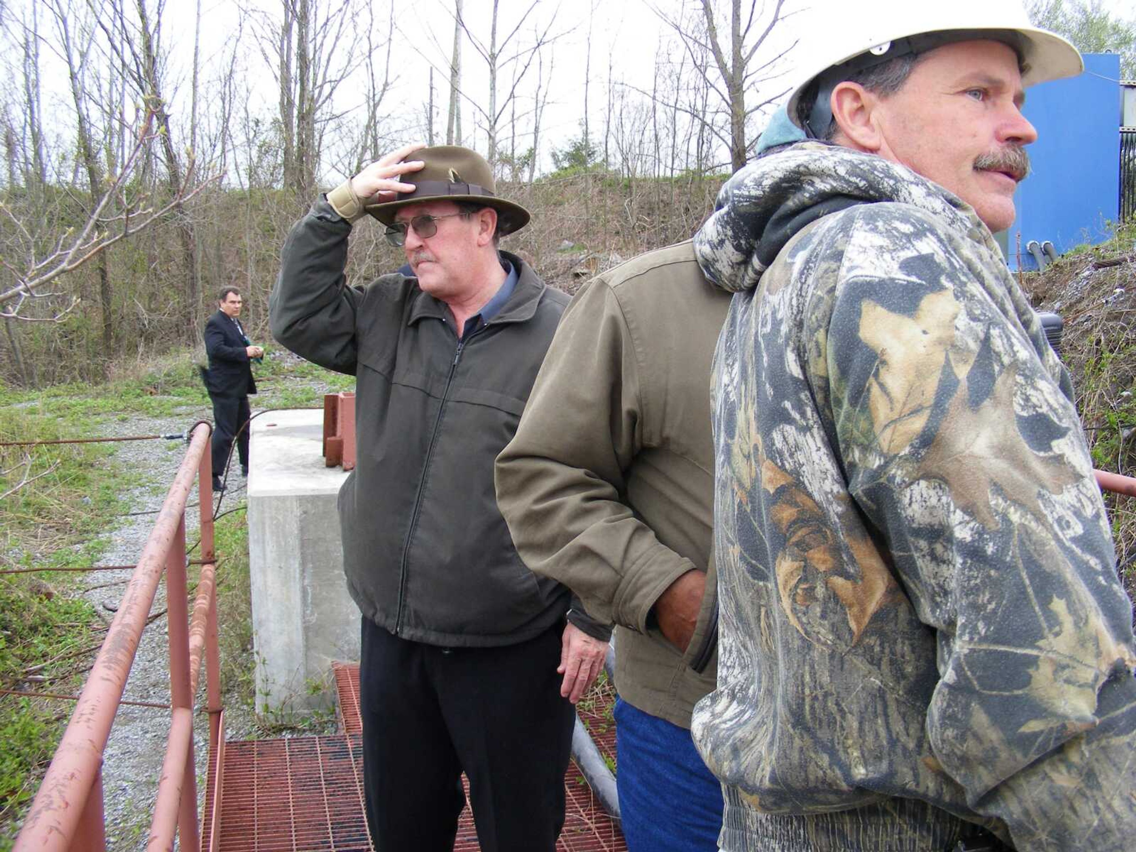
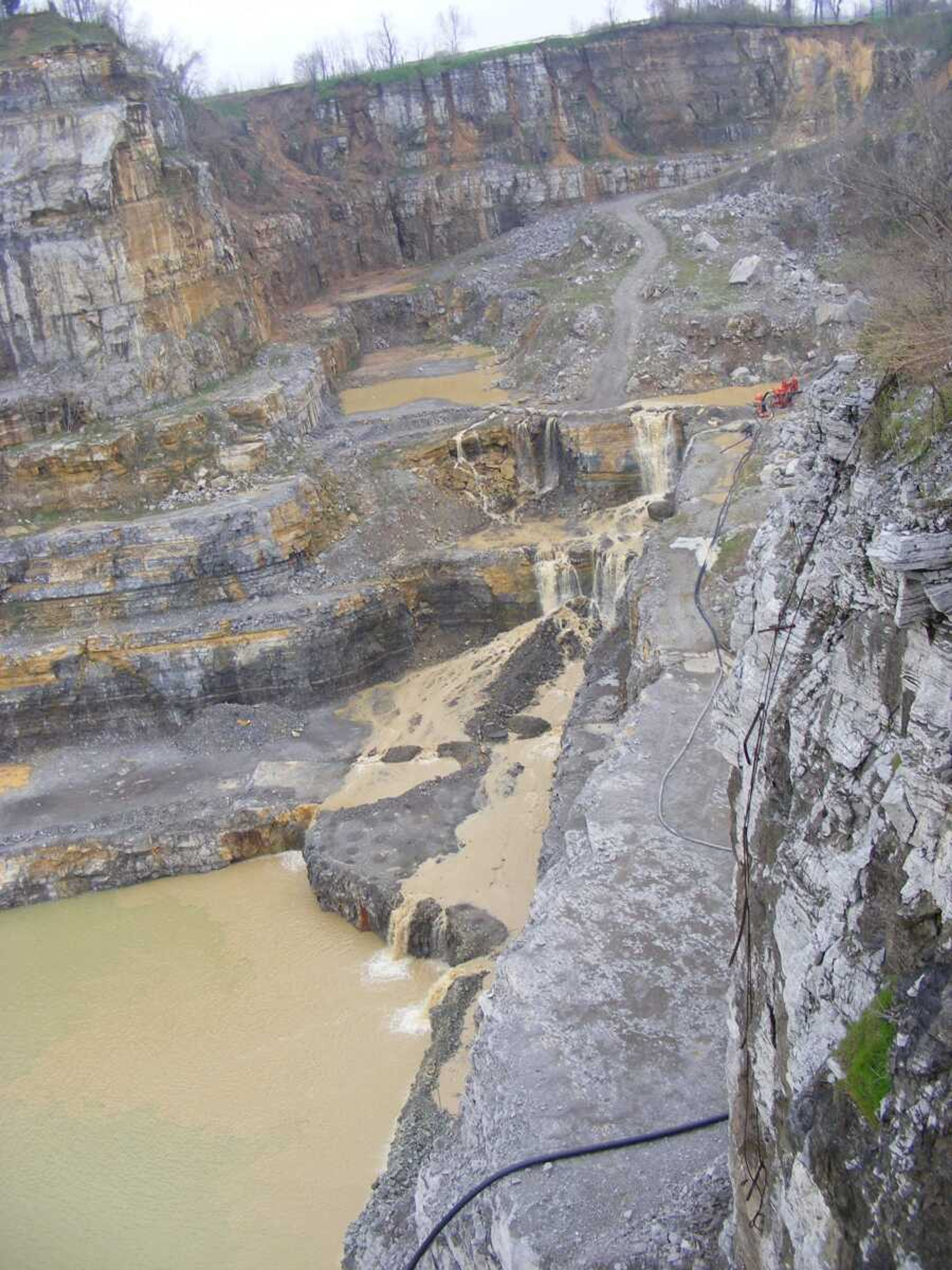
Quarry workers use a short catwalk at the edge of the quarry. This is a view looking back toward solid ground. Ken Eftink, left, is telling the group, which included geologist and former city planner Kent Bratton, center, that its time to get  back to the cars and get Emerson to her next destination.
Quarry workers use a short catwalk at the edge of the quarry. This is a view looking back toward solid ground. Ken Eftink, left, is telling the group, which included geologist and former city planner Kent Bratton, center, that its time to get back to the cars and get Emerson to her next destination.
Several sinkholes have developed along the banks of Cape LaCroix Creek. In some cases the creek banks have simply fallen into the water, an action geologists call subsidence.
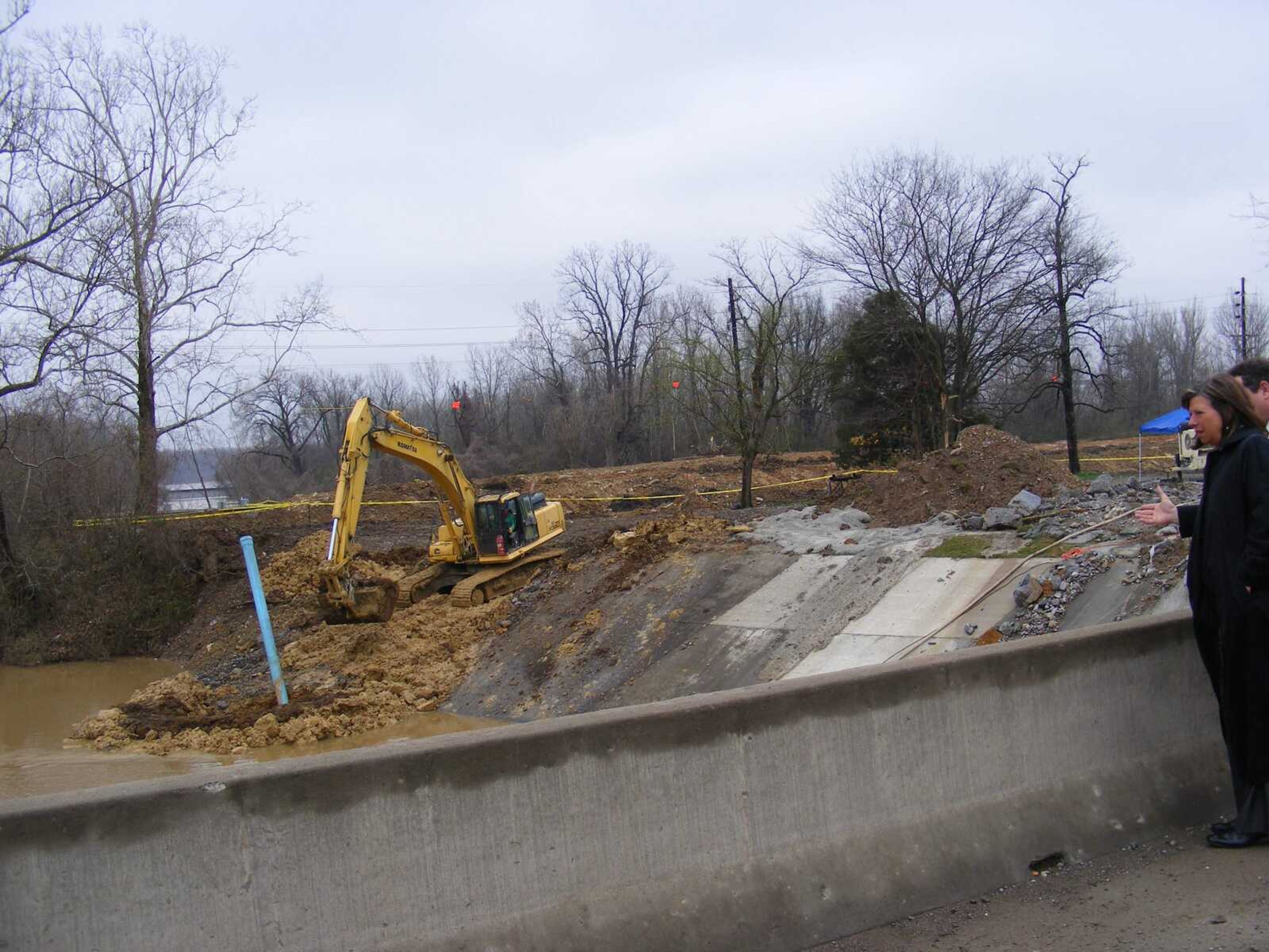
U.S. Rep. Jo Ann Emerson toured the site for the second time on Apr. 3. Her first visit was in 2007. In March, U.S. Sens. Kit Bond and Claire McCaskill, as well as state Rep. Jason Crowell, visited the site. In this photo, Emerson is listening to Ken Eftink, director of development services for the city of Cape Girardeau, explain the possible link between sinkholes on the north and south banks of Cape LaCroix Creek.
Sinkholes develop when underground water liquifies  materials such as limestone and carries it off. Over time, the underground hole expands, until the land above it collapses. Left alone, the sides of sinkholes slough off, eventually refilling the hole, though a depression in the group may remain.
Sinkholes develop when underground water liquifies materials such as limestone and carries it off. Over time, the underground hole expands, until the land above it collapses. Left alone, the sides of sinkholes slough off, eventually refilling the hole, though a depression in the group may remain.
In a residential or, as is the case in Cape Girardeau, an industrial area, the holes must be refilled as quickly as possible for safety's sake.
In some cases, the holes are filled with rock and dirt. In other cases a cement grout is used, then topped with a mound of rocks. The point is to create enough pressure to prevent water from reopening the hole.
In a residential or, as is the case in Cape Girardeau, an industrial area, the holes must be refilled as quickly as possible for safety's sake. In some cases, the holes are filled with rock and dirt. In other cases a cement grout is used, then topped with a mound of rocks. The point is to create enough pressure to prevent water from reopening the hole.
Cape Girardeau's 19th sinkhole developed under a concrete  apron on the Cape LaCroix Creek's north bank, just east of the South Sprigg Street bridge.
Cape Girardeau's 19th sinkhole developed under a concrete apron on the Cape LaCroix Creek's north bank, just east of the South Sprigg Street bridge.
Workers trying to fill sinkholes at this site said cement was poured into one hole for three days. And it still needed more.
City officials are working with the U.S. Corps of Engineers and Missouri Department of Natural Resources geologists to identify the cause of the sinkholes, along with ways to permanently fix the existing ones while preventing future collapses.
Workers trying to fill sinkholes at this site said cement was poured into one hole for three days. And it still needed more. City officials are working with the U.S. Corps of Engineers and Missouri Department of Natural Resources geologists to identify the cause of the sinkholes, along with ways to permanently fix the existing ones while preventing future collapses.
The quarry operated by Buzzi Unicem has taken on thousands of gallons of limestone-rich water that has spilled from openings on the quarry's north side.
story image illustation
Receive Daily Headlines FREESign up today!

These photos were taken on April 4 near the South Sprigg Street bridge, an area of the city where 20 sinkholes have developed.

Story Tags

Connect with the Southeast Missourian Newsroom:

For corrections to this story or other insights for the editor, click here. To submit a letter to the editor, click here. To learn about the Southeast Missourian’s AI Policy, click here.

Advertisement
Receive Daily Headlines FREESign up today!