custom ad
NewsMay 4, 2011

BOB MILLER ~ bmiller@semissourian.com

Jim and Robyn Avery shared a moment while observing the Mississippi River flood in their front yard on Water Street in Cape Girardeau on Wednesday, May 4, 2011. They were feeling much better about the situation Wednesday. "I can't believe how fast it fell," Jim Avery said. "I've lived on the river all my life, and I've never seen it fall this fast." Avery said the water did not reach the main level of his house, but he was still trying to pump river water out of his basement. He said the water level was not as high as the flood in 1993.
BOB MILLER ~ bmiller@semissourian.com Jim and Robyn Avery shared a moment while observing the Mississippi River flood in their front yard on Water Street in Cape Girardeau on Wednesday, May 4, 2011. They were feeling much better about the situation Wednesday. "I can't believe how fast it fell," Jim Avery said. "I've lived on the river all my life, and I've never seen it fall this fast." Avery said the water did not reach the main level of his house, but he was still trying to pump river water out of his basement. He said the water level was not as high as the flood in 1993.
Photo courtesy of Jim Vaughn/Dexter The above photo, looking northeasterly, depicts the raging floodwater in the scour channel below Lake Wappapello's emergency spillway at peak flood flow. Note the utility cables visible in upper center of photo.
Photo courtesy of Jim Vaughn Above is a view of the Wappapello emergency spillway and plunge pool, looking north/northeast. The toe of Wappapello dam is visible and floodwater in the central background of the photo, beyond the spillway.
Roy Presson walks away from floodwaters after trying to get a look at an area of flooded land following the Army Corps of Engineers intentional breach of the Birds Point levee Wednesday, May 4, 2011, in Wyatt, Mo.  The breach by the Corps on Monday flooded 130,000 acres of mostly farmland in southeastern Missouri. (AP Photo/Jeff Roberson)
Roy Presson walks away from floodwaters after trying to get a look at an area of flooded land following the Army Corps of Engineers intentional breach of the Birds Point levee Wednesday, May 4, 2011, in Wyatt, Mo. The breach by the Corps on Monday flooded 130,000 acres of mostly farmland in southeastern Missouri. (AP Photo/Jeff Roberson)
Floodwater covers state highway HH lined by utility poles following the Army Corps of Engineers intentional breach of the Birds Point levee Wednesday, May 4, 2011, in Wyatt, Mo.  The breach by the Corps on Monday flooded 130,000 acres of mostly farmland in southeastern Missouri. (AP Photo/Jeff Roberson)
Floodwater covers state highway HH lined by utility poles following the Army Corps of Engineers intentional breach of the Birds Point levee Wednesday, May 4, 2011, in Wyatt, Mo. The breach by the Corps on Monday flooded 130,000 acres of mostly farmland in southeastern Missouri. (AP Photo/Jeff Roberson)
Tom Griggs, left, uses binoculars as he tries to get a look at his flooded home while standing next to his uncle, Richard Griggs, Wednesday, May 4, 2011, in Wyatt, Mo. Tom Griggs' home was flooded when the Army Corps of Engineers intentionally breached the Birds Point levee on Monday night flooding 130,000 acres in southeast Missouri.  (AP Photo/Jeff Roberson)
Tom Griggs, left, uses binoculars as he tries to get a look at his flooded home while standing next to his uncle, Richard Griggs, Wednesday, May 4, 2011, in Wyatt, Mo. Tom Griggs' home was flooded when the Army Corps of Engineers intentionally breached the Birds Point levee on Monday night flooding 130,000 acres in southeast Missouri. (AP Photo/Jeff Roberson)
Vehicles splash in floodwater Wednesday, May 4, 2011, in Sikeston, Mo.  (AP Photo/Jeff Roberson)
Vehicles splash in floodwater Wednesday, May 4, 2011, in Sikeston, Mo. (AP Photo/Jeff Roberson)
In this aerial photo made Tuesday, May 3, 2011, workers fill sandbags in Caruthersville, Mo. Officials are hoping a new sandbag secondary levee catches any spillover if the Mississippi River tops the town's 50-foot floodwall. The forecast calls for a crest of 49.5 feet on Sunday afternoon in the town still recovering from a tornado six years ago that damaged more than 500 homes and businesses. (AP Photo/Jeff Roberson)
US Army Corps of Engineers Emergency Operations workers work at plugging leaks in the sea wall in Hickman, Ky., Wednesday May, 4, 2011. (AP Photo/ Daniel R. Patmore)
Homes are surrounded by flood water with vehicles are parked on the side of the road on Wednesday, May 5, 2011, in Paducah, Ky.   Flood worries that prompted the U.S. government to blast open a Missouri levee to ease pressure on some towns are rippling down the Mississippi River, leading to more evacuations and unease as the Army Corps of Engineers weighs whether to purposely inundate more land with water. (AP Photo/The Paducah Sun, Stephen Lance Dennee)
Homes are surrounded by flood water with vehicles are parked on the side of the road on Wednesday, May 5, 2011, in Paducah, Ky. Flood worries that prompted the U.S. government to blast open a Missouri levee to ease pressure on some towns are rippling down the Mississippi River, leading to more evacuations and unease as the Army Corps of Engineers weighs whether to purposely inundate more land with water. (AP Photo/The Paducah Sun, Stephen Lance Dennee)
Water from Kentucky Lake flows through the gates at Kentucky Dam Wednesday, May 4, 2011, near Grand Rivers, Ky. Lake levels at Ketucky and Barkley lakes are at record levels. The Tennessee and Cumberland rivers have been shut down to commercial traffic. (AP Photo/The Paducah Sun, Stephen Lance Dennee)
KRISTIN EBERTS ~ keberts@semissourian.com

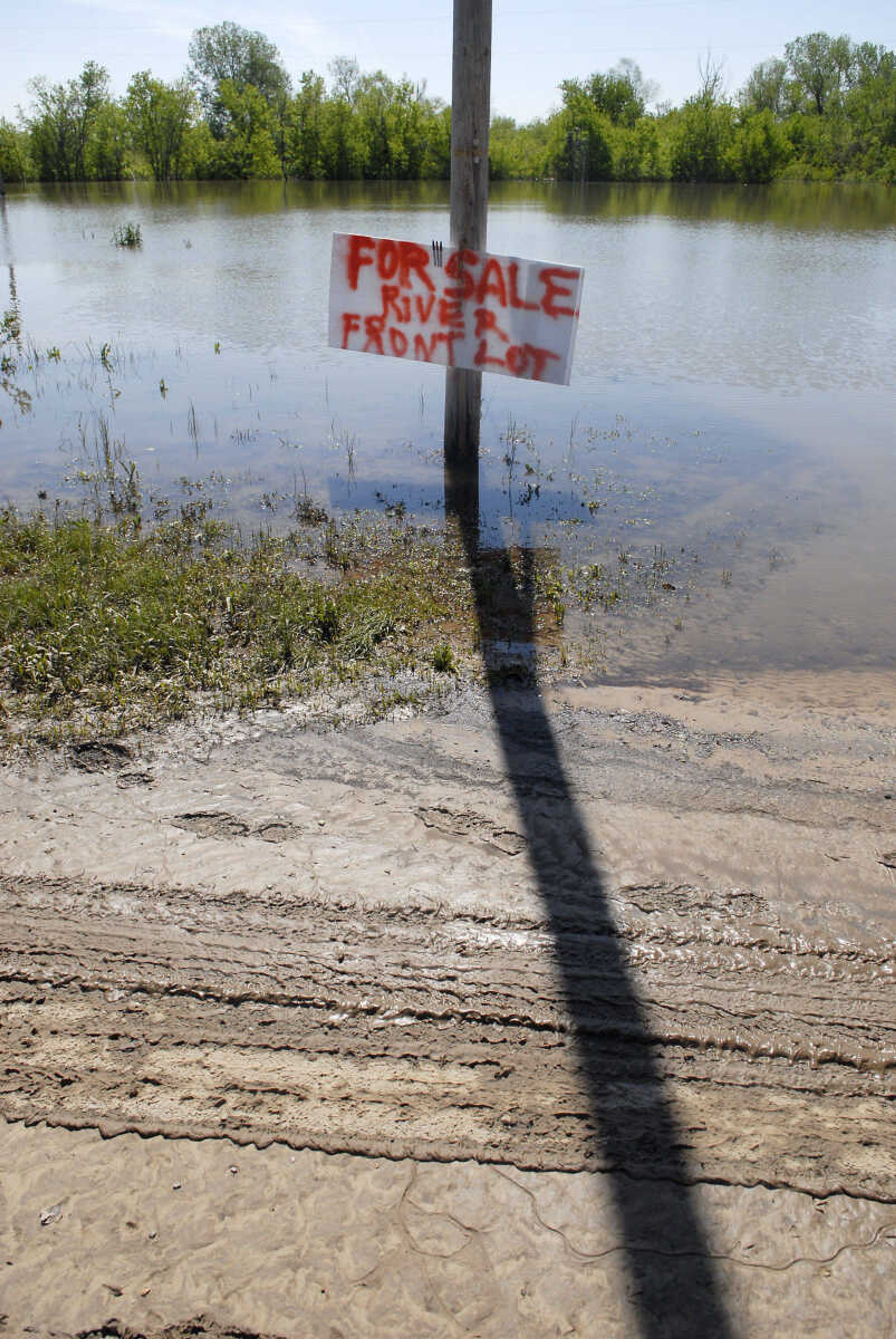
Mud and sand cover Water Street where the water has receded on Wednesday, May 4, 2011, in Cape Girardeau.
KRISTIN EBERTS ~ keberts@semissourian.com Mud and sand cover Water Street where the water has receded on Wednesday, May 4, 2011, in Cape Girardeau.
BOB MILLER ~ bmiller@semissourian.com

Jason Keesee, owner of Counters Etc, Inc., cleaned up some ruined items out of his business Wednesday, May 4, 2011. He said he got about 90 percent of his inventory out of the shop before the river flooded his business on Water Street in Cape Girardeau. He has located his business temporarily in Kelso, Mo. He called the flood a "minor setback" and said he felt more sorry for those who have been affected by flash flooding in other parts of the region.
BOB MILLER ~ bmiller@semissourian.com Jason Keesee, owner of Counters Etc, Inc., cleaned up some ruined items out of his business Wednesday, May 4, 2011. He said he got about 90 percent of his inventory out of the shop before the river flooded his business on Water Street in Cape Girardeau. He has located his business temporarily in Kelso, Mo. He called the flood a "minor setback" and said he felt more sorry for those who have been affected by flash flooding in other parts of the region.
BOB MILLER ~ bmiller@semissourian.com

Jim and Robyn Avery shared a moment while observing the Mississippi River flood in their front yard on Water Street in Cape Girardeau on Wednesday, May 4, 2011. They were feeling much better about the situation Wednesday. "I can't believe how fast it fell," Jim Avery said. "I've lived on the river all my life, and I've never seen it fall this fast." Avery said the water did not reach the main level of his house, but he was still trying to pump river water out of his basement. He said the water level was not as high as the flood in 1993.
BOB MILLER ~ bmiller@semissourian.com Jim and Robyn Avery shared a moment while observing the Mississippi River flood in their front yard on Water Street in Cape Girardeau on Wednesday, May 4, 2011. They were feeling much better about the situation Wednesday. "I can't believe how fast it fell," Jim Avery said. "I've lived on the river all my life, and I've never seen it fall this fast." Avery said the water did not reach the main level of his house, but he was still trying to pump river water out of his basement. He said the water level was not as high as the flood in 1993.
BOB MILLER ~ bmiller@semissourian.com

Jason Keesee, owner of Counters Etc, Inc., cleaned up some ruined items out of his business Wednesday, May 4, 2011. He said he got about 90 percent of his inventory out of the shop before the river flooded his business on Water Street in Cape Girardeau. He has located his business temporarily in Kelso, Mo. He called the flood a "minor setback" and said he felt more sorry for those who have been affected by flash flooding in other parts of the region.
BOB MILLER ~ bmiller@semissourian.com Jason Keesee, owner of Counters Etc, Inc., cleaned up some ruined items out of his business Wednesday, May 4, 2011. He said he got about 90 percent of his inventory out of the shop before the river flooded his business on Water Street in Cape Girardeau. He has located his business temporarily in Kelso, Mo. He called the flood a "minor setback" and said he felt more sorry for those who have been affected by flash flooding in other parts of the region.
BOB MILLER ~ bmiller@semissourian.com

Jason Keesee, owner of Counters Etc, Inc., cleaned up some ruined items out of his business Wednesday, May 4, 2011. He said he got about 90 percent of his inventory out of the shop before the river flooded his business on Water Street in Cape Girardeau. He has located his business temporarily in Kelso, Mo. He called the flood a "minor setback" and said he felt more sorry for those who have been affected by flash flooding in other parts of the region.
BOB MILLER ~ bmiller@semissourian.com Jason Keesee, owner of Counters Etc, Inc., cleaned up some ruined items out of his business Wednesday, May 4, 2011. He said he got about 90 percent of his inventory out of the shop before the river flooded his business on Water Street in Cape Girardeau. He has located his business temporarily in Kelso, Mo. He called the flood a "minor setback" and said he felt more sorry for those who have been affected by flash flooding in other parts of the region.
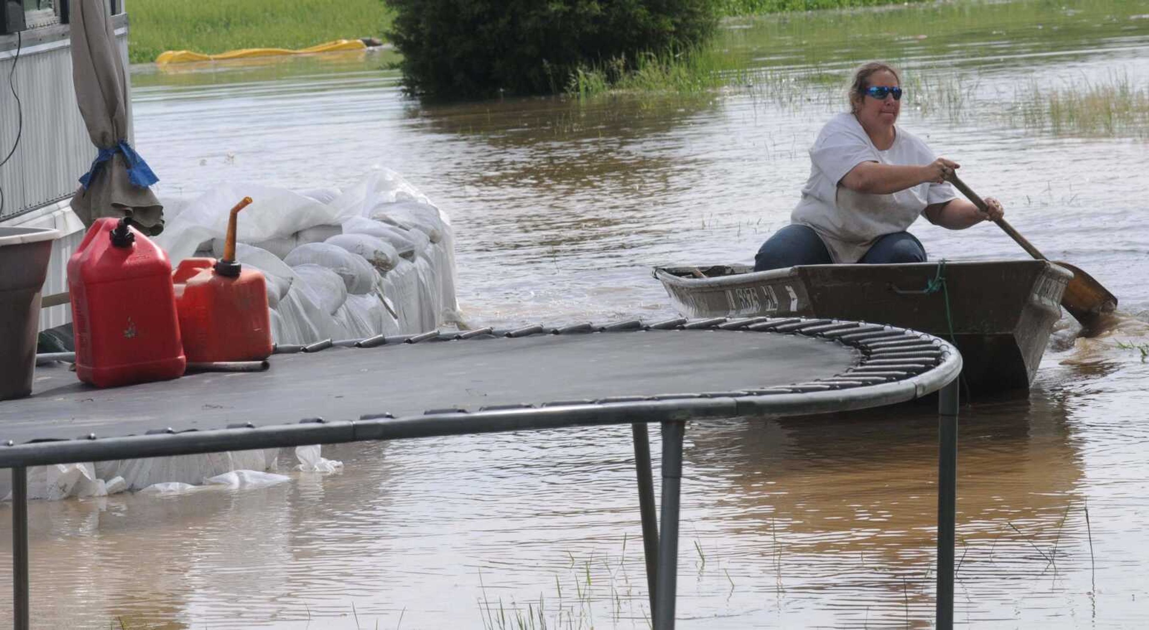
Angela Alexander  navigates through her flooded backyard in a boat Wednesday, May 4, 2011 in Shady Grove, Ill.   The dramatic, late-night demolition of a huge earthen levee sent chocolate-colored floodwaters pouring onto thousands of acres of Missouri farmland Tuesday, easing the threat to a tiny Illinois town being menaced by the Mississippi River.   But the blast near Cairo, Ill., did nothing to ease the risk of more trouble downstream, where the mighty river is expected to rise to its highest levels since the 1920s in some parts of Tennessee, Mississippi and Louisiana.  (AP Photo/The Paducah Sun, John Wright)
Angela Alexander navigates through her flooded backyard in a boat Wednesday, May 4, 2011 in Shady Grove, Ill. The dramatic, late-night demolition of a huge earthen levee sent chocolate-colored floodwaters pouring onto thousands of acres of Missouri farmland Tuesday, easing the threat to a tiny Illinois town being menaced by the Mississippi River. But the blast near Cairo, Ill., did nothing to ease the risk of more trouble downstream, where the mighty river is expected to rise to its highest levels since the 1920s in some parts of Tennessee, Mississippi and Louisiana. (AP Photo/The Paducah Sun, John Wright)
Joel Brown, a First Class Electrician's Mate, left, and Adam Wong, a Petty Officer Second Class, both with the U.S. Coast Guard, return to a staging area  on Wednesday, May 4, 2011 in their boat after transferring a pair of emergency officials to the other side of flooded  road  in the Shady Grove community of Massac County, Ill.  The dramatic, late-night demolition of a huge earthen levee sent chocolate-colored floodwaters pouring onto thousands of acres of Missouri farmland Tuesday, easing the threat to a tiny Illinois town being menaced by the Mississippi River.   But the blast near Cairo, Ill., did nothing to ease the risk of more trouble downstream, where the mighty river is expected to rise to its highest levels since the 1920s in some parts of Tennessee, Mississippi and Louisiana.  (AP Photo/The Paducah Sun, John Wright)
Joel Brown, a First Class Electrician's Mate, left, and Adam Wong, a Petty Officer Second Class, both with the U.S. Coast Guard, return to a staging area on Wednesday, May 4, 2011 in their boat after transferring a pair of emergency officials to the other side of flooded road in the Shady Grove community of Massac County, Ill. The dramatic, late-night demolition of a huge earthen levee sent chocolate-colored floodwaters pouring onto thousands of acres of Missouri farmland Tuesday, easing the threat to a tiny Illinois town being menaced by the Mississippi River. But the blast near Cairo, Ill., did nothing to ease the risk of more trouble downstream, where the mighty river is expected to rise to its highest levels since the 1920s in some parts of Tennessee, Mississippi and Louisiana. (AP Photo/The Paducah Sun, John Wright)
Joel Brown, a First Class Electrician's Mate, second from left,  and Petty Officer Zach Carlson, far right, both of the U.S.  Coast Guard, assist Willis Jordan  with building a sandbag wall Wednesday, May 4, 2011 in Shady Grove, Ill.  The dramatic, late-night demolition of a huge earthen levee sent chocolate-colored floodwaters pouring onto thousands of acres of Missouri farmland Tuesday, easing the threat to a tiny Illinois town being menaced by the Mississippi River.   But the blast near Cairo, Ill., did nothing to ease the risk of more trouble downstream, where the mighty river is expected to rise to its highest levels since the 1920s in some parts of Tennessee, Mississippi and Louisiana.  (AP Photo/The Paducah Sun, John Wright)
Joel Brown, a First Class Electrician's Mate, second from left, and Petty Officer Zach Carlson, far right, both of the U.S. Coast Guard, assist Willis Jordan with building a sandbag wall Wednesday, May 4, 2011 in Shady Grove, Ill. The dramatic, late-night demolition of a huge earthen levee sent chocolate-colored floodwaters pouring onto thousands of acres of Missouri farmland Tuesday, easing the threat to a tiny Illinois town being menaced by the Mississippi River. But the blast near Cairo, Ill., did nothing to ease the risk of more trouble downstream, where the mighty river is expected to rise to its highest levels since the 1920s in some parts of Tennessee, Mississippi and Louisiana. (AP Photo/The Paducah Sun, John Wright)
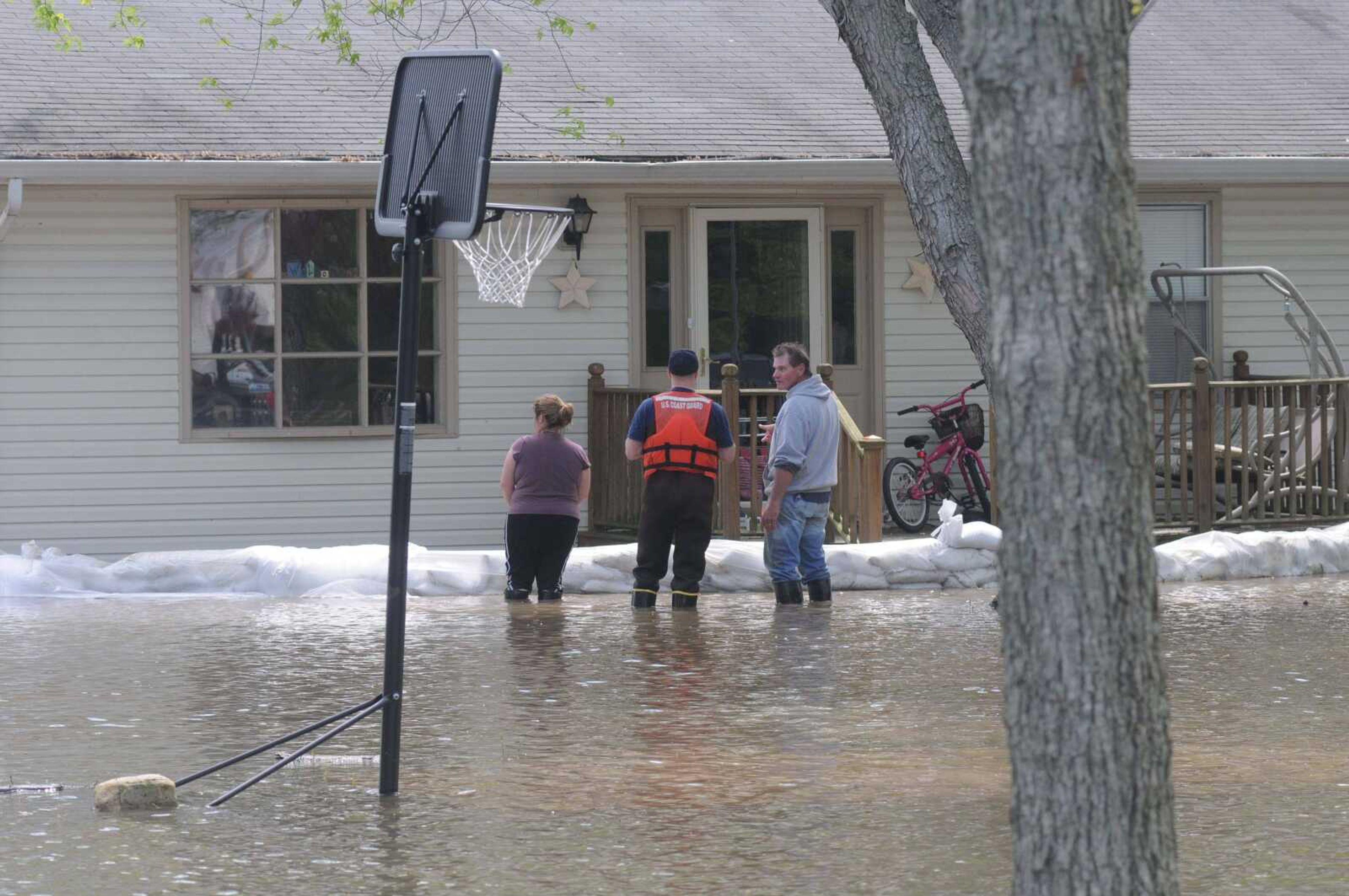
Petty Officer Zach Carlson of the U.S.  Coast Guard, middle, talks with the owners of this home on Wednesday, May 4, 2011 in the Shady Grove community of Massac County, Ill.  The dramatic, late-night demolition of a huge earthen levee sent chocolate-colored floodwaters pouring onto thousands of acres of Missouri farmland Tuesday, easing the threat to a tiny Illinois town being menaced by the Mississippi River.   But the blast near Cairo, Ill., did nothing to ease the risk of more trouble downstream, where the mighty river is expected to rise to its highest levels since the 1920s in some parts of Tennessee, Mississippi and Louisiana.  (AP Photo/The Paducah Sun, John Wright)
Petty Officer Zach Carlson of the U.S. Coast Guard, middle, talks with the owners of this home on Wednesday, May 4, 2011 in the Shady Grove community of Massac County, Ill. The dramatic, late-night demolition of a huge earthen levee sent chocolate-colored floodwaters pouring onto thousands of acres of Missouri farmland Tuesday, easing the threat to a tiny Illinois town being menaced by the Mississippi River. But the blast near Cairo, Ill., did nothing to ease the risk of more trouble downstream, where the mighty river is expected to rise to its highest levels since the 1920s in some parts of Tennessee, Mississippi and Louisiana. (AP Photo/The Paducah Sun, John Wright)
KRISTIN EBERTS ~ keberts@semissourian.com

Floodwater recedes from the sandbag wall in front of Bill Sandquist's home on Main Street in the Red Star District of Cape Girardeau on Wednesday, May 4, 2011.
KRISTIN EBERTS ~ keberts@semissourian.com Floodwater recedes from the sandbag wall in front of Bill Sandquist's home on Main Street in the Red Star District of Cape Girardeau on Wednesday, May 4, 2011.
KRISTIN EBERTS ~ keberts@semissourian.com

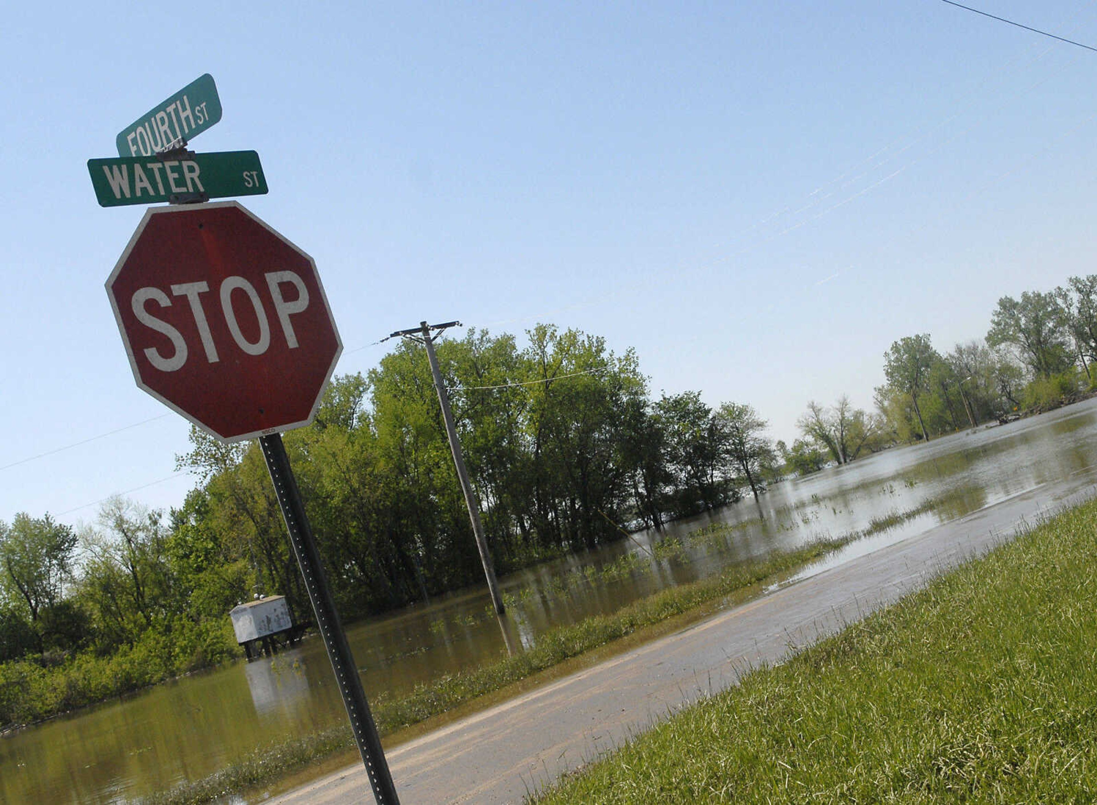
Floodwater recedes along Water Street in the Red Star District of Cape Girardeau on Wednesday, May 4, 2011.
KRISTIN EBERTS ~ keberts@semissourian.com Floodwater recedes along Water Street in the Red Star District of Cape Girardeau on Wednesday, May 4, 2011.
KRISTIN EBERTS ~ keberts@semissourian.com

Floodwater recedes from the sandbag wall in front of Bill Sandquist's home on Main Street in the Red Star District of Cape Girardeau on Wednesday, May 4, 2011.
KRISTIN EBERTS ~ keberts@semissourian.com Floodwater recedes from the sandbag wall in front of Bill Sandquist's home on Main Street in the Red Star District of Cape Girardeau on Wednesday, May 4, 2011.
KRISTIN EBERTS ~ keberts@semissourian.com

Mud and sand cover Water Street where the water has receded on Wednesday, May 4, 2011, in Cape Girardeau.
KRISTIN EBERTS ~ keberts@semissourian.com Mud and sand cover Water Street where the water has receded on Wednesday, May 4, 2011, in Cape Girardeau.
KRISTIN EBERTS ~ keberts@semissourian.com

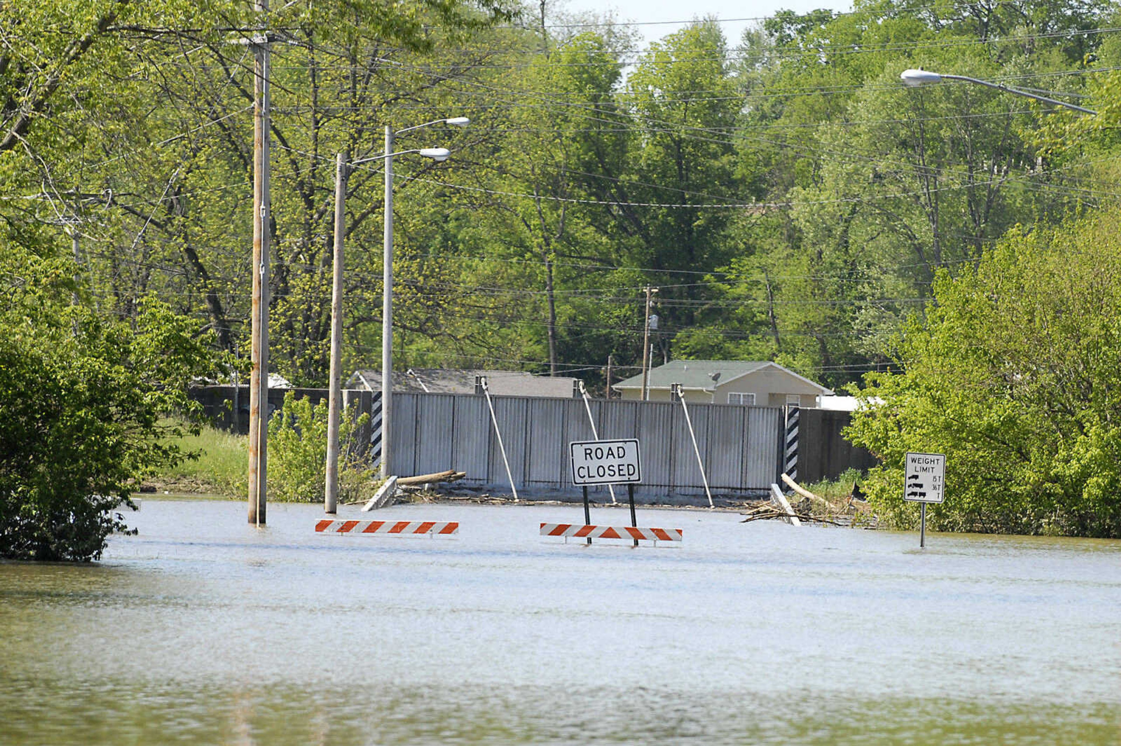
The Main Street floodgate remains closed in the Red Star District of Cape Girardeau on Wednesday, May 4, 2011.
KRISTIN EBERTS ~ keberts@semissourian.com The Main Street floodgate remains closed in the Red Star District of Cape Girardeau on Wednesday, May 4, 2011.
This NASA photo shows the floodway before activation.
This NASA photo shows the floodway after activation.
Receive Daily Headlines FREESign up today!

Story Tags

Connect with the Southeast Missourian Newsroom:

For corrections to this story or other insights for the editor, click here. To submit a letter to the editor, click here. To learn about the Southeast Missourian’s AI Policy, click here.

Advertisement
Receive Daily Headlines FREESign up today!