-
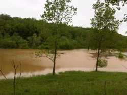
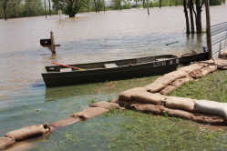
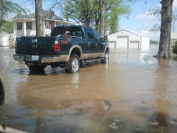
 2011 Flood on the Mississippi River (7/8/11)My husband Carl and I drove over to Thebes, IL and went up the steps of the old court house where I took this picture of the flood on the Mississippi River.
 -
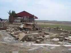 Destruction at Birds Point levee June 20, 2011 (6/21/11)Destroyed farmstead in the Birds Point Floodway. Nothing left but the foundation and concrete blocks. Farm Shop was totally washed away, just the concrete floor was left. Machine shed still standing in the background...battered, like all the homes and lives after the flood...
 -
 Tears at Birds Point Levee (6/21/11)As a lifelong farmer myself, I was horrifed when I first heard rumors that the Corps of Engineers was thinking about blowing Birds Point levee. After spending some time in the area meeting people at several events last year, I have come to love the bootheel, it's land, and it's people. A year ago this spring I drove from farm to farm there, meeting the people, and talking agriculture, and politics...
 -
 After the Rains (5/22/11)Tablerock Lake picnic area, swollen but still beautiful.
 -
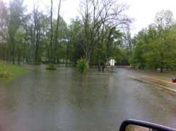
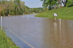
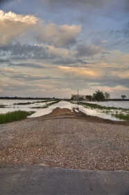 submerged road (5/9/11)submerged road in Stoddard County
 -
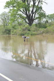
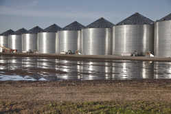 bin by the water (5/8/11)rising waters approaching a series of grain bins in Mississippi County Missouri
 -
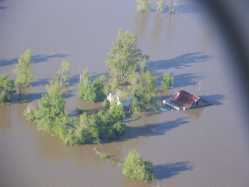
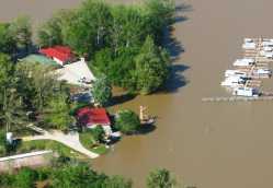
 Hubbard House (Allstun Farms) Dorena, MO (5/8/11)Aerial view of the Hubbard House (Allstun Farms) in Dorena, MO. Location Hwy 102 and "YY" junction. House was built in 1939.
 -
 Hubbard House (Allstun Farms) Dorena, MO (pic#2) (5/8/11)Aerial photo of the Hubbard House (Allstun Farms) 2nd Photo. Hwy 102 and "YY" junction. House built in 1939.
 -
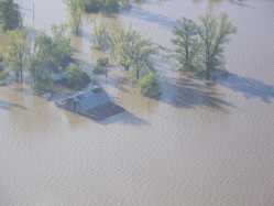
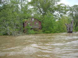
 Bruce Larkin House. Dorena, MO (5/8/11)House under water from Birds Point Levee break.
 -
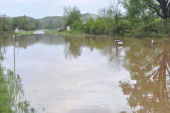
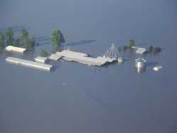 Choate Farms (5/8/11)Farm under water from Bird Point Levee Break.
 -
 Flood waters on Horseshoe Lake (5/6/11)Turtles sunning themselves on a log on the side of Rt. 3 near Horseshoe Lake.
 -
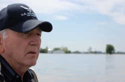 Flood of 2011 (5/5/11)This is my father, Don Farris, as we were in a boat surveying the damage to his house and his neighbors farms in Alexander Co. Il.
 -
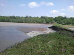
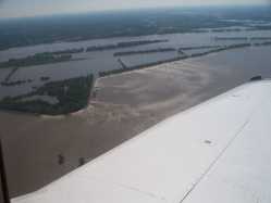 Breach in Bird's Point Levee (5/4/11)Breach in the front-Line levee at Bird's Point, MO.
 -
 Flood5211 (5/3/11)Junction of Highway W and Highway O outside Poplar Bluff, MO on 5/2/11 @ 5p.m. This area had NO water on it at 8:30a.m. this morning!
 -
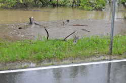
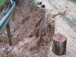 Rains wash out Cissus Lane in Cape County (5/3/11)Cissus Lane after several days of rain. Guard rail still holds on.
 -
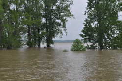
 Flooded wheat field (5/2/11)Wheat fields flooded near the levee north of Charleston.
 -
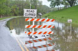
 Flooding Over the Highway (5/2/11)Flooding over State Highway 177, just past Kenco. Photo taken 5/2/11 at approximately 8 AM.
 -
 Former Intersection (5/2/11)This is the intersection of County Road 657 and State Highway 177. It's completely underwater. Photo taken 5/2/11 at approximately 9 AM.
 -
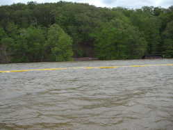
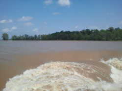
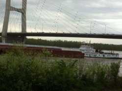 Barge on the Mississippi River (5/2/11)Rising waters of the Mississippi and barge traffic
 -
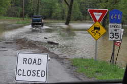 Water over County Rd 640 (5/2/11)this is county road 640 just off of 657. This route has been the main thoroughfare for residents north of the city limits after hwy 177 was closed due to flood water. Today it is closed too making the commute for most residents 15 minutes longer.
 -
 Flood Water inches up Hwy 177 more (5/2/11)The water keeps creeping up over highway 177 at the city limit of Cape Gir. Normally I take pics of some mailboxes but they are under water and I cannot get to them.
 -
 Flood Water seeks to land lock some residents (5/2/11)About a mile north on highway 177 some residents may become sandwiched between two areas of flood waters. Currently 177 at the city limits is flooded and this area looks to flood if we keep getting rising waters.
 -
 Wappapello lake Chionia Landing (5/1/11)Fly over of Wappapello Lake on Friday afternoon. Chionia Landing Parking lot under water.
 -
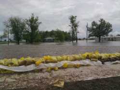
 Commerce MO flooding situation (5/1/11)From Commerce MO. The flood waters from the Mississippi continue to rise. The community contiues to reel from its devistaion. The water is higher than in both 1993 and 1995. There are two residences that have been evacuated. Sandbags are added daily in an attempt to protect one of them. ...
 -
 Another from Lake Wappapello on the lake (5/1/11)The red house at the Girl Scout Camp on Lake Wappapello, taken April 30 2011
 -
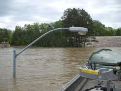 Light pole at Sundowner Boat Launching Ramp (5/1/11)Light pole next to the boat launching ramp at the Sundowner parking area
 -
 Closer shot of Peoples Creek beach? (5/1/11)Restrooms at Peoples Creek beach and swimming area
 -
 Wappapello Lake, Peoples Creek swimming area (5/1/11)Saturday afternoon April 30 cruise on Lake Wappapello Peoples Creek swimming area, beach?, picnic pavilion and restrooms
 -
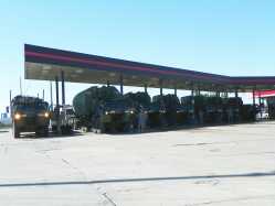 National Guard Relief (5/1/11)I happened to find this Army Convoy following me down I-55 on Friday. I didn't see them until I took the Nash Road exit to turn around. There were 20-30 vehicles. They went to the Truck stop to fill up with gas. After talking to one of the Army guys, I found out they were heading to Kennett to help out. I thanked him for serving in the many ways that they do and told him to tell the others as well!! Thank God we have them to help in times of distress...
 -
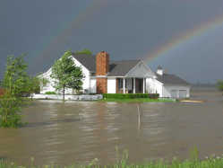 Jeff Farris House, Olive Branch IL (4/30/11)This is a photo taken in Olive Branch, IL. of the April 2011 flood, as you can see there are two rainbows above the house, kinda gives you hope that there is always light at the end of the rainbow.
 -
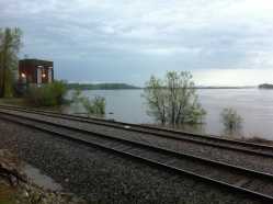
 Railroad tracks below Cape Rock. (4/29/11)This is a photo of the railroad tracks and outbuilding right below Cape Rock in Cape Girardeau on Friday, April 29th, 2011.
 -
 Before the flooding really began. (4/29/11)This is a photo of the railroad tracks and outbuilding right below Cape Rock in Cape Girardeau on April 25th, 2011.
 -
 AFTER the flooding. (4/29/11)This is a photo of the railroad tracks and outbuilding right below Cape Rock in Cape Girardeau on Friday, April 29th, 2011. (See the before picture that was taken on Monday.)
 -
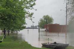
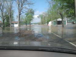
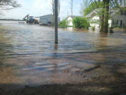
 Flooded on Main St (4/28/11)April 28, 2011 on Main St in downtown Cape Girardeau. Families using boats to get from one house to another, many evacuated.
 -
 DORENA MO. (4/28/11)DORENA MISSOURI
 -
 Highway 177 @ City Limits (4/28/11)This is the mailbox I photograph daily when the water is up. In 1993 these boxes were underwater. This is April 28, 2011. Day 3 of water over Highway 177.
 -
 Highway 177 @ City Limits (4/28/11)Water has risen more over a day. This is April 28, 2011 of flood over highway 177 @ the city limits.
 -
 MoDot gravels 177 (4/28/11)MoDot Gravels Highway 177 @ the city limits to aid stranded residents.
 -
 Route 3 in Olive Branch, IL-Kelly Cotton's House (4/28/11)My aunts house on Route 3 in Olive Branch, IL. This photo was taken 4/27 at 2:00pm.
 -
 Corps preparation to breach Birds Point levee (4/28/11)Levee at Birds Point being prepared by Corps for possible breach.
 -
Hearing on blowing Birds Point levee moved to 1:30 p.m. today (4/28/11)A federal judge in Cape Girardeau will hear arguments at 1:30 p.m. today on whether to block the Army Corps of Engineers from detonating explosives that will destroy portions of the Birds Point levee in Mississippi County. Missouri Attorney General Chris Koster, who filed the lawsuit in federal court on Tuesday, is expected to argue the state's case before Judge Stephen N. Limbaugh Jr. at the Rush H. Limbaugh Sr. U.S. Courthouse in Cape Girardeau...
-
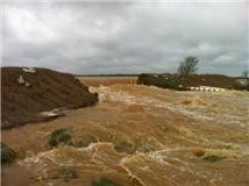
 Levee Breach (4/27/11)this is where all the water washed out to.
 -
 Levee Breach (4/27/11)this shows all the water behind the breach
 -
 Painton Flood (4/27/11)Painton Mo Flood
 -
 Painton Flood (4/27/11)Painton Mo Flood
 -
 Painton Flood (4/27/11)Painton Mo Flood
 -
 Levee Breach (4/27/11)Here im right on top of the levee breach as you can see i was within 2 ft of goin over
 -
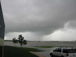 Funnel Cloud Today between Chaffee and Nash Road (4/27/11)This is the funnel cloud spotted this afternoon in the last round of heavy storms to pass through the area, located between Chaffee, MO and Nash Road. It was on it's way back up into the clouds (thank goodness!) by the time I got my camera!
 -
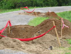
 caney levee (4/27/11)trying anything to fix
 -
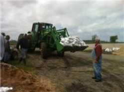
 trying to fix with 2000lb sand bags (4/27/11)heavy equipment trying to save family and friends
 -
 caney basin (4/27/11)hole getting bigger
 -
 caney basin levee breach (4/27/11)caney levee breach tues morn
 -
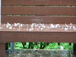 Hail in Jackson (4/27/11)A picture of the hail that fell Wednesday afternoon in Jackson
 -
 Levee Breach (4/27/11)This is a view of what the levee breach did. I was about 2.5 miles from the breach when I took this pic
 -
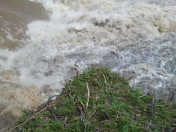
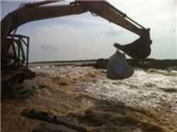
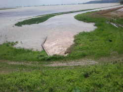 Spill way overflow near Levee Breach (4/27/11)This is the spillway that was supposed to releave the preasure behind the levee but there was so much water behind the levee that it couldnt keep up. Then after the levee breached the water started running in reverse at the spillway and started pushing more water into the levee!...
 -
 Levee Breach at Bell City (4/27/11)This is the breach in the levee were about 50 ft from it at this point!
 -
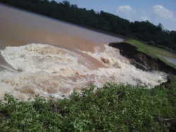 Levee Breach (4/27/11)this is the same levee breach at Bell City im about 25 ft from it here
 -
 Painton Flood (4/27/11)Painton Mo Flood
 -
 Highway 177 @ City Limits (4/27/11)This is Day 2 of the water over Highway 177 at the city limits
 -
 Highway 177 @ City Limits (4/27/11)I use these mailboxes as water markers of the water depth. This is Day 1 April 26. In 1993 these mailboxes disappeared. This is at the city limits (pet cemetery, southern County Road 657). It amazes me that the city, county has not built this short stretch of road up in all this time...
 -
 Highway 177 @ City Limits (4/27/11)I use these mailboxes as water markers of the water depth. This is Day 2 April 27. In 1993 these mailboxes disappeared. This is at the city limits (pet cemetery, southern County Road 657). It amazes me that the city, county has not built this short stretch of road up in all this time...
 -
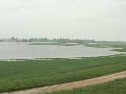
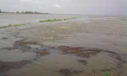
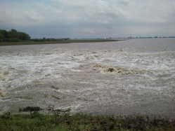
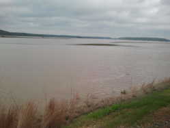
 East of Wyatt - South of Bird's Blue Hole (4/26/11)The Mississippi river as of April 26, 2011
 -
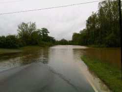
 Road to Dutchtown (4/26/11)Floodwater over Highway 74 heading into Dutchtown.
 -
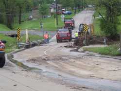
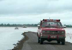 Delta Firefighters rescue trapped driver. (4/25/11)Delta Firefighters transport the driver of a car who was trapped in a ditch on Cape County Road 249 just north of Missouri Highway EE. The car was driven into water and field debris on the road which splashed onto the windshield and obstructed the drivers view...
 -
 flooding in scott city (4/25/11)my dog almost got swept away in the current
 -
 Hubble Creek by Jackson Bait & Tackle (4/25/11)Raging water during this weeks storms
