History sets foundation for Missouri Guard earthquake response training
JEFFERSON CITY, Mo. -- In the early pre-dawn hours of Feb. 7, 1812, residents of southeast Missouri experienced the rocking and shaking of a 7.7 magnitude earthquake. It was the third and largest earthquake in less than two months, and would cause devastation that can still be seen 200 years later and are reminders of the need to be prepared today.
The New Madrid Earthquakes of 1811 and 1812 rank as some of the largest in U.S. history. According to the U.S. Geological Survey, they were by far the largest east of the Rocky Mountains in the U.S. and Canada, and were 10 times as large as the 1906 San Francisco earthquake.
"It was more devastating because of the type of land and soil in this area, which is a lot of floodplains and it's soft," said Charles Machon, Missouri National Guard museum director. "Witnesses reported the land moved like waves."
The first earthquake on Dec. 16, 2011, is estimated to have been a magnitude 7.7 by the U.S. Geological Survey. The second on January 23, 1812 is estimated to have been a 7.5. The third and final shock had a 7.7 magnitude but because its epicenter was located closest to the town of New Madrid it's effect was severely more devastating.
More than 200 moderate to large aftershocks occurred between the first shock and March 15, 1812, adding to the fear and destruction throughout the New Madrid area.
The earthquakes caused landslides along hillsides and steep bluffs, uplifted large areas of land permanently, while other large areas sank and flooded with water, all making rich prairie land unfit for farming. Waves across the Mississippi River overturned boats, destroyed banks, and even whole islands disappeared. Chimneys were toppled and log cabins collapsed as far away as Cincinnati, Ohio.
Eye witness accounts in "The New Madrid Earthquakes" by James Lal Penick, Jr. give a vivid description of not only what people saw, but their mental and emotional distress.
"Water spouted to great heights, as if it were pressed 'out of the pores of the earth,'" James Fletcher told the Pittsburgh Gazette.
A resident of Little Prairie, located where Caruthersville is today, Fletcher described a frightening scene along the Mississippi River.
"He believed that the whole country was sinking and fled in horror from the river," the Gazette reported. "The agitation of the earth was so great that it was with difficulty any could stand on their feet, and some could not."
Many had fled to New Madrid between the initial earthquake on Dec. 16 until Feb. 4, when as the shocks began to increase residents and refugees in New Madrid no longer trusted the shelter of their homes and by Feb. 7 a mass evacuation took place, according to Penick.
"The banks of the Mississippi River collapsed and parts of the town of New Madrid sank," said Machon.
Even as their town flooded, residents faced more obstacles as they fled.
"In some instances the bottoms of streams, lakes and ponds were actually thrust up, their waters running off to flood the surrounding land to a depth of one to three feet," described Penick. "While some areas were uplifted, much of the timberland around the town had sunk as much as six feet. Fissures slashed and scarred the route...sand blows, the result of frightening eruptions of sand, coal, and other organic matter, dotted the landscape."
The areas felt by the last and largest earthquake were far and vast.
"The quake caused bells to ring in Charleston, S.C., and several other eastern states," said Machon.
This has much to do with the Earth's outer crust in the central and eastern regions of the country where seismic energy has a lower rate of absorption, according to the U.S. Geological Survey. The estimated area was approximately 2.5 million square kilometers. The 1906 San Francisco earthquake was only about 150,000 square kilometers.
The damage caused by the earthquakes led Missouri Governor William Clark to request federal aid, the first U.S. governor to do so, and led Congress to pass the first disaster relief act, introduced by Missouri's territorial delegate, Col. Rufus Easton, in 1815, which provided landowners of ravaged ground with an equal amount of land in unaffected regions.
Machon said you can still see the effects today.
"You can see sand blows around the Sikeston airport and Reelfoot Lake in Tennessee used to be a part of the river but it was cut off and created a whole new landmark," said Machon.
The earthquakes' devastation has been a stark reminder for the Missouri National Guard and civilian responders to be prepared for the next one.
"If something like this were to happen again, it would be extremely devastating," said Machon.
The death toll is unknown but is estimated by the Geological Survey to be low because of the region's sparse population and log-cabin construction, which can withstand shaking very well. Today the infrastructure is dramatically changed, and the population of New Madrid County is nearly 19,000.
For Chief Warrant Officer 3 Timothy Forney, project officer for Missouri's Vigilant Guard, the New Madrid earthquakes are not about if they might happen again, but when and how the Missouri National Guard can always be ready.
"We know that is a threat to our community," said Forney. "It was a very significant event in 1812. It would be even more devastating with the increased population and infrastructure today."
Missouri has already done a great deal of training for an event of this nature, said Forney, including the addition of homeland defense training at the unit level, weekend drills and command post exercises for the past several years.
Although it is difficult to predict when and how intense the next earthquake will be, the Missouri National Guard takes everything into consideration.
"It is projected that the area that will be hit the hardest is southeast Missouri," said Forney. "Depending on the intensity of the earthquake, it could have very negative effects on areas as far away as St. Louis."
Much like 200 years ago, a hard hitting earthquake would be devastating to the rural areas of southeast Missouri. It would lose its intensity as it moves north along the Mississippi River, and to the west towards central Missouri, but there would be an increase in damage to man-made structures as there are more and larger and buildings, bridges and other structures nearer to the St. Louis area and other more densely populated areas towards the center of the state, said Forney.
To prepare even more, Missouri participates in the U.S. Northern Command and National Guard Bureau sponsored Vigilant Guard, which provides State National Guard Headquarters and supporting units with an opportunity to improve cooperation and operational relationships with their civilian, federal and military partners in preparation for domestic emergencies and catastrophic events.
"Vigilant Guard gives us a very unique opportunity to work with military and civilian emergency responders," said Forney. "We train side by side and several states participate."
If there was another earthquake, the Guard's first consideration would be saving lives through rescue efforts.
"We could be asked to help civilian responders with mass care to those affected," said Forney. "We'd also be able to help government agencies re-establish essential services such as communication, public works and lines of transportation, to name a few."
In 2011 the Missouri National Guard participated with six states and the federal government in the biggest Vigilant Guard exercise yet to feature a response to a natural disaster.
The scenario-based exercise helped prepare and evaluate the state's ability to respond to the worst case situation. In the simulation, Soldiers and Airmen were expected to support local authorities by conducting search and rescue mission, clearing routes, transporting resources including food and water to resident in need, and providing security were requested.
This year's exercise will include Missouri and its neighboring states, said Forney, and will be more detailed and in-depth.
Central and southeast Missouri is still very active and continues to provide data for the Guard to use in preparation. The most recent earthquake was a magnitude 3.9 on June 7, 2011 near Sullivan, 183 miles from New Madrid and 68 miles from St. Louis.
The mission and capabilities of a Missouri Guardsmen help prepare the state for whatever may happen, said Forney.
Soldiers and Airmen of Missouri are among the first responders for state emergencies and disasters, including five this past year: the northwest Missouri blizzard, lower Mississippi River floods, the St. Louis tornado response, the Joplin tornado response, and the northwest and central Missouri River floods.
"We're prepared to meet the demands if something were to happen," said Forney.
More information about the 1811-1812 New Madrid Earthquakes can be found:
"The New Madrid Earthquakes" by James Lal Penick, Jr. http://earthquake.usgs.gov/earthquakes/states/events/1811-1812.php
http://www.dnr.mo.gov/geology/geosrv/geores/techbulletin1.htm
For more information about the Missouri National Guard, please visit www.moguard.com and our social media sites: www.facebook.com/Missouri.National.Guard; www.twitter.com/Missouri_NG; www.youtube.com/MoNationalGuard; www.myspace.com/missouri_ng; www.flickr.com/photos/missouriguard; www.moguard.com/blog

 Local News 4/18/24Catholic Charities to hold ribbon-cutting for LifeHouse grand openingLifeHouse Crisis Maternity Home will provide education and support to pregnant women and new mothers at risk of homelessness. After 15 months of construction, the first resident will move in at the end of April. ...
 Local News 4/18/24Tenmile looks to add balcony to old Esquire Theater building1Cape Girardeau City Council approved a license and indemnity agreement with Tenmile Holdings LLC on Monday, April 15, for the installation of a marquee sign and awning with column posts for the old Esquire Theater building. ...
 Local News 4/18/24SEMO Orchestra to perform Elgar, Dvorak next week at River CampusThe Southeast Missouri State University Orchestra and guest cellist Julian Schwarz will present a two-piece program Tuesday, April 23, at the River Campus in Cape Girardeau. The concert will begin at 7:30 p.m. in Bedell Performance Hall, 518 S....
 Local News 4/18/24Police: Bollinger County woman told elaborate lies across multiple investigations, including sexual assaultBOLLINGER COUNTY — Police say a Bollinger County woman told several elaborate lies during sexual assault and harassment investigations in a complex and escalating scheme that targeted the mother of her fiance’s child. Michelle D. Kaempfer of Glen...
 Local News 4/18/24Jackson police, DEA host National Prescription Drug Take Back DayThe Jackson Police Department and Drug Enforcement Administration (DEA) will team up to host DEA’s National Prescription Drug Take Back Day on Saturday, April 27. The two organizations will collect different forms of prescription drugs. The...

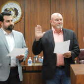


 Local News 4/16/24New Cape Girardeau City Council members sworn in; multiple appointments made to advisory boards3The Cape Girardeau City Council swore in new members and approved various appointments to multiple advisory boards Monday, April 15. New council members David Cantrell, Ward 4, and Rhett Pierce, Ward 5, took the oath of office at the meeting....
 Local News 4/16/24Fredericktown woman arrested in Cape on charges of stealing car, possessing drugs3Anna J. Dobyns, 40, is in the custody at the Cape Girardeau County jail in lieu of a $40,000 bond on charges of first-degree tampering with a motor vehicle, possession of a controlled substance and unlawful possession of drug paraphernalia. ...
 Local News 4/16/24Judge awards $23.5 million to undercover St. Louis officer beaten by colleagues during protest6ST. LOUIS — A St. Louis judge Monday awarded nearly $23.5 million to a former police officer who was beaten by colleagues while working undercover during a protest. Luther Hall was badly injured in the 2017 attack during one of several protests that...
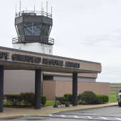 Local News 4/15/24Cape airport explores funding for possible new air traffic control tower12As Cape Girardeau Regional Airport’s construction projects move along, airport manager Katrina Amos and the Airport Advisory Board may start to look at possible funding options for a new air traffic control tower. Amos said the next big project on...
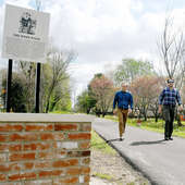 Local News 4/15/24Take a hike: Charleston introduces the town’s first trail — The Byrd WalkCHARLESTON — The late James L. "Jim" Byrd III loved his hometown of Charleston. He also loved trains. Now his family has combined those two loves to continue to grow Byrd’s legacy. With funds from Byrd’s estate, a new walking path was recently...


 Most read 4/12/24Notre Dame to transition to president/principal model beginning July 17Notre Dame Regional High School announced Monday, April 8, that it will be transitioning to a president/principal model Monday, July 1. Current principal Tim Garner will assume the role of president, while assistant principal Paul Unterreiner will...
 Most read 4/12/24Coroner still hasn't found attorney as Missouri AG seeks to remove him from office13More than two months after the Missouri Attorney General's Office filed court action to remove Cape Girardeau County Coroner Wavis Jordan from office, the local officeholder has still not found an attorney to help him fight to keep his job. Wavis...
 Most read 4/11/24Cape Girardeau woman accused of biting man for second time3Police arrived to a domestic disturbance call Tuesday, April 9, to find a man bleeding with a tennis ball-sized bite wound to his inner forearm. It allegedly wasn’t the first time. Colleen Ann Lewis, 53, was charged with third-degree assault. ...
Respond to this story
Posting a comment requires a subscription.