
- Email link
- Contact editor
- Report error
- Share:


Spring Flooding - Wednesday
Scenes of flooding in the Commerce, Dutchtown and Cape Girardeau areas on Wednesday, June 5.
-
 The rising Mississippi River covers Route E in Commerce, Mo. on Wednesday, June 5, 2013.
 -
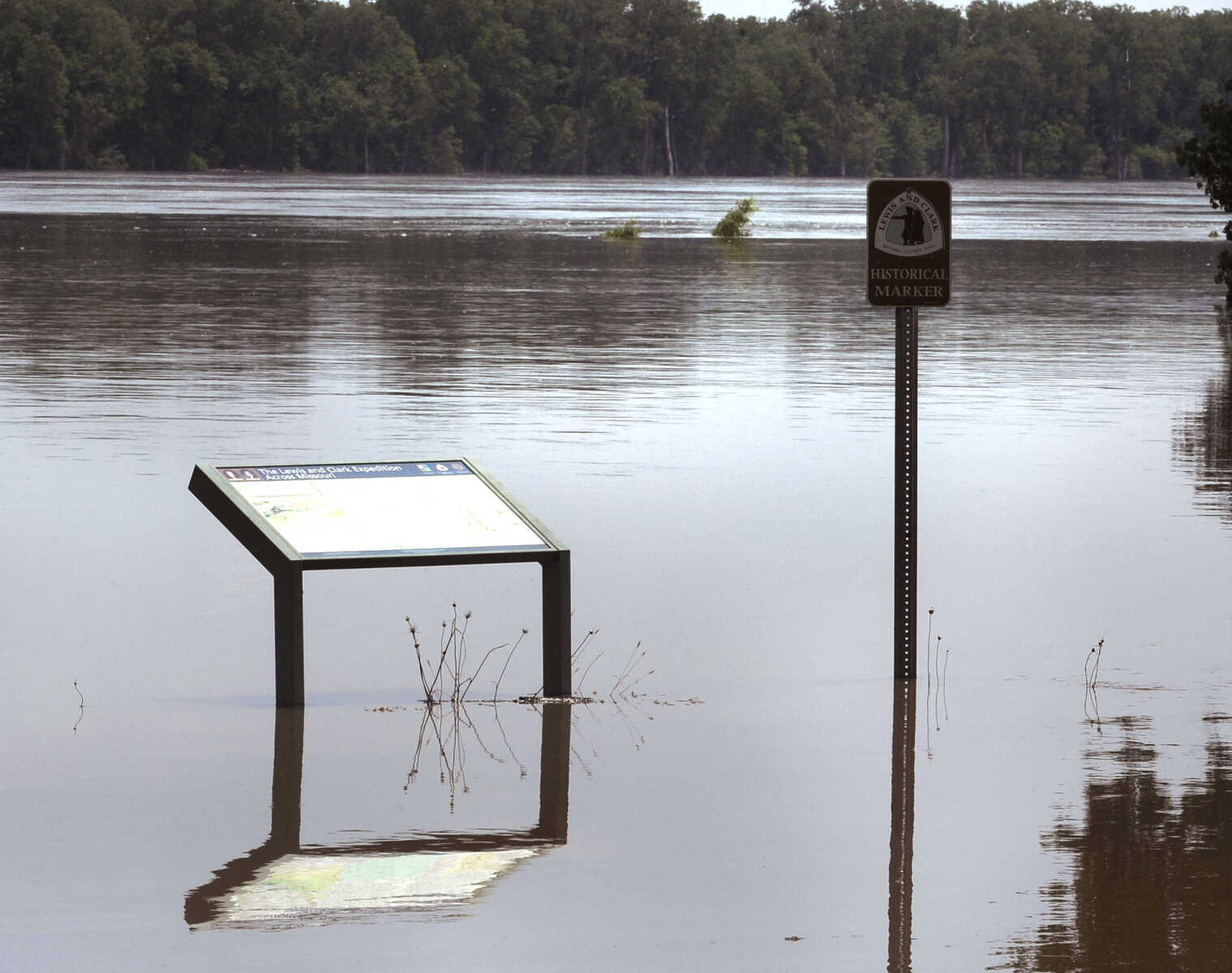 This historical marker is surrounded by the Mississippi River in Commerce, Mo. on Wednesday, June 5, 2013.
 -
 Opportunity awaits for this fisherman in Commerce, Mo. on Wednesday, June 5, 2013.
 -
 Floodwaters from the Mississippi River surround this protected house in Commerce, Mo. on Wednesday, June 5, 2013.
 -
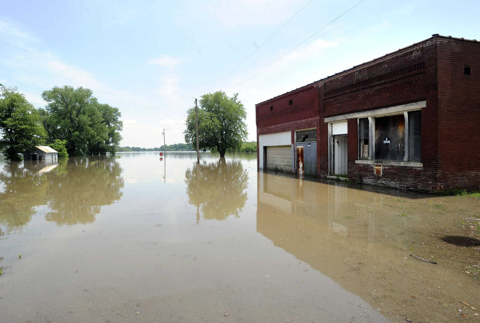 The rising Mississippi River has reached this old building in Commerce, Mo. on Wednesday, June 5, 2013.
 -
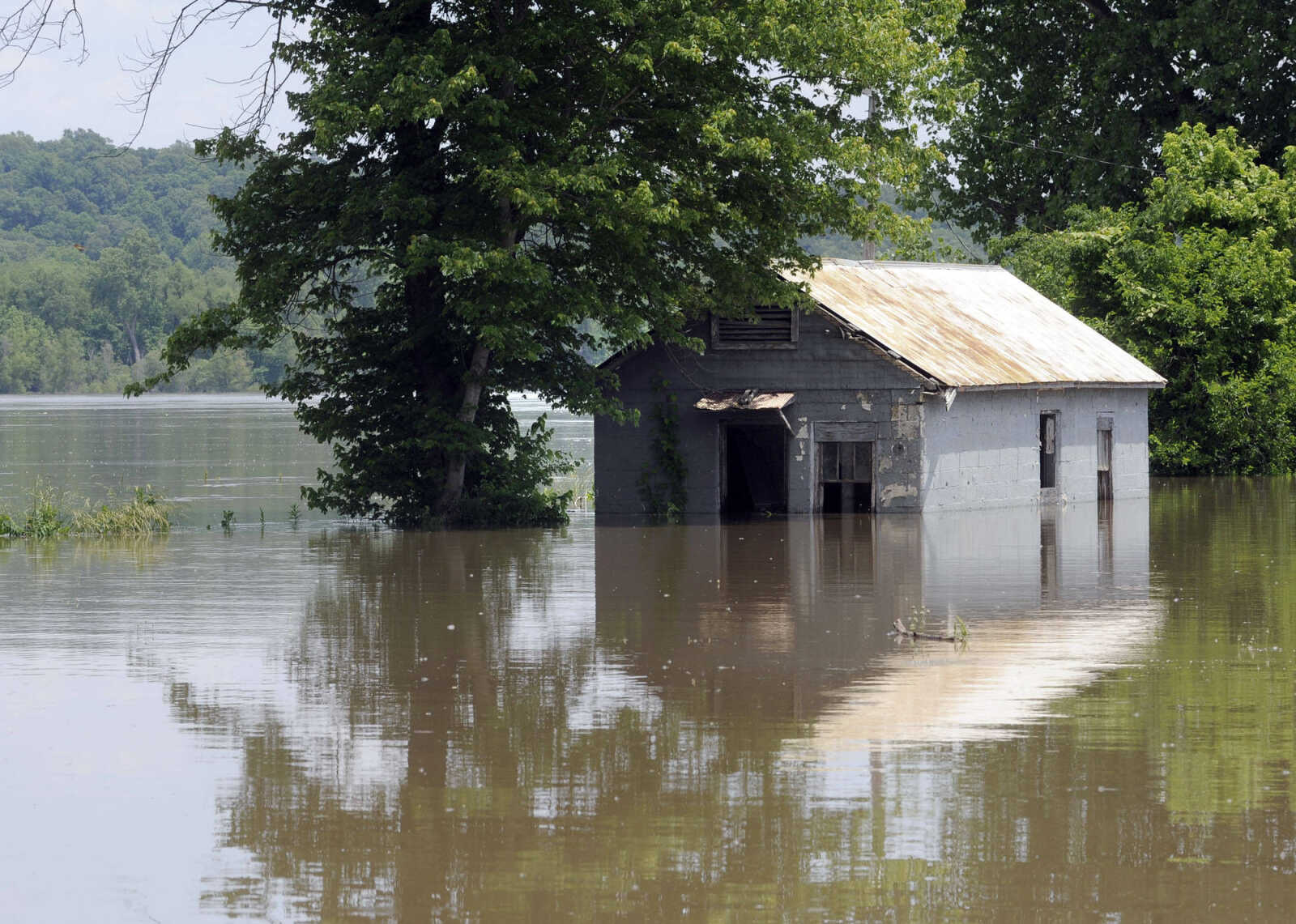 The Mississippi River surrounds this old building in Commerce, Mo. on Wednesday, June 5, 2013.
 -
 Cliff Overbeck takes pictures of the floodwaters over Highway 74 just east of Dutchtown on Wednesday, June 5, 2013. Highway 25 is also closed to the south of Dutchtown as well as Route A to the west. (Fred Lynch)
 -
 Floodwaters from the Diversion Channel cover farmland along Highway 74 near Dutchtown on Wednesday, June 5, 2013.
 -
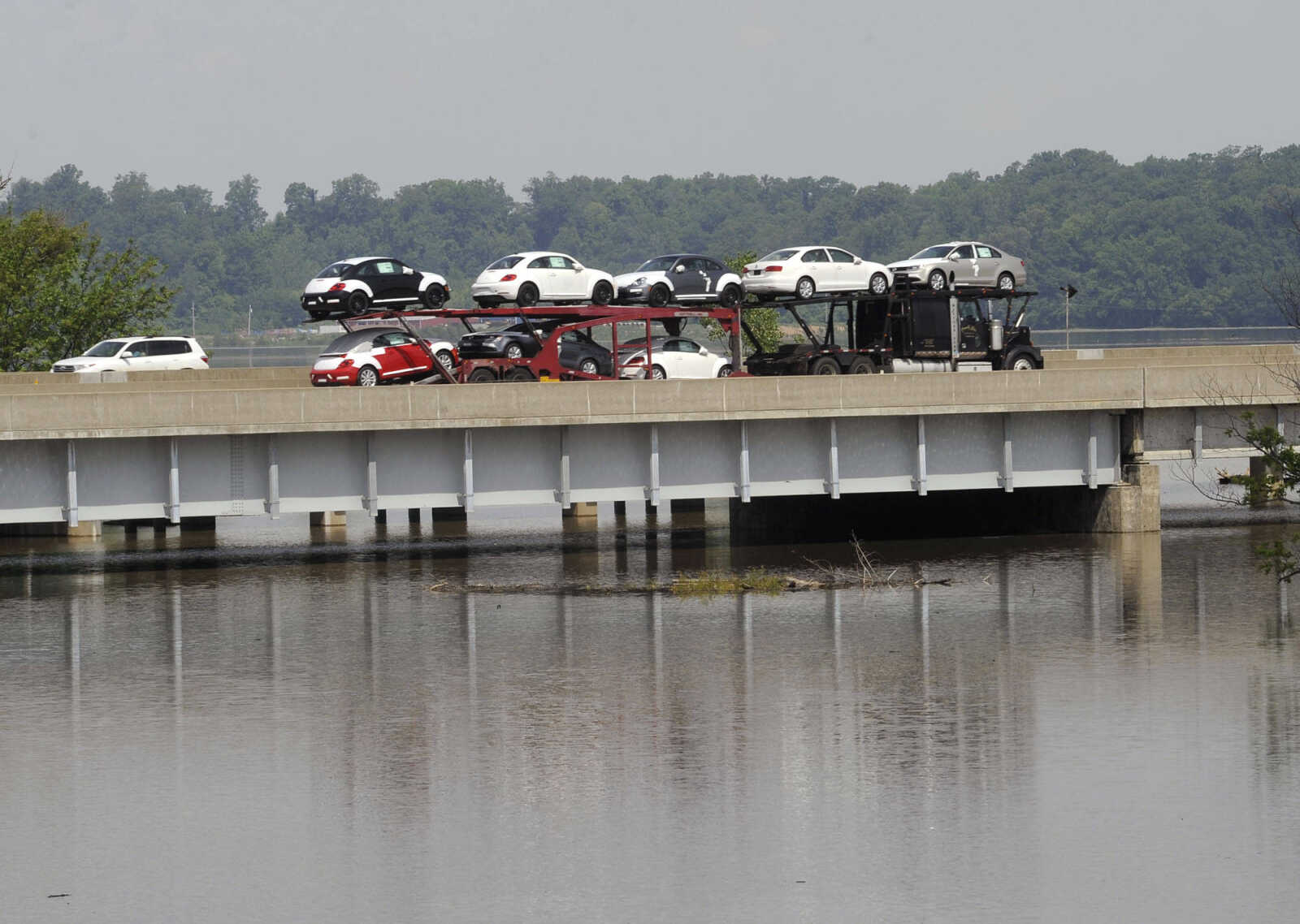 This is a view of the northbound Interstate 55 bridge over the Diversion Channel with floodwaters from the Mississippi River on Wednesday, June 5, 2013 south of Cape Girardeau. (Fred Lynch)
 -
 Floodwater flows from a relief well on the south side of the Diversion Channel levee near Nash Road on Wednesday, June 5, 2013. (Fred Lynch)
 -
 The Mississippi River is seen through the Red Star Access on Wednesday, June 5, 2013 in Cape Girardeau.
 -
 The Mississippi River is seen through the Red Star Access on Wednesday, June 5, 2013 in Cape Girardeau.
 -
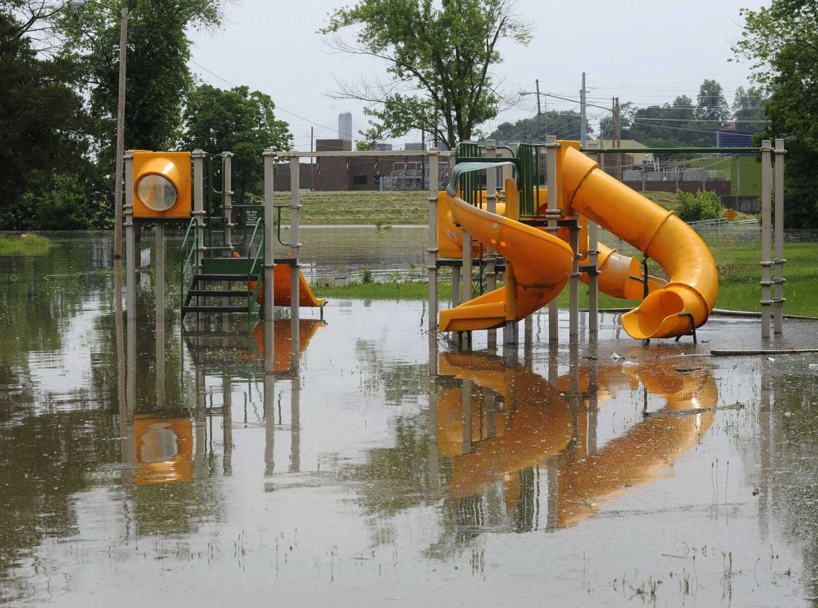 Mississippi River floodwaters surround a playground near the Red Star Access on Wednesday, June 5, 2013 in Cape Girardeau.
 -
 Sloan's Creek is high with floodwater from the Mississippi River on Wednesday, June 5, 2013 in Cape Girardeau.
- Email link
- Contact editor
- Report error
- Share: